
RING OF KERRY
The Ring of Kerry is a world-renowned scenic driving route that follows N70 around a loop, or ring, to the best of County Kerry and the Iveragh Peninsula.
You can stay on the N70 road for about 111 miles and drive the entire ring in a matter of hours, but you would be missing the entire point. There are so many spots to overlook natural wonders, to eat in charming villages, or to chill on lively beaches.
I wrote about County Kerry, the Ring of Kerry, and Killarney National Park in the first part of this blog series, if you want to check that out and then come back here.

The drive from the Ladies View overlook through Moll’s Gap where we left off to the town of Kenmare takes less than twenty minutes, and it is full of stunning views.
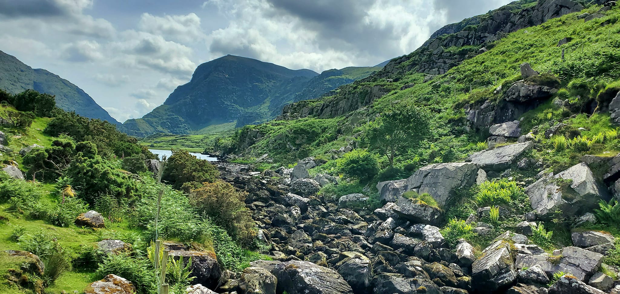
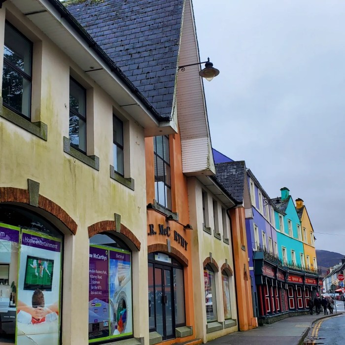
KENMARE
Kenmare is a tidy town, literally, as it won the Tidy Towns competition that has happened each Spring since 1958.
It also holds the titles of Kerry’s Tidiest Town, Ireland’s Best Kept Small town, and Ireland’s Tidiest Small town.
Tidy Towns was first called An Tostal, meaning “Ireland at Home,” and the competition is meant to encourage locals to clean up, preserve their heritage, and take pride in their towns.

Kenmare Tidy Towns is the organisation that continuously maintains the town of Kenmare, making sure it stays in tip top shape and meets all the criteria that will keep earning awards.
The group also focuses on sustainability, fostering biodiversity, and various initiatives like keeping Kenmare litter-free.

Fáilte Ireland has also crowned Kenmare as the very first Kerry Heritage Town. In 1670, Sir William Petty-Fitzmaurice founded a village-like settlement near modern day Kenmare that was called Kenmare Old.
It would be another century before Kenmare town was officially developed by the first Marquess of Lansdowne, becoming one of the first planned towns of Ireland.
Kenmare was designed with an X-shape and the three primary streets of Main, Henry, and Shelbourne form a triangle for the town’s marketplace.
This crossing is where you will also find Kenmare’s town center and the beautiful Fair Green park.

Kenmare is located in Kenmare Bay and is intersected by two major tourist routes, the Ring of Kerry and the Ring of Beara.
It is the closest substantial town near Killarney National Park heading clockwise on the Ring of Kerry.

Kenmare is known for its galleries, gardens, golf, and horseback riding. Its Irish name is Neidin which means “little nest,” perhaps because of how small, quaint, and cozy it is.
Kenmare is known worldwide for its special brand of embroidery called Kenmare Lace, which is a huge part of Kenmare’s past as well as its ongoing future.
Kenmare Lace was first created in 1861 when the Poor Clare Nuns moved to Kenmare with dreams of educating local children.
Constructing of their convent brought years of employment to many local tradesmen.
After its completion, when many locals found themselves unemployed and desperate, the Poor Clare Nuns once again stepped up.
The nuns developed an industrial school and taught workers to create a specific pattern of lace embroidery that quickly became in demand across the globe.

The Poor Clare Nuns, their convent, and its lace school are long gone and a different sort of school has been operating on the site since 2001, but the lace is still being produced at the Kenmare Lace and Design Centre.

Kenmare, like other towns in Ireland, is well-stocked with Ireland’s own brands of wool clothing and accessories. You can easily find Quills Woolen Market and similar shops in the town center.
Try your hand at a new craft or pick up more locals designs at the Kenmare Courtyard Gallery Arts & Crafts Co-Operative.

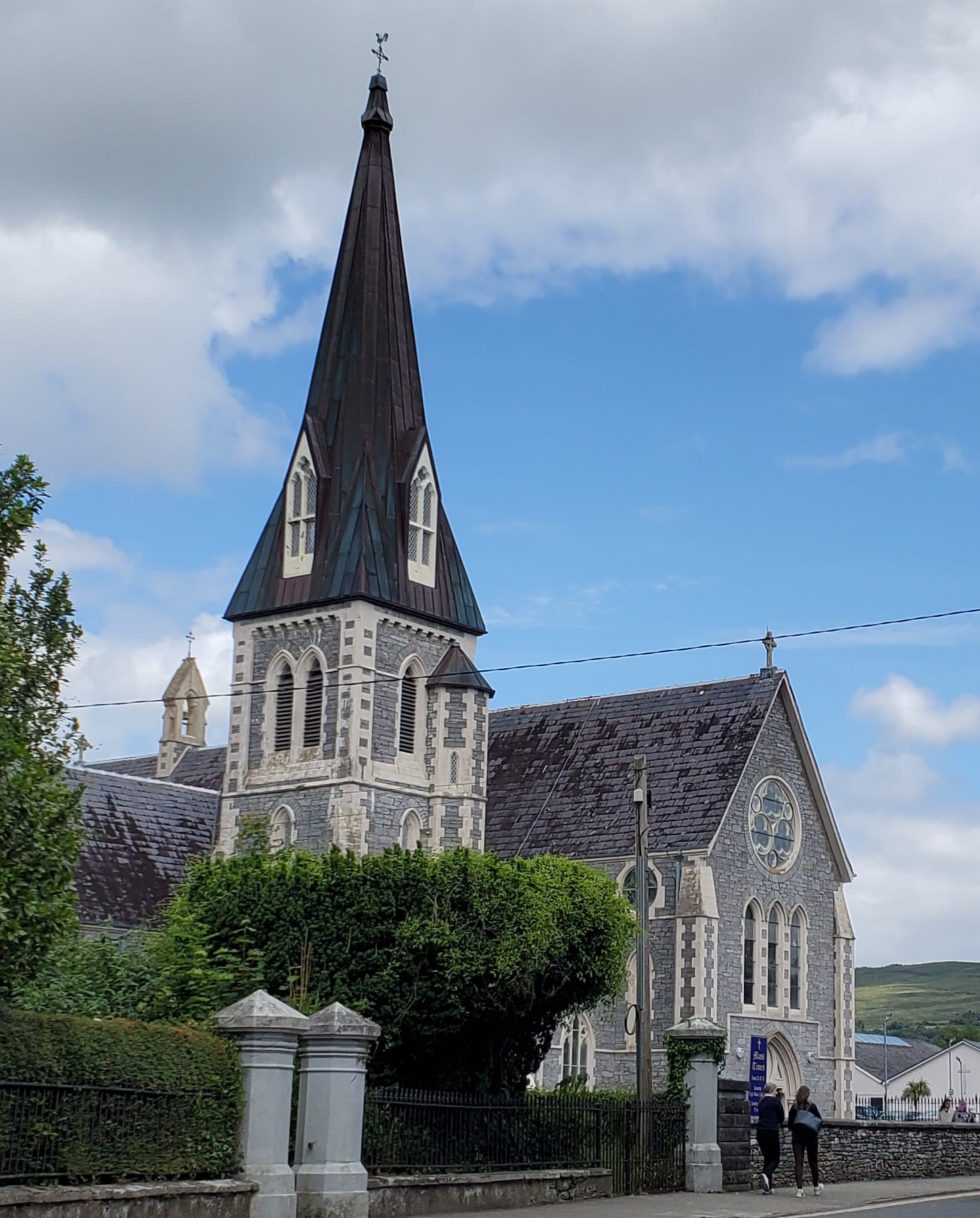
Popular Kenmare attractions include the Kenmare Stone Circle which is actually oval-shaped, the Verart Sculpture Garden, Reenagross Park, the Bonane Heritage Park & Archaeological Preserve, Dromore Castle, and the Holy Cross Church.
Kenmare’s town library was funded by Andrew Carnegie in his Carnegie Libraries initiative. It was opened in 1918 and the building now hosts the Carnegie Arts Centre and Theatre.
You might have heard mention of Kenmare before in the Harry Potter series. One of the Quidditch teams is called the Kenmare Kestrels and they appear donned in green robes with yellow K’s on them to represent Kenmare.
In Star Trek Enterprise, a group of school children from Kenmare appear in one episode called “Breaking the Ice.”

Kenmare even has a popular song about it called “As I Leave Behind Neidin” that many different recording artists have made their own.
The most exciting, but also the most crowded, times to visit Kenmare are in July when the towns hosts its Kenmare Food Carnival and Parade, or on 15 August, the town’s annual Fair Day.

Restaurants like Cafe Mocha, Wharton’s Traditional Fish & Chips, Bookstop, The Coachmans, Crowley’s Bar, Park Hotel, O’Donnabhain’s, The Lime Tree, The Wander Inn, Landsdowne Arms, and The Horseshoe are blasting out amazing smells everywhere you go.
It was not easy to leave this town, that is for sure.

Check out Kenmare Bookshop, Kenmare Antiques, Bridge Street Co-operative Society, Nest, Hallissey’s, and The White Room if you love to shop.

Outside of Kenmare proper, The Ring of Beara is known for its wilderness and abundant archaeological sites.
In Kenmare’s community of Templenoe, visit the Cos (aka Coss) Strand. There is no website for Cos(s) Strand but you will see various signage and parking spaces for beach access along the way.

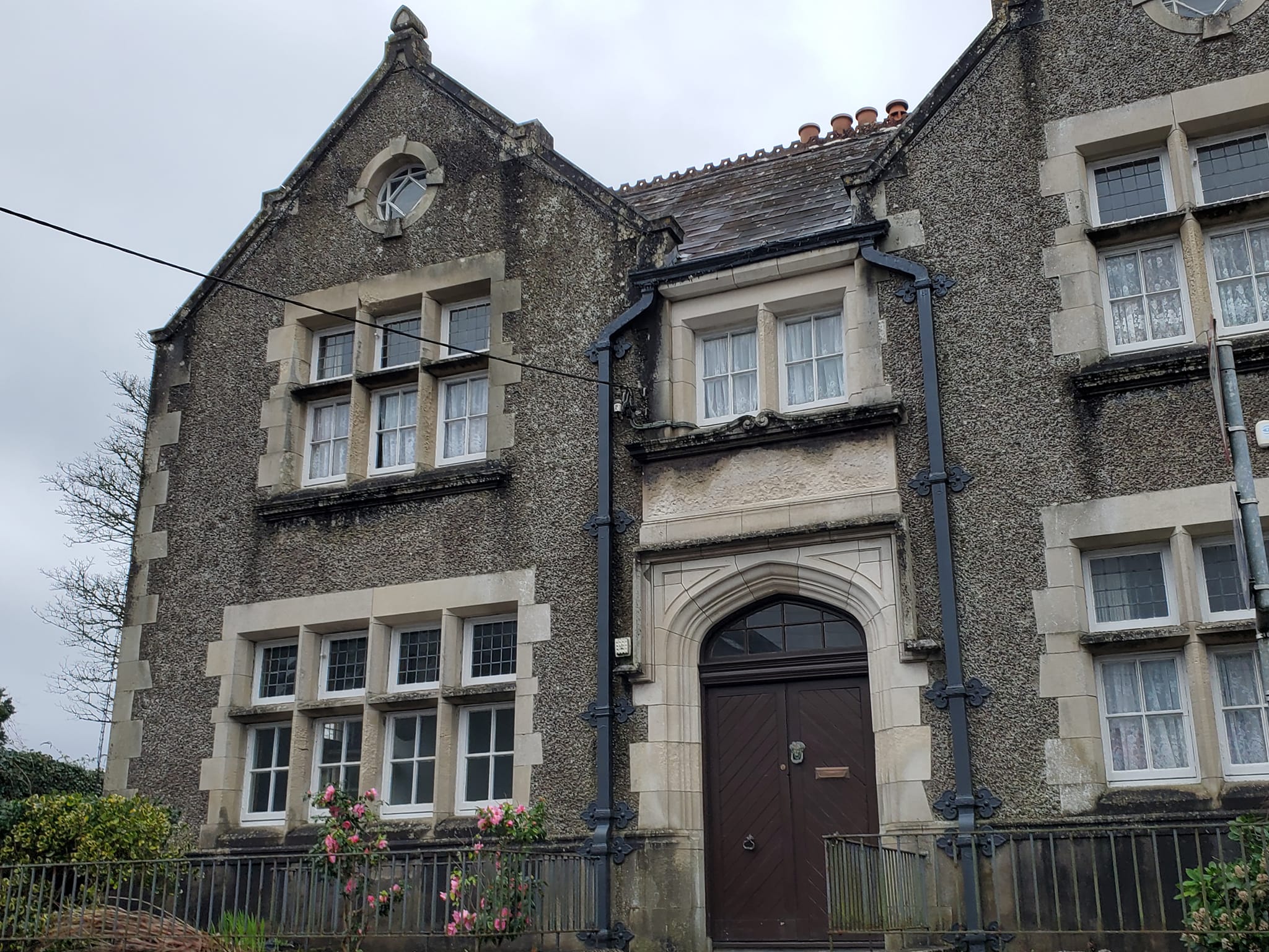
Driving through Kenmare, you can not miss this former Church of Ireland parish with hot pink doors and accents. After the parish closed, it was a restaurant for a while in the 1980s and now it is an AirBnb called “The Vestry“.

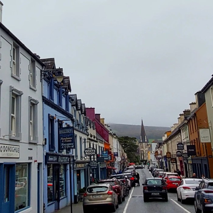
SNEEM
Sneem is the major town that you will reach when you hop back onto the Ring of Kerry and drive clockwise. My favourite part about Sneem is that the Sneem River gushes right through the town center.

Its name means “The Knot” and it is considered the knot in the world renowned Ring of Kerry route.
Sneem is also located right on the Wild Atlantic Way, The Kerry Way, and other famous driving and walking routes.

Sneem has a Sculpture Trail that includes the figure of Isis, Pyramids, a giant panda, famous athletes, a salmon weathervane, and other interesting choices.
Below is The Peaceful Panda, with Sneem Church in the background.
This carved white marble statue was received in 1986 as a gift from the Peoples Republic of China to honour former Irish President O’Dalaigh after he had visited to China and appealed to the United Nations to allow China to join.

What most people call the Sneem Pyramids is an installation by Kerry sculptor, James Scanlon, called The Way the Fairies Went.
While you are visiting The Pyramids, be sure to check out St. Michael’s Catholic Church and gardens next door.

Next, make your way to the Garden of the Senses.


Two more stops on the Sneem Sculpture Trail are found in the middle of the town square.
Below is a statue of football mega-star John Egan, with a memorial to the late and former Irish President Ó Dálaigh just over his shoulder. Ó Dálaigh lived near Sneem before he passed away, and his funeral was held in Sneem.
The famous Irish athletic family known as the Casey Brothers are also from Sneem, but some locals may tell you that the biggest Sneem celebrity was Big Bertha the Cow.

Like many Irish towns, Sneem is known for its brightly painted exteriors that help the locals find their way through its frequent dense fogs.

A time capsule was buried somewhere in Sneem that will be opened in 2100 and I am pre-sad that I won’t even be alive for it.

M, my favourite character from James Bond 007 films, was inspired by a Sneem man named William Melville, who went by the agent code name M.
Melville moved to London and eventually became the head of the British Secret Service in 1903.
This could likely be a coincidence, however, Bond creator Ian Fleming also worked for the BSS for several years, before he began writing his famous series.
There is an exhibit about this in the Kerry Geopark, right in the town center.

We stopped by Bridge Cafe & Bistro for lemonade and chips (fries, for you Americans) and admired the view of the Sneem River and bridge from the restaurant’s balcony.

Sneem Tavern has no website but is usually the most hopping place in town after mid-day.

Dan Murphy’s Bar is another contender alongside Riney’s, Fishers Bar, and D O’Shea’s.

The Green House Curiosity Shop is a very interesting collection of antiques and novelties.
I found the most gorgeous silver ring with a green malachite stone at Green House, and I think of our visits to Sneem each time I put it on.

Sneem Bookshop and Green Chair are two more locally-owned shops you should not miss.


Just like in Kenmare and other Irish towns, there is a Quill’s Woolen Market in the town center.

Navigating Sneem is easy, because it has a tiny town center with just two squares.
The amusing thing about that, though, is that the square on the west side is called North Square, and the square on the east side is called South Square.
No one seems to know why, but the names remain unchanged.
If you can find it in stock, pick up a book called Sneem, the Knot in the Ring by T.E. Stoakley that covers much of Sneem’s early history and cultural events.
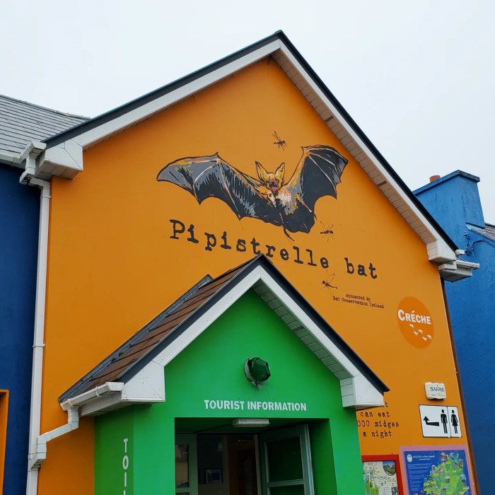
The tourist office in the middle of town is likely your best bet and it has a rad Pipistrelle bat mural above its front entrance.

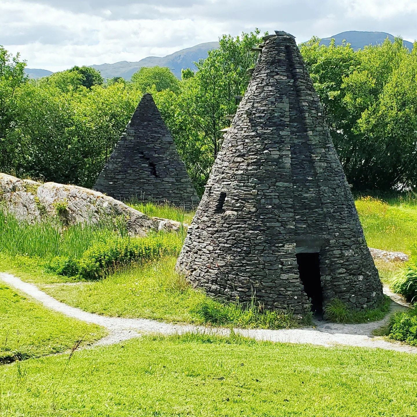
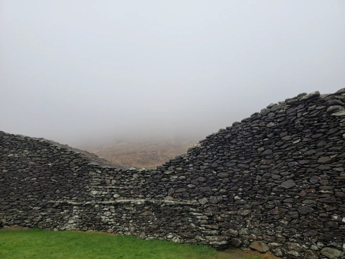
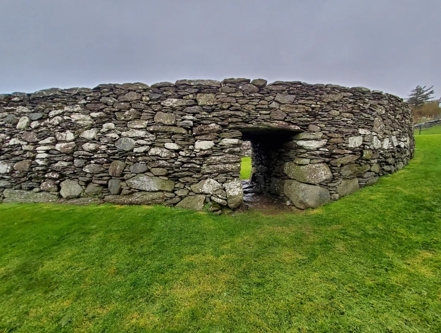
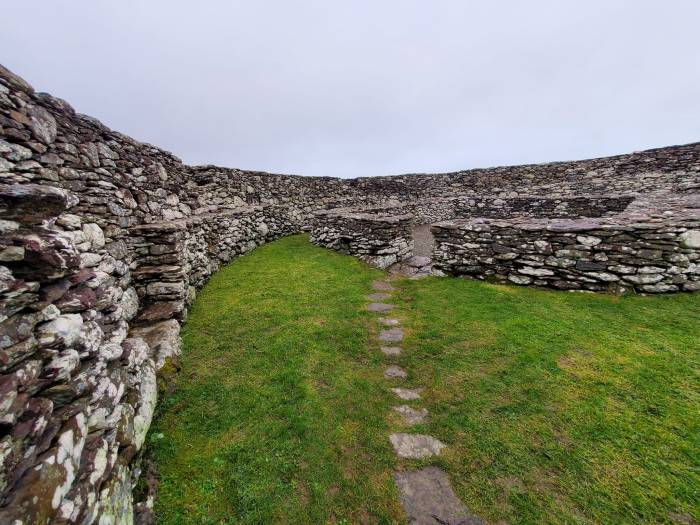
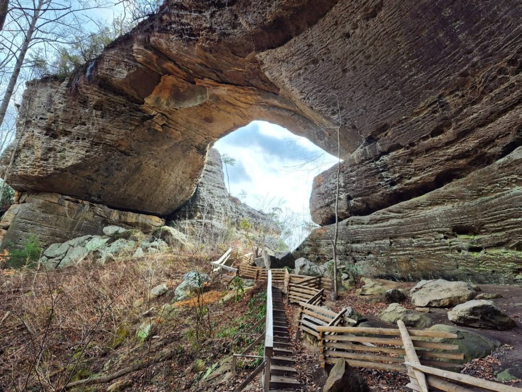
STAIGUE FORT
Between Sneem and Caherdaniel, there is an amazing circular stone fort dated to the year 300 BC or earlier.
This is a National Monument of Ireland and it is said to be the oldest, one of the largest, and the best preserved stone fort in the country.
Staigue is pronounced like “stake” with a hard G at the end instead of a k. I could not find information about the origins of the name Staigue, but most sources say the village and fort functioned as a tribal center and place of worship even outside times of war.
During wartime, people seeking shelter inside the ring fort would brought their livestock in with them.
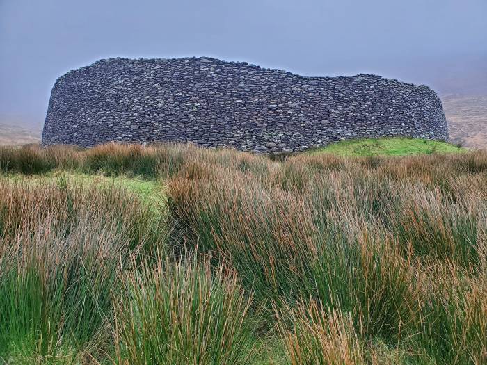
The fortified walls are 25 feet high at most points, about twelve feet thick, and the circumference is more than 90 feet across.

Even more impressive is the method of its construction.
A technique called Drystone or drystacking involves building walls and archways by stacking stones without any substances to bond or hold them. It requires great skill, and is almost strictly unique to Ireland.

Modern architects estimate this kind of structure would take a crew of a hundred men more than six months to complete.
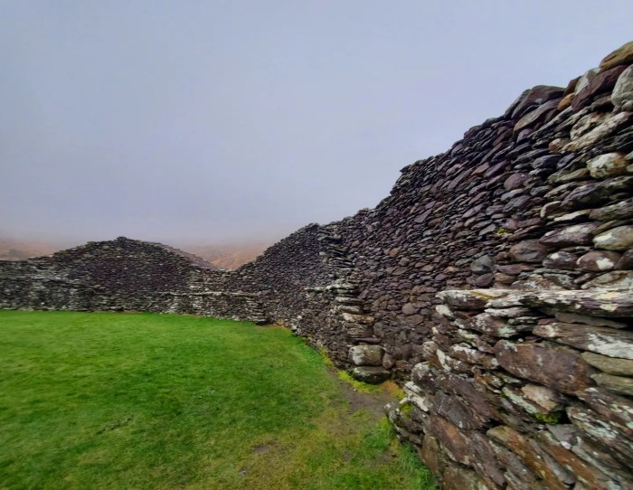
The inner walls of the fort have ten different stone staircases leading to the top edge of the walls, likely where those guarding the fort could watch in relative safety.
I really loved visiting this site. Signage make it easy to find, and once you park, it is a very short walk to the opening of the fort.
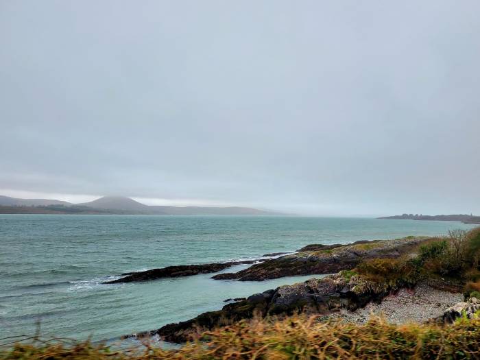
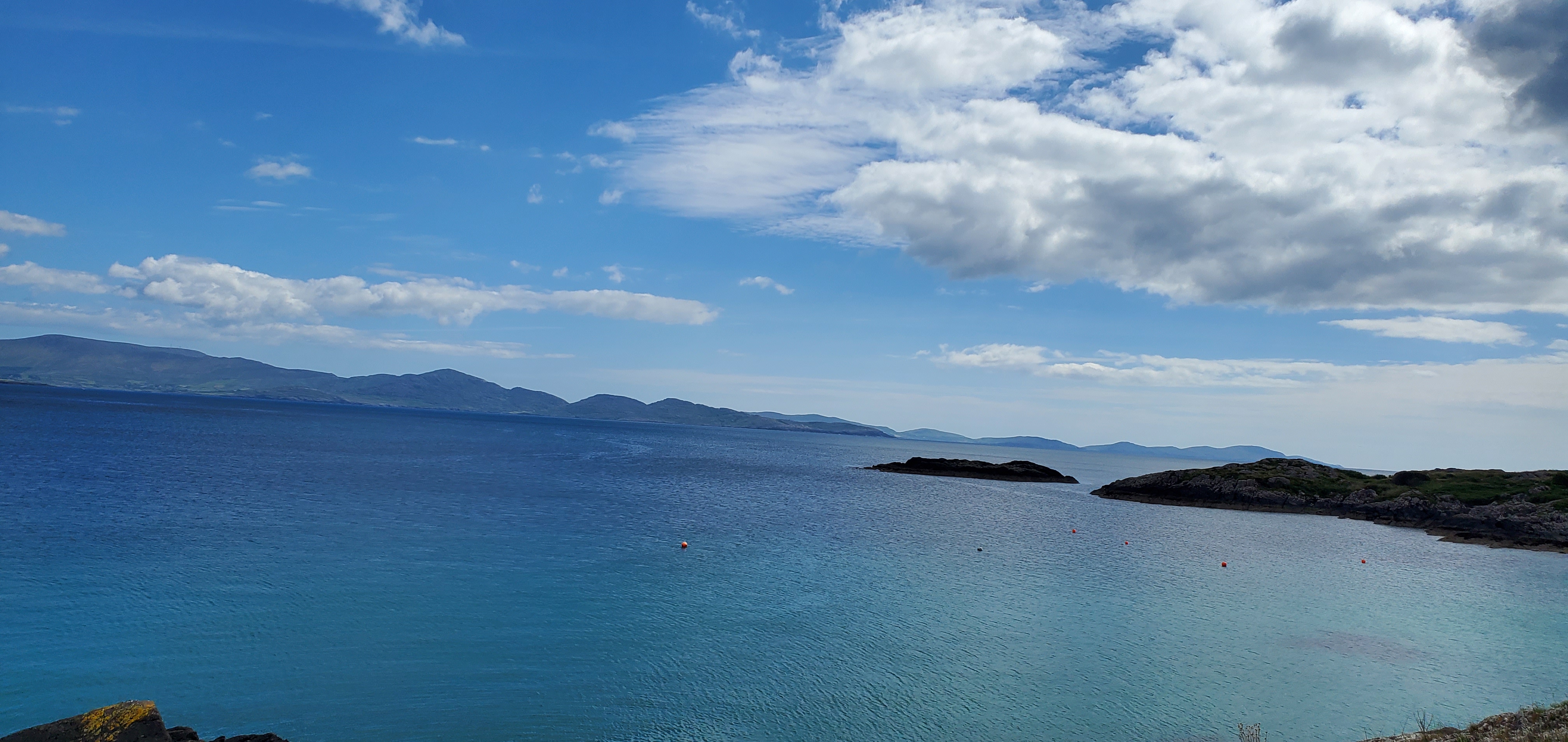
THE COVE
When you leave Staigue Fort and get back on the Ring of Kerry driving clockwise, you will be rewarded with a unique view of the Atlantic Ocean for the fifteen minutes or so it takes to reach Derrynane.

You will pass through Castlecove Beach and The Cove (O’Carroll’s Cove), and Glanbeg Beach before you arrive at the fork in the road for Derrynane or to continue on The Ring of Kerry to the town of Caherdaniel.
DERRYNANE
The village of Derrynane is southwest of Caherdaniel right on the Atlantic Coast.
Derrynane is most famous for its Blue Flag Beach, which means it has received a certificate for meeting standards of environmental management and water quality, among other criteria, that is recognised worldwide.

Derrynane Beach is also part of the Derrynane National Historic Park, along with the Derrynane House & Gardens.

THE PARK
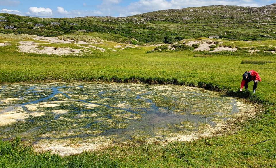
Derrynane National Historic Park boasts about a mile of sandy beach shoreline, rock features, and sand dunes.
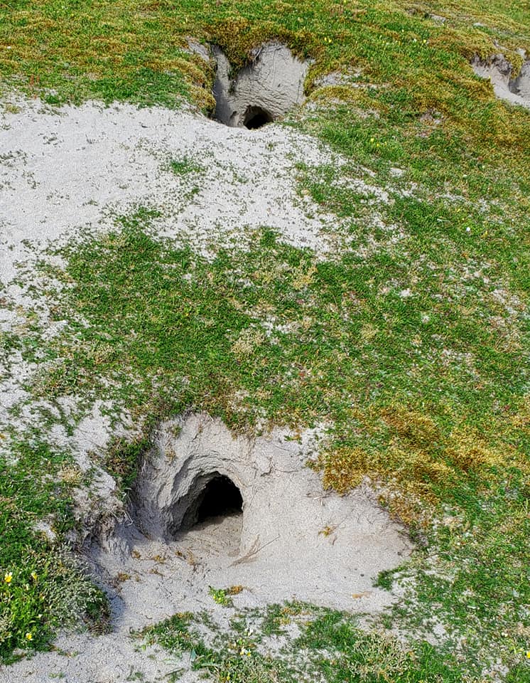
In nice weather with lower tides, visitors can walk across the sandbar to Abbey Island, but we did not make it that far out. We spent most of our time checking out bog ponds in hopes of sighting Natterjack Toads.

Natterjack Toads are Ireland’s only native toad species, and you can only find them in Derrynane and around Dingle.
You can easily identify the toads by the yellow stripe down the center of its bumpy light green skin, but the most unique feature about them is their short little legs, which usually leads to them running or walking instead of hopping.
It is a really strange thing to witness. Check out this Youtube video that does not belong to me to see an example.

My friend spotted some Natterjack spawn and tadpoles in the pond and, while we were watching them swim, we saw some leeches slithering around. My skin was crawling around more than they were.
Later at night, on Rosscullen Island, we spotted on a Natterjack on the path we were walking and he snapped the photo below.
It is illegal to trap or harm the toads, and we would never! We were just thrilled to get a close up photo.


DERRYNANE HOUSE & GARDENS
One of Ireland’s most famous and influential politicians, Daniel O’Connell, was born in 1775 near Cahersiveen but adopted by his uncle Maurice who owned the Derrynane House.
We did not go inside the house, but opted to walk through the gardens on restricted time.

O’Connell was known as “The Liberator” and the “Uncrowned King of Ireland” who worked tirelessly for equality and full political rights for Catholics.

He was the first Catholic to sit in the the House of Commons and the first Roman Catholic Lord Mayor of Dublin.

O’Connell Street in Dublin was named after him, just like O’Connell Street in Limerick, and there are statues of him in Dublin and outside the St. Patrick’s Cathedral in Melbourne, Australia.

In Cahersiveen, the 1888 Daniel O’Connell Memorial Church was the first Catholic church in the world to be dedicated to a “lay person” or someone who had not been canonized.

He was buried in Dublin’s Glasnevin Cemetery after passing away in 1847.

DERRYNANE OGHAM STONE
Another must see in Derrynane is its Ogham Stone, called the [Darrynane Beg] Ogham Stone.
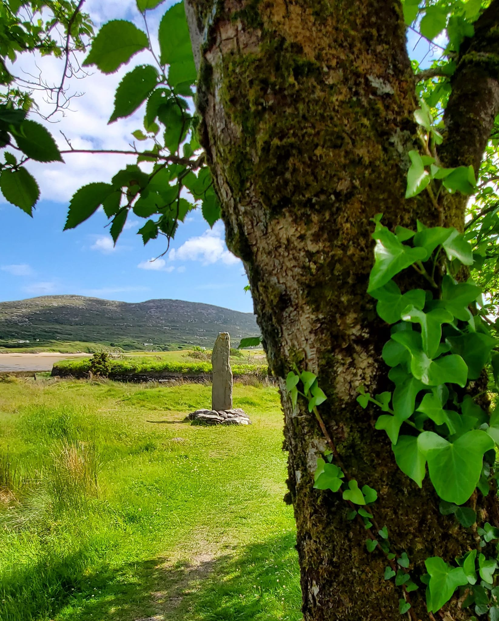
Ogham stones were the first known written form of the Irish language.
Ogham is a form of writing called the Celtic Tree Alphabet with 20 different letters, and it was used between the second and ninth centuries.

They are very commonly found in southwest Ireland and more than 130 are in County Kerry, more than any other county.
The stones are a type of standing stone and are named for the pagan Irish God, Ogma.

Each one is unique and has inscriptions for ceremonies practiced by those who created them, often telling the story of someone who is interred below the stone.
Not all stones have bodies below them, though.

The Ogham stone in Derrynane is surrounded by a gorgeous panoramic view.

CAHERDANIEL
Caherdaniel is a proper village of its own, but shares most attractions and geographic features as Derrynane.
I have learned that many people are referring to sites historically placed in Caherdaniel as being in Derrynane now.
I am not qualified to explain this phenomena, just know that you might be looking for a place in Caherdaniel and a local might tell you “Oh that’s the Derrynane [whatever]” instead.
While you are in Caherdaniel, be sure to visit the Kerry Gold Tier International Dark Sky Reserve. This is one of just three such reserves, and the only one in the northern hemisphere.
It has open access for the public but you can book tours by contacting the group through their website, and attend their annual Skellig Coast Dark Sky Festival each Spring.

LOHER STONE FORT
From Caherdaniel, the drive to Loher and the Loher Stone Fort is about 18 minutes, but a third of it is backtracking down a ferociously bumpy one-lane gravel road to get to the fort itself.

It is kinda scary, too.

This stone fort, also called Loher Cashel, is a National Monument.
It was built in the 9th century with walls that are about nine feet thick and nearly seven feet high.
Just like Staigue Fort, it was built with the Drystone stacking method and has several staircases leading up the inner walls to the top.
The most delightful part of our visit to Loher was when the farmer who owns this land brought his adorable sheep dog down the hill.
Before we even realised what was going on, the pair staged a wildly entertaining show for us.
The dog led the flock back and forth across the farmland in various formations, in accordance to whichever commands the farmer shouted.
Of course, the sheep were precious too. I was so enthralled with what was happening that I failed to capture a video or better photos. Sometimes you just get lucky and have to roll with it.

In the area for a while? Follow me further along the Ring of Kerry to Waterville, Cahersiveen, and Killorglin (in progress).
*************
© Fernwehtun, 2015- Current. Unauthorized use and/or duplication of this material without express and written permission from this site’s author and/or owner is strictly prohibited. Excerpts and links may be used, provided that full and clear credit is given to Fernwehtun and Fernwehtun.com with appropriate and specific direction to the original content.


Leave a comment