
DINGLE PENINSULA
The Dingle Peninsula (Irish: Corca Dhuibhne) is on the southwestern coast of the Republic of Ireland. In the center of its southern border is Dingle Town.
It is a scene of crashing waves, rocky cliffs, remote beaches, mosaic patches of farmland, skyscraping mountain passes, and rich green hillsides. This is where I learned the two new words, promontory and tombolo, which I will explain later.
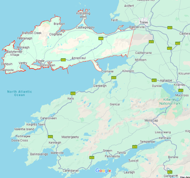
Dingle Peninsula juts out 30 miles into the Atlantic Ocean, west of N70 where it connects Tralee southward to Milltown. You can see it outlined in red in the photo below.
N70 continues south beyond the Peninsula to the town of Killorglin, which is the perfect starting point for the Ring of Kerry and Killarney National Park.
The Peninsula is part of Ireland’s Wild Atlantic Way, the longest coastal route in the world. It spans over 1,500 miles along Ireland’s west coast from Donegal in the north and tucks into Cork down in the south.
Wild Atlantic Way runs right on the edge of rocky cliffs and shorelines of the Atlantic Ocean, a contrast to the rolling hills and valleys of Dingle.
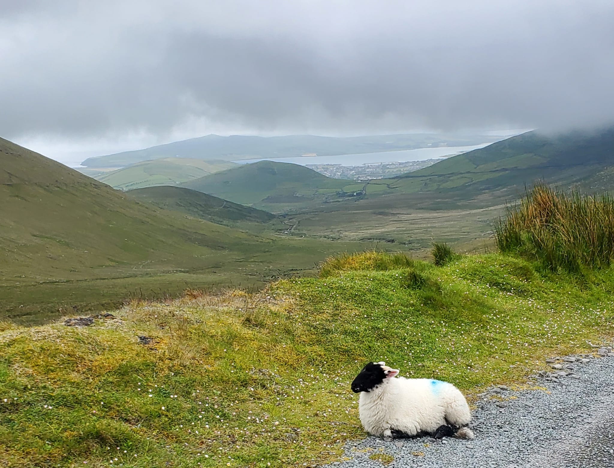
Dingle Peninsula is remote and a little windblown in some places. It has been inhabited for around six thousand years and currently has around ten thousand residents.
The region has an unbelievable 200+ historical monuments and other ruins, making it one of the most abundant archaeology collections in Europe.
You can read an extensive history of the Dingle Peninsula here.
Its most popular attractions are Conor Pass, Slea Head Drive, Fahan Beehive Huts, Inch Beach, the Blennerville Lighthouse, The Maharees, Oceanwnorld Aquarium, St. Manchan’s Oratory and its Ogham stone, and the Slieve Mish and Brandon mountain ranges.
Major villages of the Dingle Peninsula include Ventry, Dunquin, Blasket Islands, Castlegregory, Blennerville, and its only “real” town, Dingle Town.

DINGLE TOWN
Dingle (Irish: An Daingean) Town, which I will just refer to as “Dingle” from here on, began and remains a major fishing port that dates back to the Norman invasion of Ireland.
Traces of the town’s close ties to Spain can be seen in some remaining Spanish architecture, built when Spanish (and French) fleets used Dingle as a trading point and specializing in the trades of wine, fish, and animal hides.

Dingle comes from the Irish term “An Daingean” and means valley, though in older times it referred to a fortress.
The people of Dingle petitioned for a “murage grant” in 1569, which essentially meant building walls around the town to fortify it.
This was rather common at the time, and both Queen Elizabeth and James I got involved to make it happen. You can only see fragments of the wall now.

Dingle suffered a series of tragedies like cholera and plagues, being pillaged and burned multiple times, the Nine Years’ War, and the Wars of the Three Kingdoms.
It slowly recovered and eventually thrived, largely credited to the Knights of Kerry and the Fitzgerald Family, whose move to import flaxseed led to the development of the flaxseed linen industry.

Dingle is part of County Kerry. South of the Dingle Peninsula is the Iveragh Peninsula that is home to the famous Ring of Kerry.
More than twenty percent of Dingle Peninsula’s population lives in Dingle proper, located at the very center of the southern coast.

Dingle is a Gaeltacht town where Irish Gaelic is still widely spoken, printed on road signs and businesses, and taught in schools.
Many of Ireland’s Gaeltachts, where government subsidizes residents in the area with the intention of keeping the language, culture, and traditions in place, are located along Ireland’s western coast.
Beyond County Kerry, you can find Gaeltachts in Counties Donegal, Galway, Cork, Meath, Mayo, and others.

Dingle is highly celebrated as a hub for traditional Irish music and for its hardware store + pub combos.

Honestly who wouldn’t like to sip a pint while checking out the newest lighting fixtures?
This is where my dream sequence cuts over to me strolling through Lowes with a Bulmer in hand.
Dingle is full of shops and boutiques, from custom designed bags and woolen accessories and gifts.


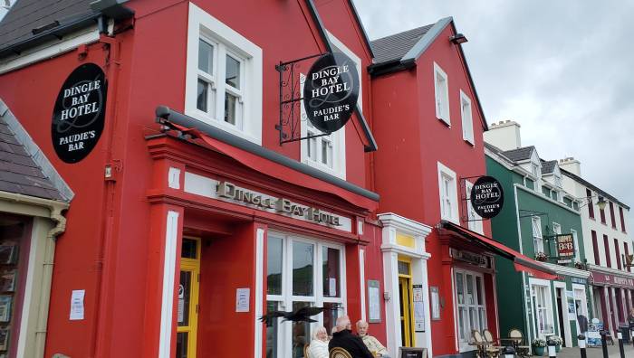
Dingle has a variety of small inns rather than chain hotels, usually just blending right in with the stores and restaurants.

We stayed at Base Dingle and the room was clean and cozy, with everything we wanted to see within walking distance.

NOTABLE FIGURES
Parents of the McDonald’s fast food chain founders are from Dingle, but thankfully there is not a franchise around.
The most notable figure of Dingle, depending on who you ask, was Fungie, a bottlenose dolphin who started rolling up on Dingle Harbour in 1984.
Locals believed he lived in a cave below the cliffs and preferred staying in one place instead of roaming the sea with his own kind.
Fungie loved to swim beside humans and boats and to guide them back to the harbour like a sheepdog. He was silly and full of mischief and brought so much joy to tourists and locals who interacted with him daily, an estimated 200,000 visitors each year.
Sadly, and mysteriously, Fungie did not show up one morning in October of 2020, and never again afterward.
Locals slowly accepted the probable fate of their beloved dolphin mascot, and had a memorial of him created in the town center near the harbour.

The Dolphin Shop across the street is where you can learn more about Fungie or pick up some souvenirs to keep his memory alive.

DINING IN DINGLE
I have had some really delicious meals in Dingle.
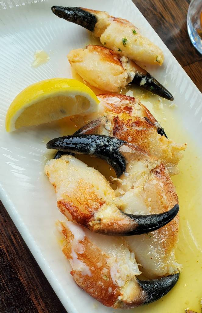
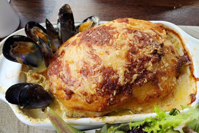
The Boatyard Restaurant looks out over the harbour so naturally they have the best seafood.

My favourite dish there is the Fisherman’s Pie which is a thick casserole of fish and shellfish baked inside a puffy potato shell.
It is crispy and covered in smoky cheese, and has a creamy leek sauce inside.
One of their evening specials was a filet of hake that came with friend cabbage and bacon.

Out of the Blue Restaurant was also fantastic. The space is much smaller with a bit of an eclectic dive feel that I love.
I am perpetually on a mission to try fish chowder at every opportunity when I am in Ireland, and theirs was honestly one of my top picks.

This is the grilled monkfish with mushrooms and sugar snap peas.

I really enjoyed this herb crusted hake also.

The Dingle Diner was just around from Base Dingle, and this block of businesses has the cutest exterior.

We stopped in for an Irish breakfast. Portions are huge and the coffee was super.

For lighter fare, stop by An Cupan Tae in the stone cluster of shops facing the harbour and marina.

There you can find all sorts of pastries, sandwiches, teas, coffees, and other treats for dining in and take away (to go).

You will not be at a loss for options to get drinks or hear live music in Dingle.

This interesting building first opened its doors in 1881 as the Dingle Creamery, meeting the community’s need for milk and butter just as much as their need for a social venue.
Unfortunately the creamery closed after many decades and the building sat idly until the Dingle Brewing Company opened in 2011.
DBC’s only brew was the Tom Crean golden lager, named after a Dingle native who became famous for exploring Antarctica. Allegedly Crean’s family did not appreciate having a beer named after him and he brewery was forced to halt production, and eventually the brewery closed.
Do not despair if you are looking for local spirits though, just stop by Dingle Distillery.

Another interesting building in Dingle is the Nelliefred’s Guesthouse with a giant mural on its exterior.

SLEA HEAD DRIVE
Just like Kerry and the Iveragh Peninsula has its Ring of Kerry route, Dingle Peninsula has Slea Head Drive.
At times, Slea Head Drive overlaps or runs along the Wild Atlantic Way. Many visitors plan their trips to Ireland’s west coast so that they can tour both peninsulas and follow as much as they can on the three sightseeing routes.

Slea Head Drive (R559) makes a 26-mile circle that starts and ends in Dingle, where most make their home base during the trip.
Plan for at least one entire day to travel Slea Head Drive, and get an early start.
If you are staying in the area for more than a few days, consider following the longer route called Dingle Peninsula Drive, which will show you even more of the region.
I have been around Slea Head Drive twice now, but have not had the luxury to take on the full Dingle Peninsula Drive just yet.

DUNQUIN & BLASKET ISLANDS
We left Dingle and drove westward in a clockwise pattern on Slea Head Drive, through Ventry and into Dunquin.
Dunquin (Irish: Dún Chaoin) is a term for “Caon’s fort” is the most western part of Dingle Peninsula.

Several scenes from the film Ryan’s Daughter were filmed there as well as the Ferriters Quarter in Dunquin.

Just down the road, Dunmore Head is the most western point of Ireland’s mainland, and some Star Wars scenes were filmed there.

Coumeenoole Beach is one of County Kerry’s best beaches and is known for its view of the Blasket Islands.

Blasket Islands are a small group of islands off the mainland that were abandoned in the 1950s, but continued to inspire authors and poets like Tomás Ó Criomhthain, Peig Sayers, and Muiris Ó Súilleabháín and even more today.
Much of their work keeps the culture, heritage, language, and the Béaloideas oral tradition of Ireland and this region alive.

Kruger’s Bar, “Ireland’s Most Westerly Bar,” has been a welcoming spot for many of writers and artists over time.

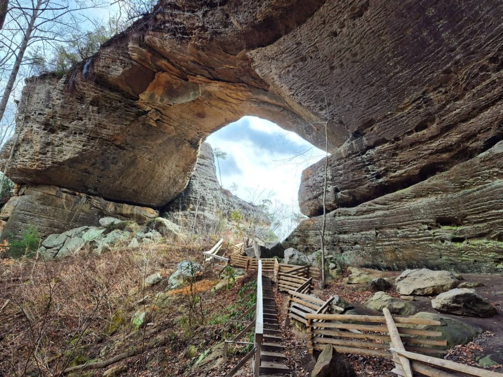
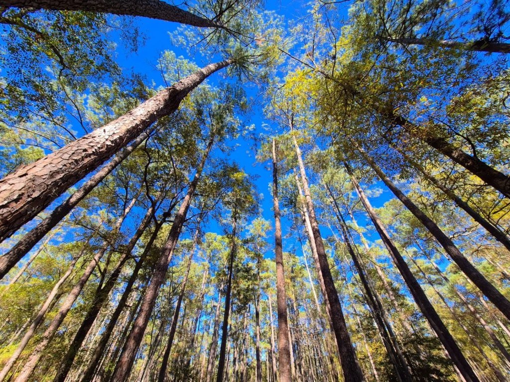
CONOR PASS
The Conor Pass (Irish: Páirc Náisiúnta na Mara, Ciarraí) is Ireland’s newest National Park, and the road you drive to view it is R560.


It is the eighth national park and first marine national park in Ireland, and its 70,000+ acres now make it the largest of all.


My first visit was in March of 2024, a few weeks before the official declaration was made.
I did not even know about all the hype regarding its new national park status at that time.
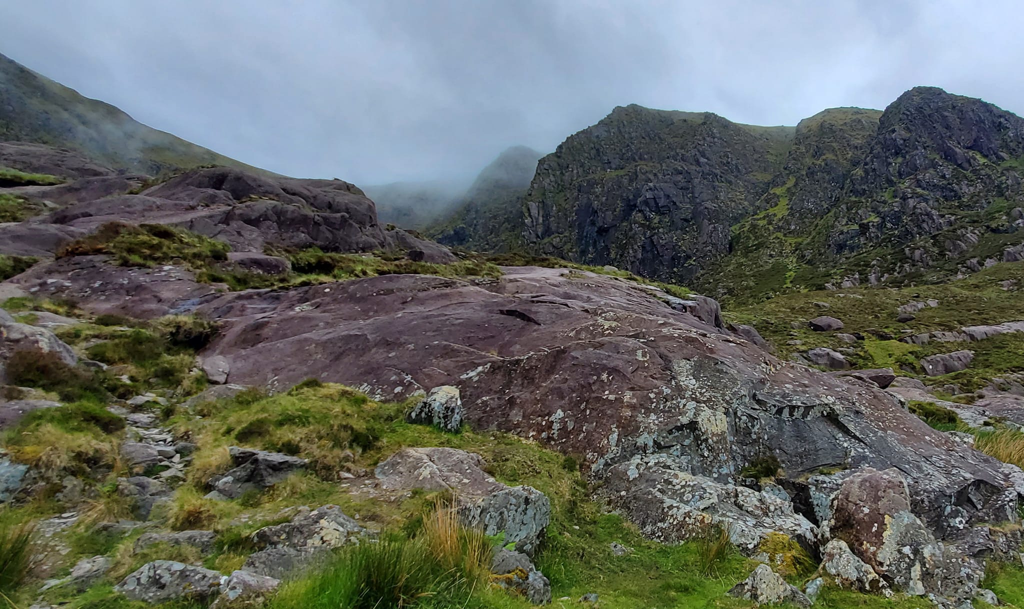
It was so foggy in March that I could not see anything AT ALL beyond the window shield, and I still laugh every time I look at this photo.

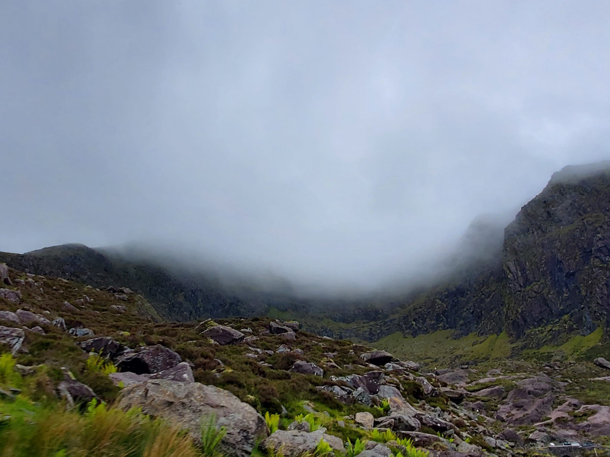


Conor Pass Waterfall is fed by one of the lakes you can see in the photos above called Lough Doon.
It is not very high, but it is right on the side of the road with a small parking lot.
Many people like to scramble about 20 or 30 feet higher on the boulders for a different view, but I was satisfied staying in one piece where I was.

CASTLEGREGORY & THE MAHAREES
Follow Conor Pass up to Castlegregory and visit the Maharees.

Castlegregory (Irish: Caisleán Ghriaire) means “Castle of Griaire” and it is a small village in the northeastern section of the Dingle Peninsula.
This region is known as both “Kerry’s Gold Coast” and “The North Shore.”

North Shore includes the villages of Camp, Stradbelly, Cloghane, Brandon, Aughacashla, and Castlegregory, the largest.

Castlegregory is located right at the base of the Maharees tombolo, one of those two new words I just learned.
Tombolo is a fancy word for a sand bar that connects an island or group of islands to the mainland.

There are fewer than 400 people living in the village, and North Shore in general is much more remote than the rest of Dingle Peninsula.
Most visitors come for kayaking, sailing small boats, golfing, fishing, guided dives, or some good old serenity on the quiet beaches.

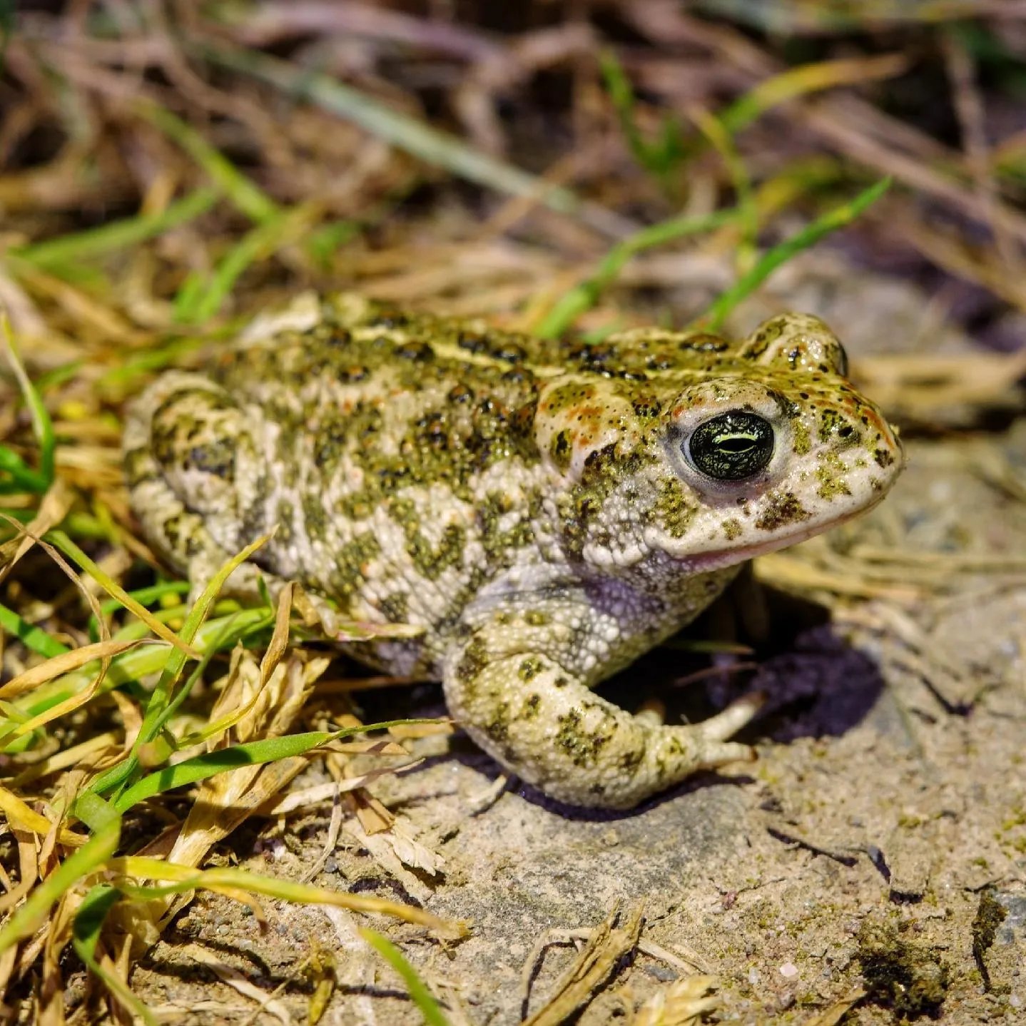
The Maharees three-mile tombolo is full of giant sand dunes that are known for being particularly hospitable to Natterjack Toads, a special type of toad found only in parts of Northern Europe and Ireland.

You can tell them apart from other toads by the distinct yellow line that begins between their eyes and runs all the way down their backs.
We found loads of tadpoles and skeletons in Derrynane National Historic Park and a few live ones on Roscullen Island, but not much luck in Castlegregory.

Toads are cool, but I was searching for niche culture. I learned about two local festivals in Castlegregory, The Pattern and Wren’s Day.
Wren’s Day coincides with St. Stephen’s Day each year on 26 December.
On Wren’s Day, the tradition is to wear “dresses” or headdresses made of grasses from the dunes or synthetic fibres to go searching for wrens.
The searching parties are known as the Wrenboys or Mummers, and they act out the hunt against wrens because they are attributed to the betrayal of St. Stephens and other crimes according to Irish folklore.
Now, the Wren’s Day parade and other activities are light hearted and fun. You can read more about the origins and meaning of Wren’s Day here.

A “pattern” is a term for a celebration that takes place on the feast day of a given parish’s patron saint, and the word actually comes from “patron.”
This is when people or a church body of people gathers to socialize, enjoy food and drinks, and maybe dance and pray together.

Castlegregory’s Pattern origins are said to have began as villagers and local merchants welcomed “maggies” or travelers who came through mid-August each year after the Puck Fair in Killorglin.
The maggies came to visit the village well that allegedly had special healing powers, so why not take the opportunity to throw a party?
During the Castlegregory Pattern, it is traditional to bake mutton pies and quickly simmer them in onion bone broth before serving them.
I am OBSESSED with celebrations of any kind that involve a particular type of food or drink reserved for the event, so this was a thrilling discovery.

BLENNERVILLE
Leaving Kerry’s Gold Coast, drive east to Blennerville.
Blennerville began as a trading port for the nearby town of Tralee, though it was all but abandoned after the canal opened in the 1840s.
The Blennerville Windmill is a working one, and visitors always flock to it for photo ops. It was built in 1800 for Sir Rowland Blennerhassett with five stories and stands 69 feet tall.
There is a restaurant, gallery, arts and crafts shop, and visitors center where you can book tours just outside the windmill.
For anyone interested in the Dingle Way walking route, it starts in Blennerville and ends in Dingle, or vice versa.

ROSCULLEN ISLAND
Making our way back to Dingle, we stopped at Roscullen Island strictly to look for Natterjack Toads. I did not really see anything else to do for entertainment purposes.
If you go out there looking for critters, remember that there are strict protections over the toads and other rare wildlife.
Most of us have some sense about not touching, moving, and certainly not injuring animals, but in some places you could get in serious trouble just for searching.
INCH BEACH
Inch Beach is located in the Inch village, and is most famous for its Blue Flag beach that stretches over three miles along the Dingle Bay.
Most days, the beach is much brighter and sunnier, but we caught it on an overcast evening shortly after rain.
I did not drive a lot during any of my trips to Ireland because I can not handle how narrow and windy the roads are in most places, but I will never forget a few silly moments of driving on Inch Beach, right up against the waves.

FAHAN BEEHIVE HUTS
Visit the Dunbeg Fort, which I learned is a promontory fort, then make your way to the Fahan Beehive huts.
The Fahan property does not have an official tourism website but someone has created an odd Facebook page about it.

These ancient medieval corbelled stone houses (clocháns) were built and lived in by monks as far back as the sixth century, and are recognizable by their unique beehive shapes.


Some of you dorks will probably recognize them from the ones seen on Skellig Michael where Luke Skywalker hid out in Star Wars: The Last Jedi.


Ring forts are found throughout Ireland, but these huts were a special treat.
Cashels, which means castle fort or city, are another interesting structure found around Ireland. You can visit Cashel Murphy just past the Fahan Beehive Huts.

Of course, the surprise addition of PUPPIES helped. These cute little babies were being weaned and prepared to be trained as sheep herding dogs.

Keep your eyes open for other interesting stops along Slea Head Drive, and pop into a local pub any chance you get.
Even if you are not drinking, they are almost always sure to have a big boiling pot of stew and fresh fish in the oven, live music or some kind of game going on, and everyone hollers at you when you walk in like you are one of the neighbours.
If only.

Check out this rad collection of Dingle Peninsula maps before you start traveling Slea Head Drive, or just wing it.

In the area for a while? Follow me to Killarney National Park, The Ring of Kerry, County Galway, and County Tipperary.
*************
© Fernwehtun, 2015- Current. Unauthorized use and/or duplication of this material without express and written permission from this site’s author and/or owner is strictly prohibited. Excerpts and links may be used, provided that full and clear credit is given to Fernwehtun and Fernwehtun.com with appropriate and specific direction to the original content.


Leave a comment