
BADLANDS NATIONAL PARK
The Badlands National Park is officially located in the town of Interior, South Dakota, just seven miles from Wall and about 60 miles east of Rapid City. It was established in 1978 as the 38th national park and the 28th largest.
Within its 382 square miles (244K acres) is one of the most abundant fossil beds and the largest swatch of mixed-grass prairie in the United States.

There is a North Unit and South Unit of the park.
North Unit is where most of the tourist features are like the main driving loop road, overlooks, and hiking trails are, and the South Unit is where the Aerial Gunnery Range, White River Visitor Center, and Pine Ridge Indian Reservation are.
WHAT’S IN A NAME?
Badlands. What’s the first thing that comes to mind when you hear that?
Frederick Remington, an American explorer and landscape painter described his efforts to paint the Badlands as “One set of buttes, with cones and minarets, gives place in the next mile to natural freaks of different variety never dreamed of by mortal man. The painter’s whole palette is in one bluff.”

Former President Roosevelt said “the Bad Lands grade all the way from those that are almost rolling in character to those that are so fantastically broken in form and so bizarre in color as to seem hardly properly to belong to this earth.”
Lakota people call it mako sica which literally means bad lands, and that name stuck.

Despite its beauty, the land is also bizarre, with extreme weather and temperatures, dry rocky soil, constantly eroding rock structures, and almost no protection or shade for miles and miles.
It is gorgeous and awe-inspiring to visit but most of us could not last an entire day out in that sun without some type of shelter.
The Badlands are also known as the Land of Stone and Light, and I like that name even better.

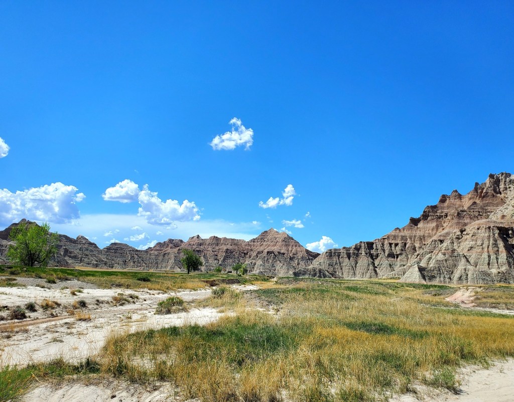
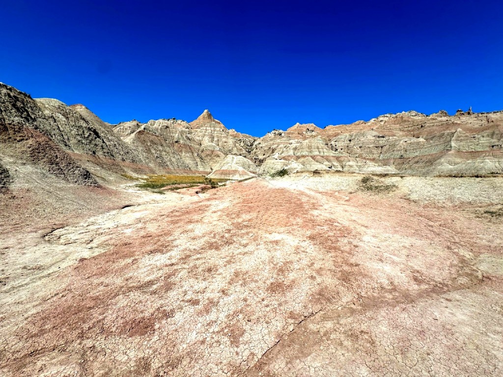
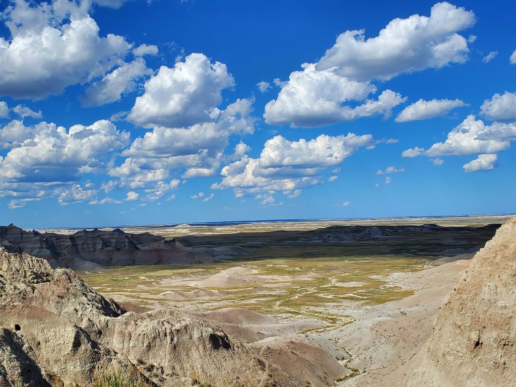
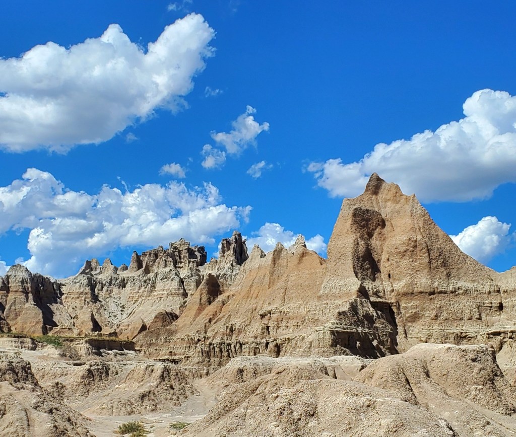
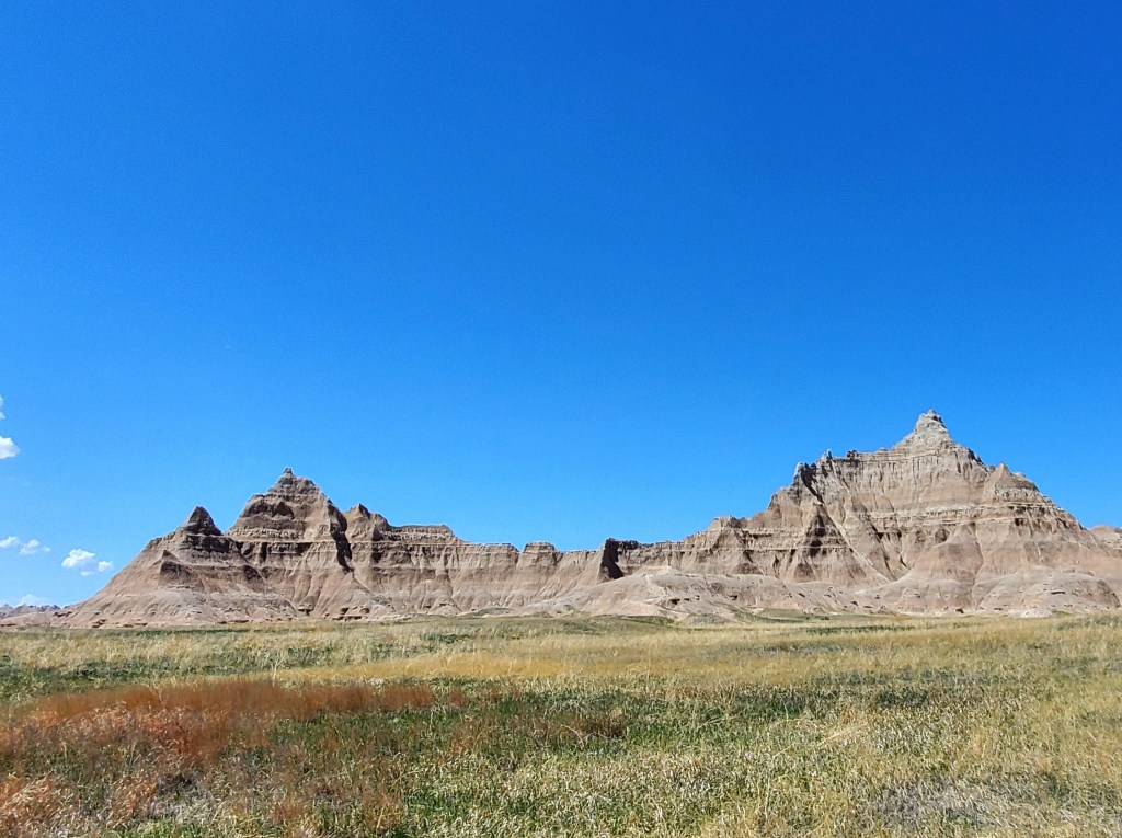
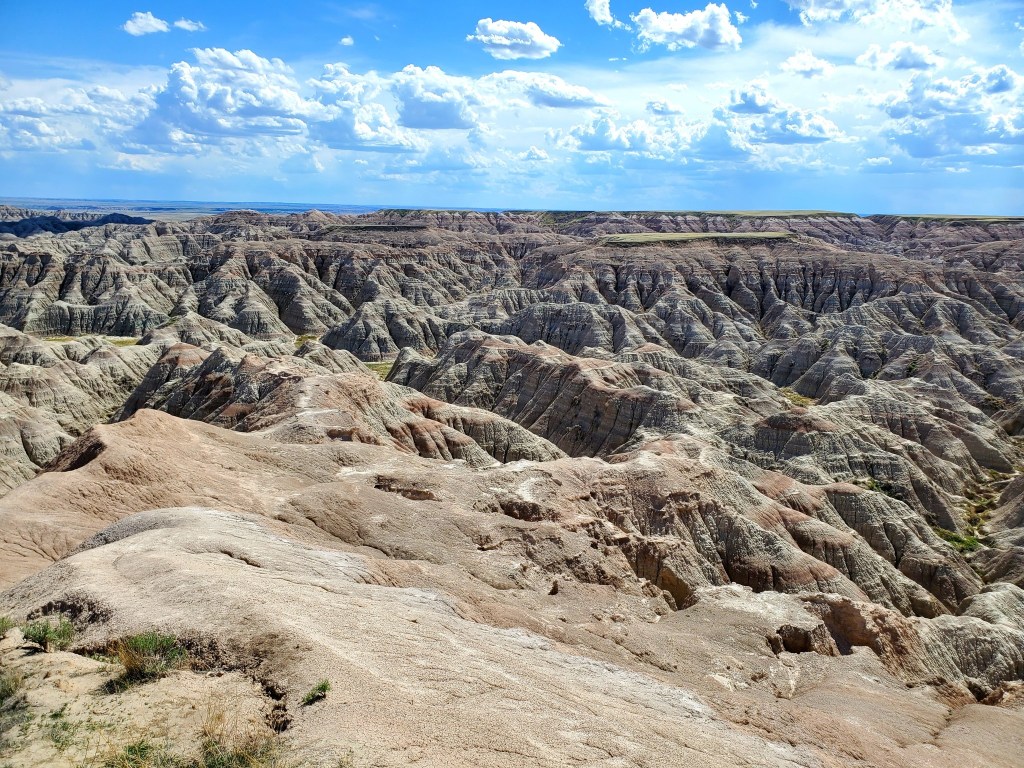
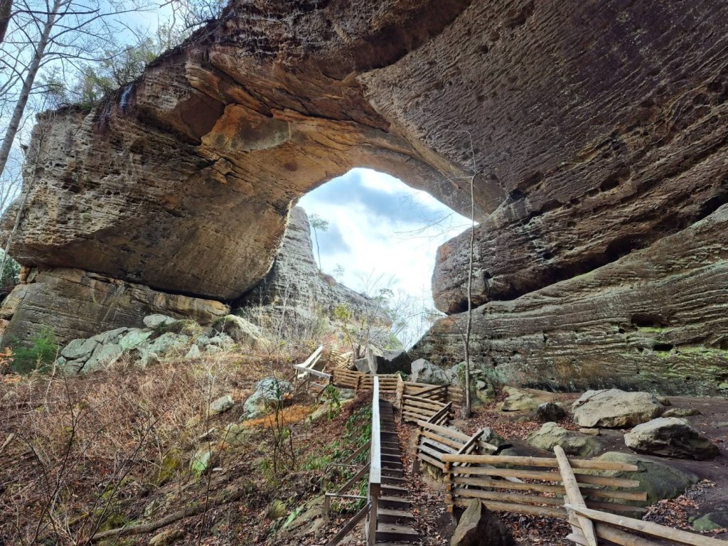
GEOLOGY & FORMATIONS
The castle-like spires, deep canyons, multi-coloured rock mounds, and other unique geological formations have all made this attractive landscape a filming location for famous films like Dances With Wolves, Starship Troopers, Nomadland, Armageddon, and Thunderheart.
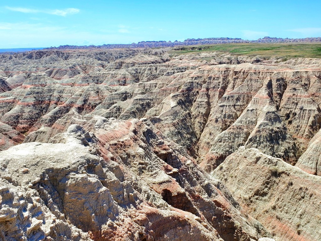
This part of the Badlands is alternately called the White River Badlands, and is considered one of the best places to study erosion. Around 80 million years ago, this area was once part of a massive saltwater sea.
Volcanic activity pushed up the sea floor and as the water drained, it left behind a landscape of marshy plains.
You can see a variety of colours in the layers of sediment. Silt, clay, and volcanic ash create the silver, white, and grey ribbons. Oxidized manganese looks purple, and iron oxide appears orange, red, or tan.
The thick and nearly impassible wall of rock and sediment that creates the east-west boundary of the park is also known as the Badlands Wall.
Sandstone, limestone, shale, and other types of rock formations are found in abundance throughout the Badlands.

FOSSILS & WILDLIFE
The Badlands National Park is famous for having one of the most abundant collection of fossil beds, specifically for mammal fossils.
The most common fossils in the Badlands include horses, rhinoceroses, camels, and other hooved and horned animals like oreodonts and brontothere. Saber tooth tigers, bison, wild dogs, alligators, turtles, crocodiles, birds, and ammonites have all been found as well.

Oglala Lakota people in the Badlands knew about these fossils long before paleontologists started digging them up in the 1800s, eventually identifying more than 80 distinct species.
I will tell you more about the Oglala Lakota people later.

Be sure to walk the Fossil Nature Trail to view some of the fossils and learn more about them.

Living animals at the Badlands include bison, Bighorn sheep, prairie dogs, Pronghorn, porcupines, black-footed ferrets, jackrabbits, deer, coyotes, mice, plus loads of birds, amphibians, and reptiles, so be on the lookout.

The Badlands Wilderness Area covers almost 65,000 acres and it is the site where National Park Service reintroduced bison/buffalo and Bighorn sheep many years ago after they were hunted into near extinction in the 1800s.

TRAILS & ROADS
Other trails in the Badlands include the Door Trail, a 0.26 mile round trip on a wooden boardwalk that takes an average of 20 minutes to complete, depending on how easily distracted you are by rocks.
The Window Trail and Fossil Trail are also classified as easy, accessible boardwalk trails like Door Trail, though the Fossil Trail is slightly longer.

More moderate or even strenuous trails include the Notch Trail, Castle Trail, Medicine Root Loop Trail, and the Cliff Shelf Nature Trail, which range from 1.25-10.2 miles long.

Saddle Pass Trail is considered the most strenuous, though not the longest, at 0.68 miles. It has been described as treacherous during and after rainfall and visitors are advised to practice extreme caution or even avoid it at those times.
Click here to view the NPS guide on hiking trails and other activities in the Badlands.

Driving through the park is easy, just follow the paved Badlands Loop Road, aka Highway 240. The nearly 30-mile route will take you through all the most famous formations and scenic overlooks, along the Badlands Wall, and to mail trailheads.
Conata Basin Road is another option if you want to access the less crowded paths.

SCENIC OVERLOOKS
Each scenic overlook at the Badlands National Park is unique and fascinating, with differing views of this wild landscape. The first overlook you see coming through the park’s Northeast entrance will be the Big Badlands Overlook, right before the Ben Reifel Visitor Center and the Interior entrance.
Here is a map from the US Geological Survey:

You will soon see the Castle Trail, Fossil Exhibit Trail, White River Valley Overlook, Big Foot Pass, Panorama Point, Prairie Wind Overlook, Burns Basin Overlook, Homestead Overlook, Conata Basin Overlook, and many other beautiful stops before you reach the Yellow Mounds.

YELLOW MOUNDS
My favourite spot in the park is the Yellow Mounds, a vibrant rainbow of coloured mineral and sediment layers that add even more rizz to a collection of hilly mounds that remind me of bundt cakes.
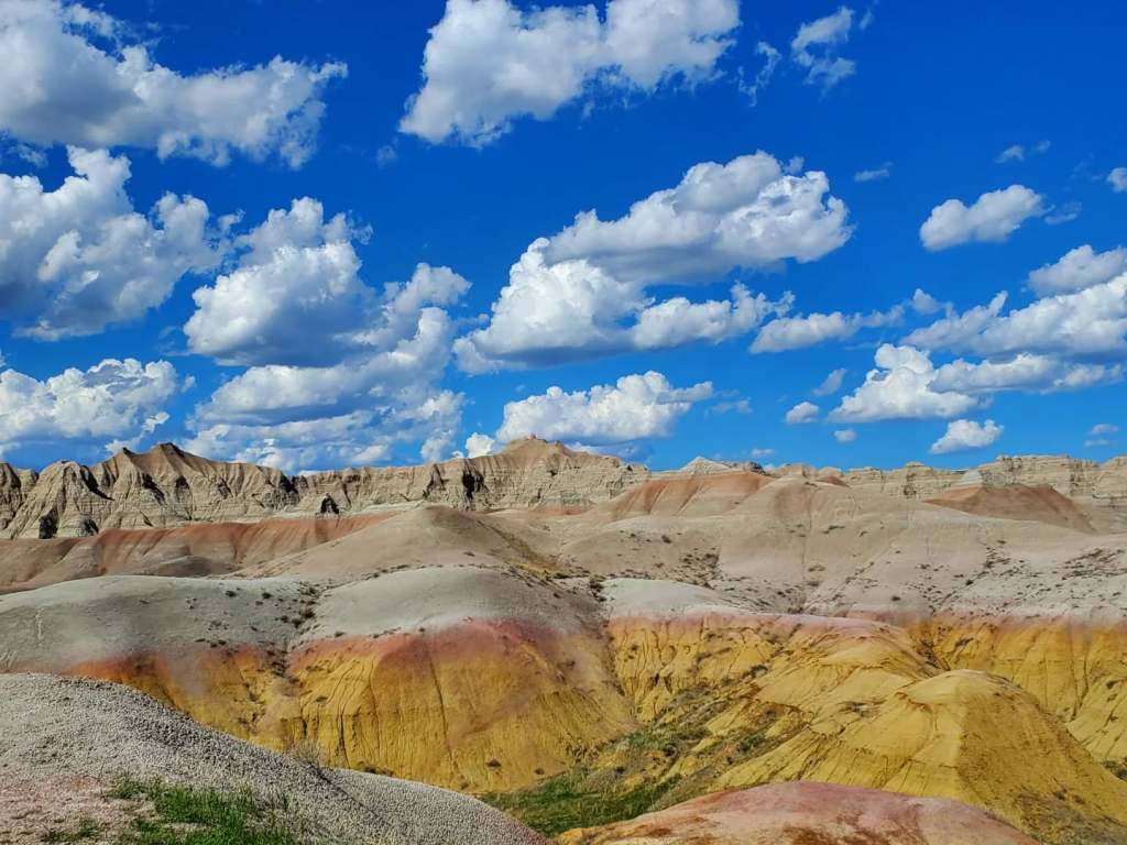
The mounds sit on top of the Pierre Shale, the bottom layer of the sea floor that remains. As the sea drained eons ago, the shale that was left behind condensed into a mineral rich soil layer called a paleosol.
Goethite is found in high concentrations here in the Yellow Mounds, providing its notorious hue.

Click here to read much, much more about that.

After Yellow Mounds, continue along the Badlands Loop Rood to the Ancient Hunters Overlook, Pinnacle Overlook, Hay Butte Overlook, Badlands Wilderness Overlook, and Sage Creek Basin Overlook.
On that side of the park you will see Roberts Prairie Dog Town and you will be near the Badlands Wilderness Area.
Buffalo Gap National Grassland surrounds the entire park and fills the spaces between the North Unit from the South Unit.
MORE SITES TO SEE
Be sure to stop by the Ben Reifel Visitor Center, Fossil Prep Lab, the Badlands National Park Museum with over 360,000 historical and archaeological artifacts, and the Badlands Herbarium to learn about all the various plants and fungi in the Badlands ecosystem.
Check their calendar first because some sites are only open seasonally.
Minuteman Missile National Historical Site is where you can learn and view the Minuteman Missile, America’s most daunting and iconic weapon of the Cold War. The Aerial Gunnery Range is where military exercises like aerial bombing and fire practice take place.
I am obsessed with Cold War spy history but am not really into weapons, bombing, or shooting, so we passed on those two stops. Perhaps next time.
Star Gazers, do not miss out on Night Sky Viewings and the annual Badlands Astronomy Festival.

ATTRACTIONS NEAR THE PARK
We drove in from Rapid City and stopped at the mind-blowing Wall Drug before going to the Badlands.
From Wall, we passed the Minuteman Missile National Historic Site, the Badlands Ranch Store, and Prairie Homestead before reaching the Northeast entrance to the park.

BADLANDS RANCH STORE could be another roadside convenience store at first glance.
Look closer and you will see dozens, and then HUNDREDS, of prairie dogs with tiny little heads popping up, barking at each other, and darting across a space that stretches as far as the eyes can see.
Carefully pull into the gravel parking lot, take a selfie with the Route 66 style monument, then purchase some peanuts from the self-serve boxes on the porch.
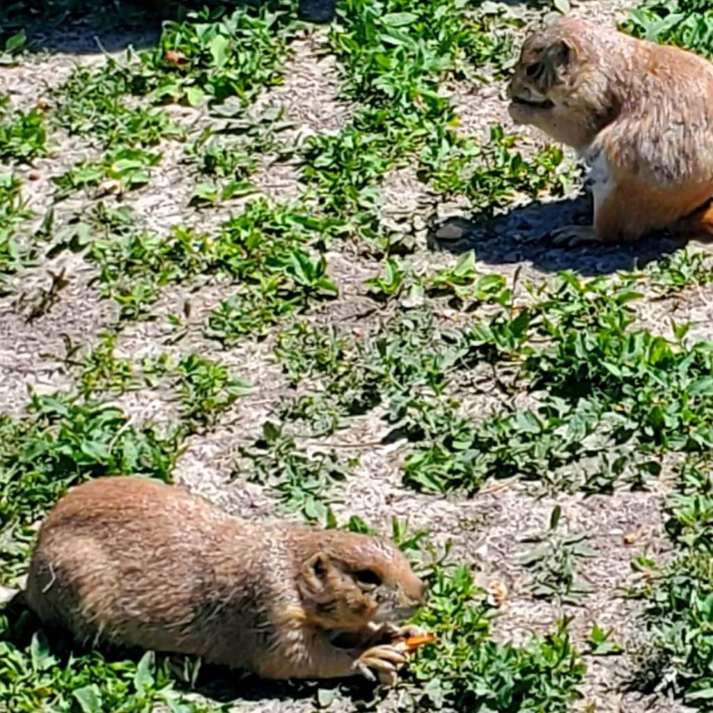
Buying peanuts from the ranch ensures that you are feeding the prairie dogs a food item that is safe for them and approved by wildlife management. Proceeds support the cost of caring for the prairie dogs and maintaining the property, since there is no admission fee or parking fee.
Touching or disturbing the prairie dogs is prohibited.
If you are calm and still, they will often take the peanuts right out of your hand then put on a show of crunching into the shells and devouring them right before you. You can also toss the peanuts a few inches away and they will scurry over to snatch them up.
We apparently passed the vibe check because they were following us around, chittering at us, eating out of our hands, and standing on top of our feet.

PRAIRIE HOMESTEAD is a preserved homestead from the early 1900s and living history attraction where you can learn about more primitive life on the plains.

The site was not open for the season yet, but you can still see some old fashioned farming equipment on display.

Here is a little secret, too: you can catch sightings of rare WHITE prairie dogs on this property.
White prairie dogs, here at least, are leucistic rather than albino. This means they lack most pigments in their fur and skin but still have it in their eyes and nails. It is common to see streaks of grey, black, or brown under their limbs or tails.
We pulled over and watched as two of them ran around, ducking into various holes. This was especially exciting for two women who recently drove to a town almost three hours from home to try our luck at finding rare white squirrels, and we did it!
Unfortunately the photos did not come out well.

OGLALA LAKOTA
One of the main reasons I became so interested in visiting the Black Hills region and the Badlands, aside from its unique formations, was to learn more about the Oglala Lakota people. I published a blog about Wind Cave National Park, the Oglala Lakota people, and their connection to the Black Hills that you can read here.
To summarize, this region of South Dakota that includes the Black Hills and Badlands National Park are sacred to the Lakota, a subtribe of the Great Sioux Nation, and other tribal nations. It is also their home.
There has been an ongoing land battle for over a century now because the US Government seized their land, made and broke multiple legal treaties where they “gave” it back but took it again.
The US Government continues to acknowledge that they are in the wrong but only offer cash instead of just giving the people their #LANDBACK. What the people want most is to just have the right to make decisions about how their land is used and to protect it from being destroyed.
A memorandum was agreed on in 1976 that gave tribal members a little more say in how their land is used, the ability to receive a share of the funds that NPS collects from visitors paying admission fees to the park, and more control over how bison and other animals are managed.

The South Unit of the Badlands is much different from the North Unit that I detailed above. South Unit lies entirely within a Tribal Trust, which means it is Native American land that is being held in trust that is managed by the US Government.
Most Oglala Lakota live on the Pine Ridge Indian Reservation in the South Unit of Badlands National Park. Other Lakota tribe members are known to live nearby on the Rosebud Indian Reservation, Lower Brule Indian Reservation, Cheyenne River Indian Reservation, and Standing Rock Indian Reservation.
There are a few smaller reservations across the state borders of North Dakota, Montana, and even Canada. In more recent years, significant numbers of Lakota people have moved into Rapid City and even Denver, Colorado.
Pine Ridge Indian Reservation is the essential home of the Oglala Lakota, though, and it has been since 1889.

PINE RIDGE INDIAN RESERVATION
Pine Ridge is the second largest Native American reservation in the United States, with around 40,000 people in about 3,000 square miles of rugged and nearly uninhabitable terrain.
There are nine districts and more than fifty distinct communities within the reservation. It overlays much of Oglala Lakota County in South Dakota, which has a CDP community within it called Oglala. Part of the reservation also extends into northern Nebraska.
Oglala.gov Map: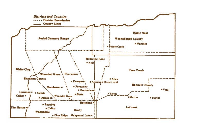
Pine Ridge is the site of the Wounded Knee Memorial, where the US Army murdered nearly 300 Lakota people (mostly women and children) in 1890 because they dared to defend themselves during the Ghost Dance War. You can also visit the nearby Wounded Knee Museum in Wall to learn more about that while you are in the Black Hills.
The Oglala Sioux Tribal Council governs mundane affairs on the reservation, with what little control they are given.
Life at Pine Ridge has been described as miserable and hopeless in every documentary and article I have viewed about it.
Here are some quick facts that I have compiled from various internet sources, listing what I found to be consistent:
- Oglala County is the poorest county in the entire United States.
- Between 50-77% of its residents are living far below the poverty line (sources vary)
- Average life expectancy for residents of the Oglala Lakota in Pine Ridge is 42-55 years old, the shortest range for any community or county in the US. More generous sources quote 66 years.
- Suicide rate is 5x higher than anywhere else in the country
- School dropout rate is over 75%.
- Up to 40% of people on the reservation do not have their own home. Many ran down single-wide trailers house up to 20 or more individuals.
- Around 40% of Pine Ridge residents do not have running water, sewage systems, electricity, or telephone access
- Violent gangs and lethal drug overdoses have become prevalent. Lack of resources, education, and options to earn income makes drug distribution one of the few or only options people on the reservation can turn to. There are few jobs available within the reservation and job seekers report that non-Indigenous companies refuse to hire them when they learn that the applicant lives on Pine Ridge
- Incidents of violent crime and rape have increased at staggering rates but the OST Tribal Police force is so understaffed and underfunded they can not keep up with responding to and handling such urgent issues.
- Over half of the children in foster care in the state of South Dakota are of Native American descent, and there are laws that prohibit grandparents or other Native American relatives from taking the children, reportedly to perpetuate separating children from Indigenous culture just like the “Indian schools” of the past enforced.
Check out NPR’s feature called “Lost Children, Shattered Families” that investigated the foster care system for Native American children, exposing the kidnapping and abuse of Native children that has been going on in various ways since the 1800s.
Here are three videos from YouTube that I want to share:
-and-
-and-
SO HOW CAN WE HELP?
I have spent countless hours researching Lakota-owned businesses and organizations and I feel like there is so much more to learn, but here are a few ways we can help.
The Oglala Lakota people operate a few business in or near the Pine Ridge Reservation like Prairie Wind Casino, Cedar Pass Lodge, Oglala Lakota Artspace, and Singing Horse Trading Post & Bead Store that you can visit and shop in person.
Wozani Native Botanicals, Tanka Bar, and Charging Buffalo Meathouse each have online shopping options as well.
You can attend the Oglala Lakota Living History Village and the annual Oglala Nation Pow Wow & Rodeo to learn more about the Oglala Lakota way of life and meet the people as you support them.
In Rapid City, we fell in love with the Prairie Edge Trading Company. I bought a beautiful black moonstone ring, books on local Indigenous icons, and some other treasures in between wandering their art galleries and bead library.
One Spirit Lakota also has a database of Oglala Lakota families you can directly sponsor sort of like an online Angel Tree if you prefer a more hands-on and direct way of donating.
I would love to see the Lakota people thrive and show the world their talents. Some of the many non-profits and community development organizations for Oglala Lakota people include Oglala.gov, OneSpiritLakota.org, Running Strong, Oyate Teca Project, the Maȟpíya Lúta Red Cloud Heritage Center, Thunder Valley Community Development, NDN Collective, and Re-Member.org.
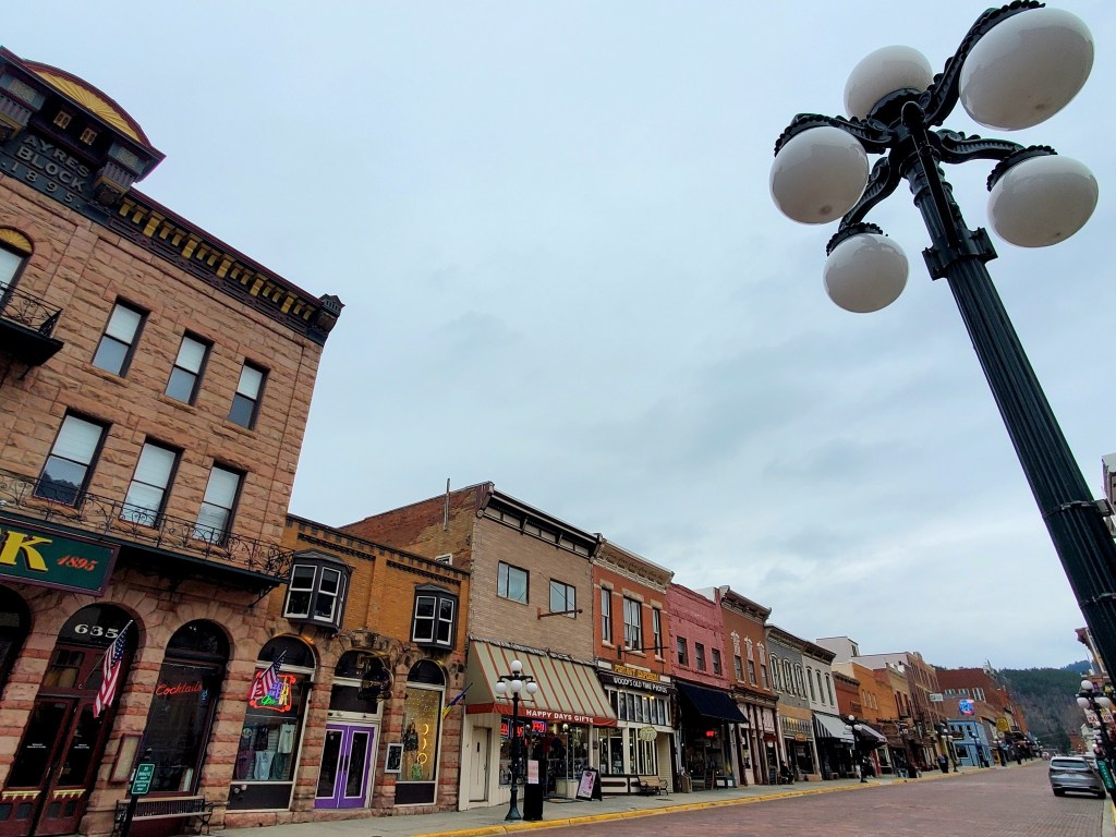
In the area for a while? Follow me to check out more rad sites in the Black Hills National Forest like Keystone, Mount Rushmore, Crazy Horse Memorial, Wind Cave National Park, Custer State Park, Hot Springs, Rapid City, Lead, Wall Drug, Deadwood, and Spearfish Canyon.
You can also check out the Dignity: Of Earth & Sky statue and the Akta Lakota Museum near Chamberlain, follow the Native American Scenic Byway through the heart of the Great Sioux Nation in central South Dakota, and take the 388-mile Oyate Trail from Vermillion to Edgemont.
*************
© Fernwehtun, 2015- Current. Unauthorized use and/or duplication of this material without express and written permission from this site’s author and/or owner is strictly prohibited. Excerpts and links may be used, provided that full and clear credit is given to Fernwehtun and Fernwehtun.com with appropriate and specific direction to the original content.


Leave a comment