
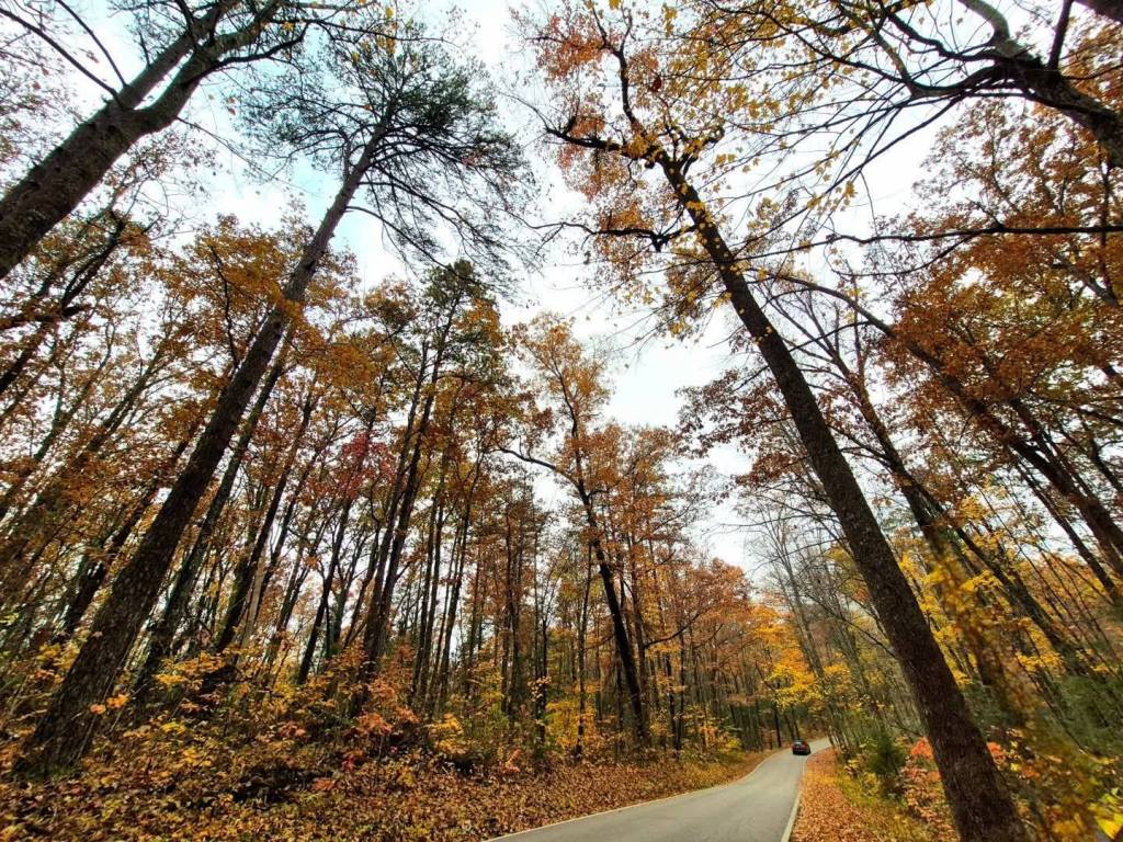
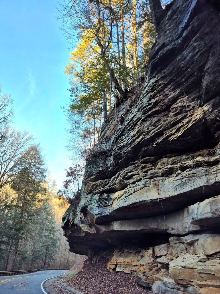
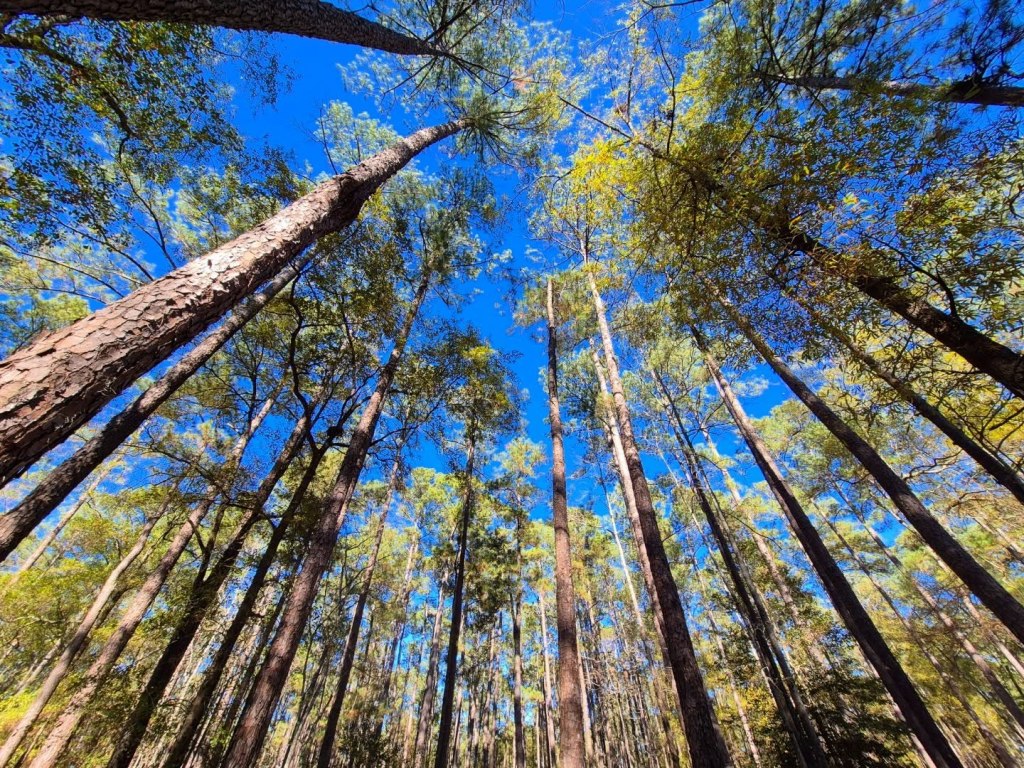
Daniel Boone National Forest spans northeast from the TN/KY state line of Scott County and through Kentucky, beyond Lexington. It is located in the Cumberland Plateau and is part of the Appalachian Mountain foothills; defined as rugged and full of sandstone cliffs, wild formations, and narrow ravines.
DBNF is divided into four ranger districts with the Cumberland, London, and Stearns ranger districts forming a “mainland” column. The fourth district, the Redbird District, is detached from the column and situated slightly east.
Here is a map shared from Kentuckytourism.com: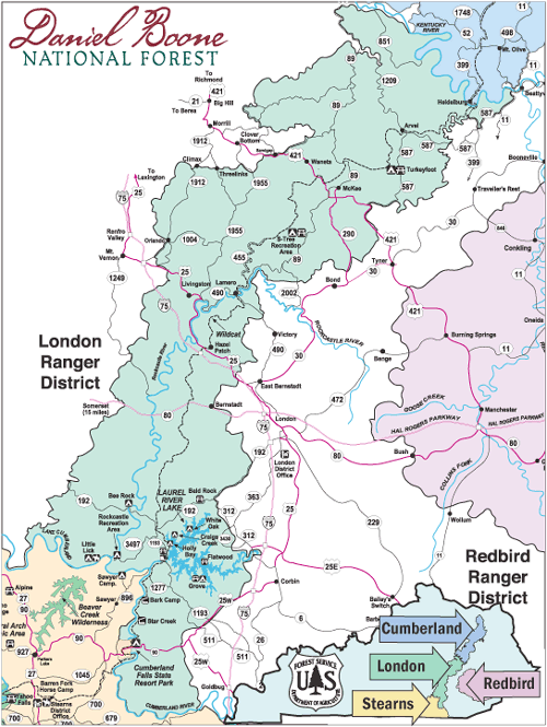
1. CUMBERLAND RANGER DISTRICT
Stars of this northernmost district are the Red River Gorge and Cave Run Lake.
Other popular spots include Creation Falls, Pooch’s Turtle Falls, and Copperas Falls, Princess Arch, Grays Arch, Chimney Top Rock, Indian Staircase Trailhead, Gladie Center, Tater Knob Fire Tower, Clear Creek Iron Furnace, and the Nada (“NAY-duh) Tunnel below.
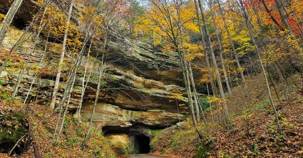
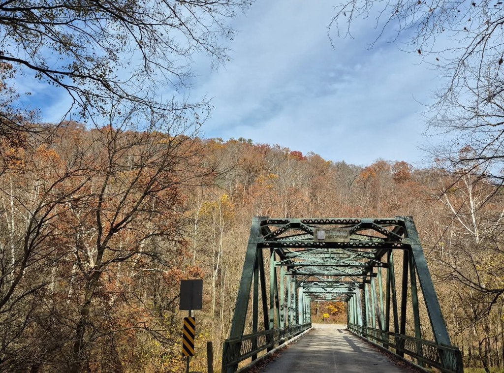
Nada Tunnel serves as a Gateway to the Red River Gorge and it is common to see people pulled over or standing along (or in) the street, admiring its beauty and snapping photos. The tunnel was named after the nearby former logging site and ghost town of Nada, Kentucky.
Only one car can pass at a time through this 900-feet tunnel, there are no traffic signals, and there is no artificial lighting inside.
Be sure to yell really loud the whole time. People also like to honk their horns during this short, but scary, journey.
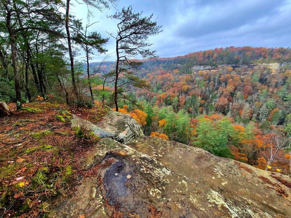
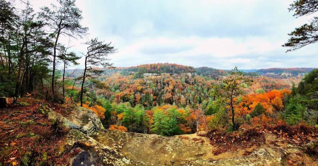
RED RIVER GORGE is alternately known as the Red River Gorge Geological Area, which covers an area of around 29,000 acres and has over 100 natural sandstone arches.
The abundance of cliffs and arches has earned Red River Gorge the prestige of being one of the world’s top rock climbing destinations and it is the headquarters of the Red River Gorge Climbers’ Coalition.
Red River Gorge is listed on the National Register of Historic Places and has been designated as both a National Natural Landmark and National Archaeological District.
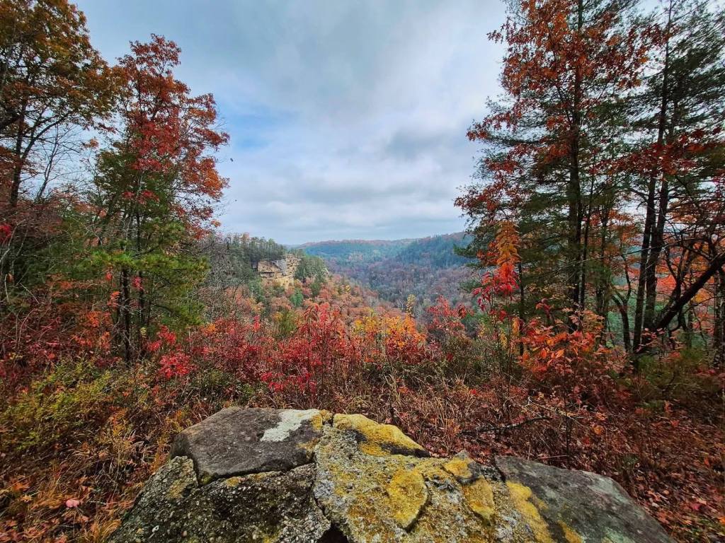
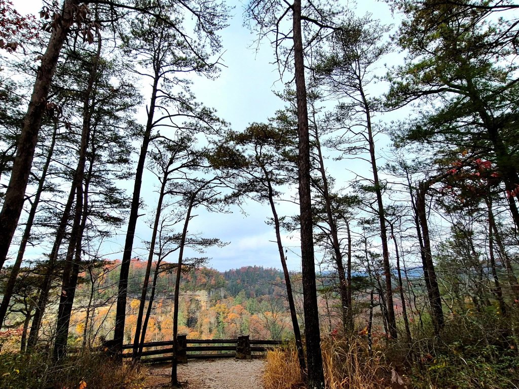
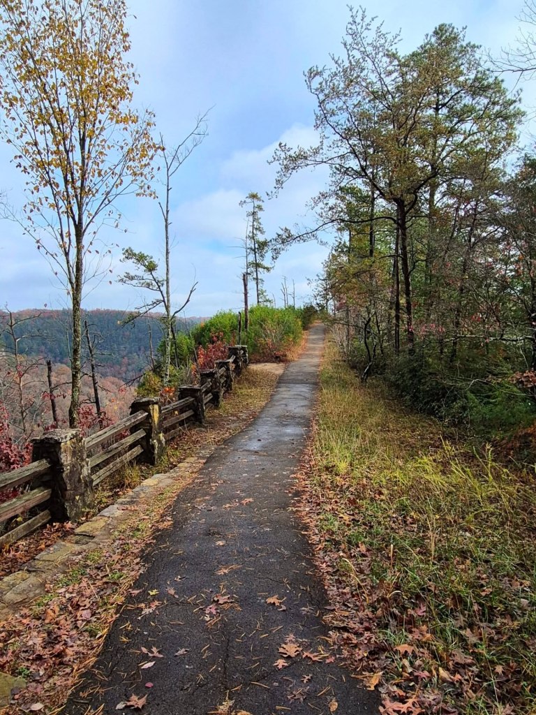
There are so many overlooks to pull off, walk around a bit, and take in the view, even if you do not or can not hike an entire trail.
You can visit RedRiverGorge.com for a free downloadable guide and maps for more than 60 miles of trails by clicking here, and view a list of the Top 10 Red River Gorge Trails here.
Native Americans of the Paleoindian Period were the first to inhabit the area, and you can take a deep dive on five distinct periods by reading this article.
The human population of the Red River Gorge was relatively low until after the Civil War.
After disastrous flooding and destruction, the University of Kentucky commissioned Wendell Berry in 1971 to write The Unforeseen Wilderness, a book to advocate for preserving Red River Gorge.
Berry, now in his 90s, is a famous author, poet, activist, and local farmer.
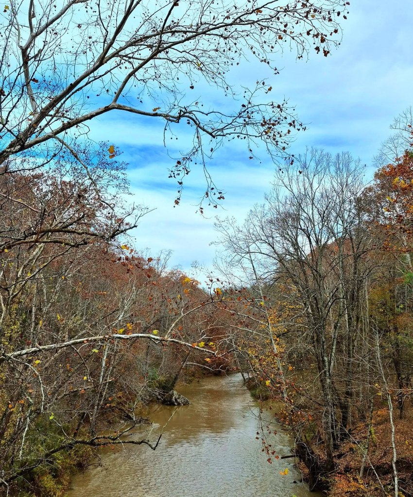
The Red River is a tributary of the Kentucky River and it flows through the Red River Gorge, providing countless opportunities to launch a kayak or canoe.
Red River was declared a National Wild and Scenic River in 1993, a move that protected a 19-mile segment of the river from dams or other construction that would destroy the natural gorge.
Sometimes it can be difficult to tell the difference between a natural arch and a natural bridge, but it comes down to which elemental process created the landmark.
If a structure was weathered into shape by elements like wind, heat, cold, or seeping water but without running water, it is geologically defined as a natural arch. If it was eroded into shape by running water, it is a natural bridge.
The nearby Red River Gorge Sky Bridge can be seen in the film, The Kentuckian, which was the first major motion picture ever filmed in Kentucky.
We enjoyed all the arches, bridges, man-made bridges, and lovely views at every turn.
NATURAL BRIDGE STATE RESORT PARK and Red River Gorge share a border, but the park is technically located outside of the gorge. Both are within the Daniel Boone National Forest, though, and mandatory for any DBNF visit.
The Lexington and Eastern Railroad company first claimed the Natural Bridge as a tourist attraction in 1895, and the area was designated as a State Park in 1926.
It is comprised of about 2,300 acres surrounding the sandstone arch, which stands 65 feet high and spans 78 feet across.
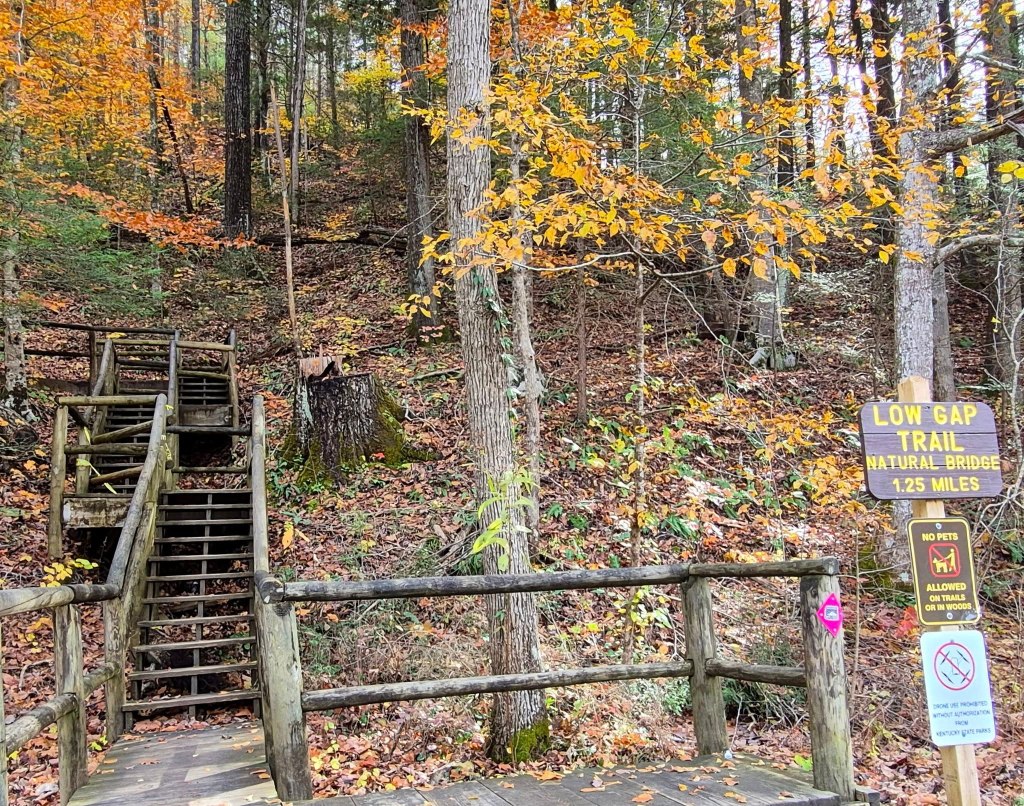
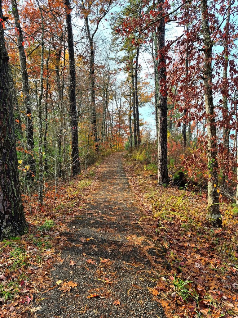
More than 20 miles of hiking trails wind through the park, from 3/4 mile long to seven miles long.
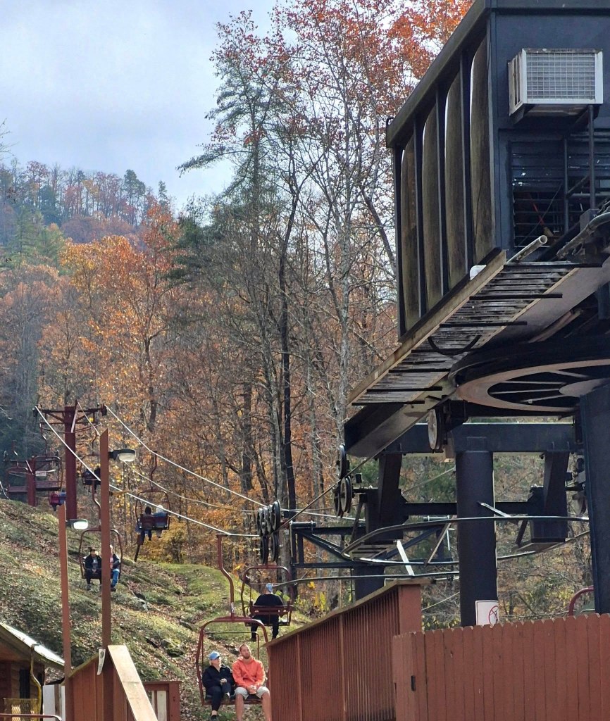
We took the 3/4 mile trail from the parking lot to the bridge first, then checked out the Sky Lift later.
Check out Fort Boonesborough State Park, Olympia State Forest, Paintsville Lake State Park, and Boone Station State Historic Site while you are in the area.
Also consider walking part or all of the 354-mile Sheltowee Trace Natural Recreation Trail which connects Burnt Mill Bridge all the way south to Rugby, Tennessee.
Sheltowee Trace was created in the 1970s by the US Forestry Service and is maintained today by the non-profit Sheltowee Trace Association. The trail is divided into northern and southern sections, and you can visit this site to view or buy trail maps.
2. LONDON RANGER DISTRICT
Stars of Daniel Boone National Forest’s central district are the Cumberland Falls Resort State Park and Laurel River Lake.
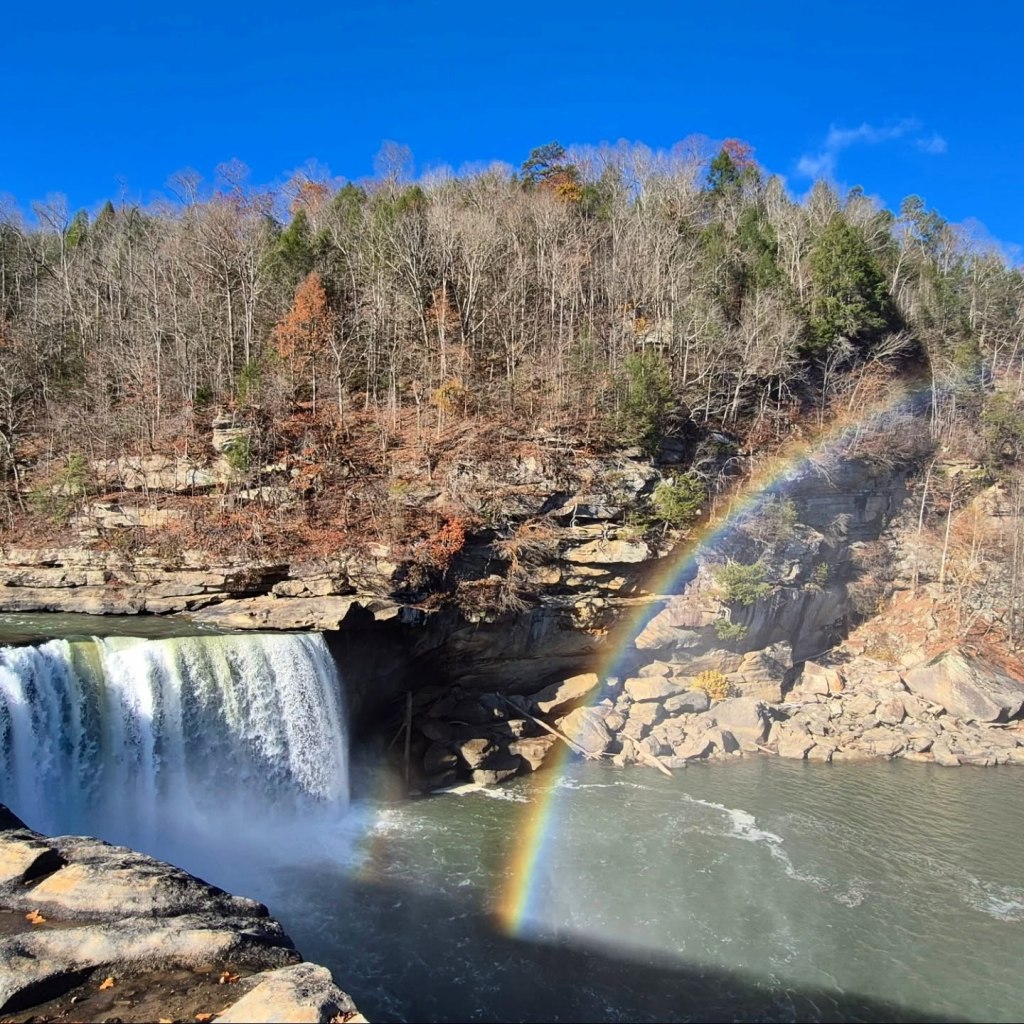
CUMBERLAND FALLS RESORT STATE PARK is famous for its 125-feet wide falls that drop more than sixty feet and are often called “Niagara of the South.”
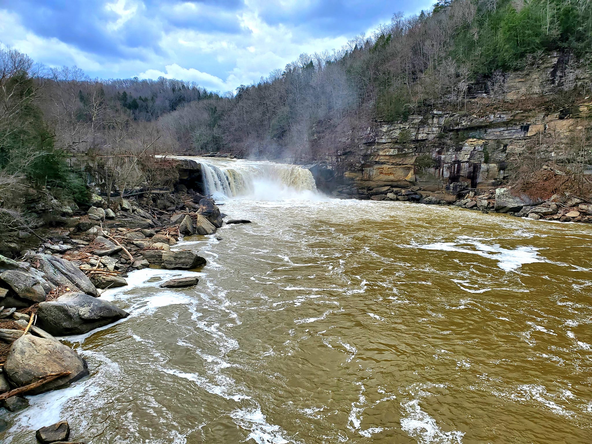
Cumberland Falls are also famous worldwide for the Moonbow, a phenomenon that happens regularly in only six other places in the world. Among these sites are Hawaii, Zimbabwe, Australia, Iceland, Yosemite, and a little town in Arizona that I love called Jerome.
I have not been able to visit during a Full Moon to catch the moonbow, but I have seen the most vivid rainbow of my life there during the day.
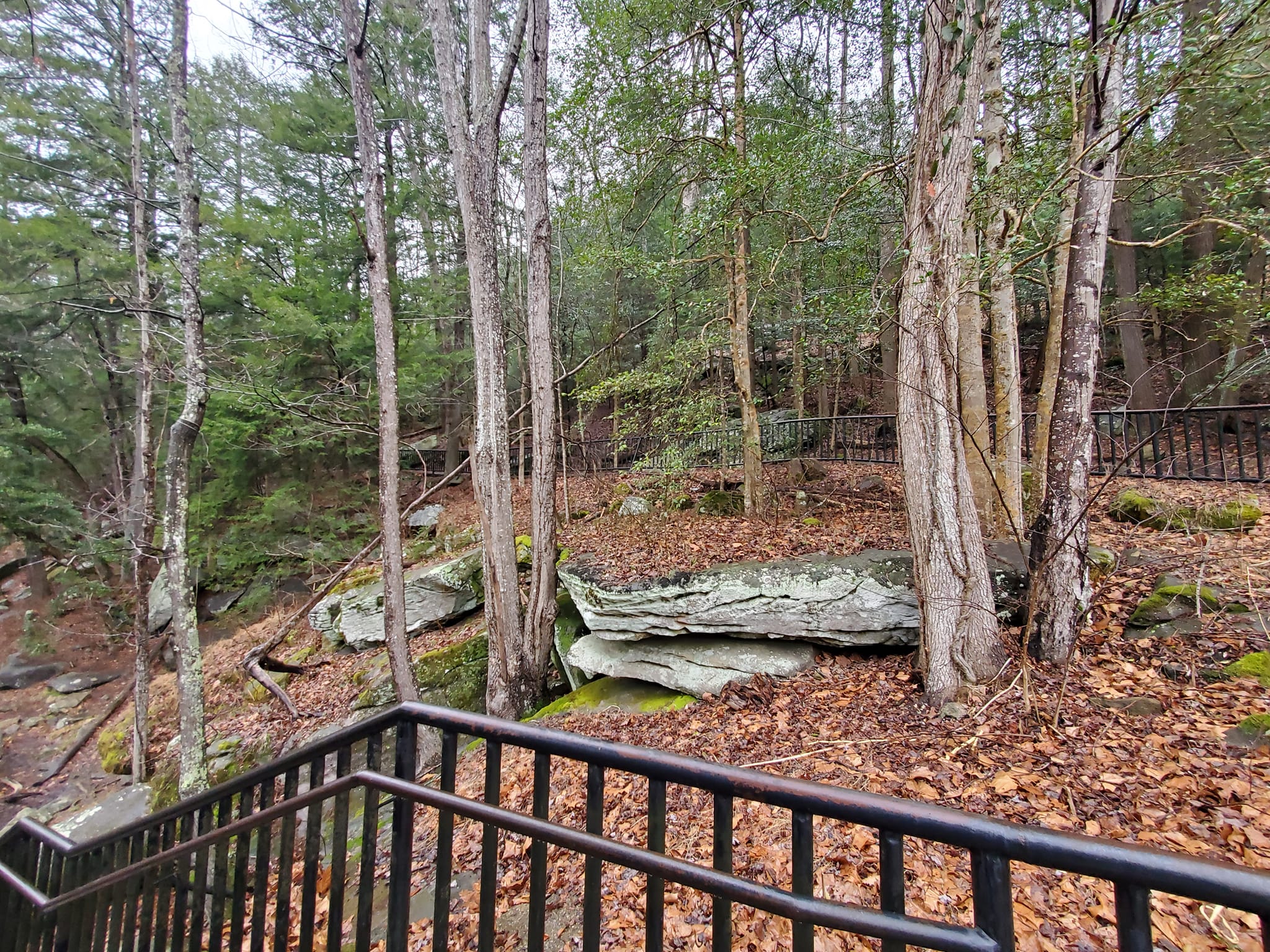
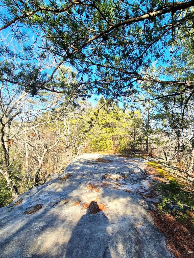
There are almost twenty miles of hiking trails through the park, and the Moonbow Trail leads you to some of the Daniel Boone National Forest trails. The ones nearest to the overlooks have handrails and stone steps or paving, but beyond that it is just you and the dirt.
The park includes a visitors center, gift shop, trail check-in, picnic areas, shelters, several overlooks, a paved path to the main overlook, horseback riding stables, water sports/activities, and some interesting historical and mining exhibits.
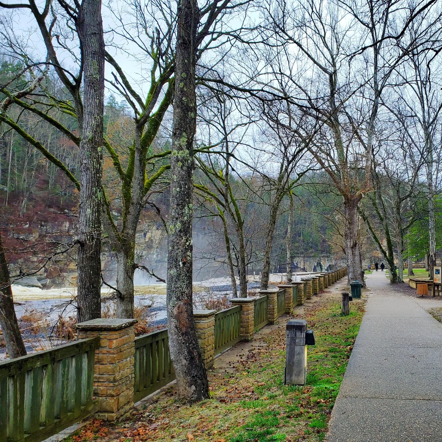
Visit the DuPont Lodge around the corner for an overnight stay. Some additional trails start just outside the lodge and connect near the waterfall.
I have written a separate blog about London, Kentucky if you would like to learn about the city and other area attractions.
More sites you should check out in the London Ranger District include Laurel River Lake, Rock Creek Natural Research Area, Big Dog Branch Falls, and Eagle Falls, just north of Cumberland Falls Resort State Park.
3. STEARNS RANGER DISTRICT
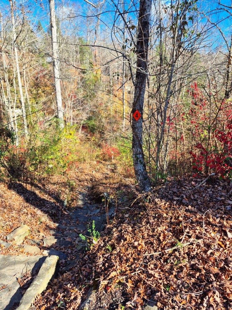
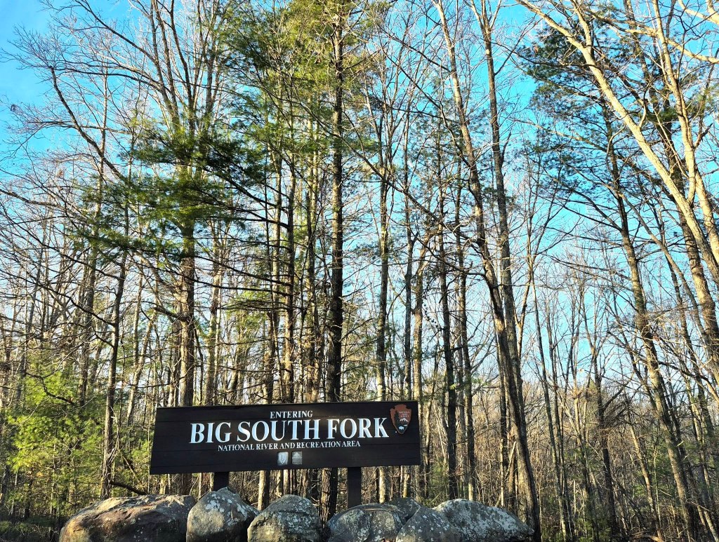
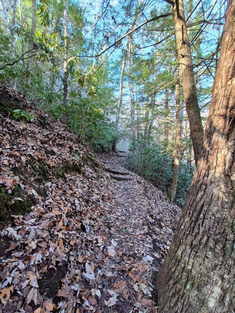
The star of this southernmost district near the Kentucky/Tennessee state line is Big South Fork National River & Recreation Area, or just Big South Fork. This name is applied to many of the area’s attractions but originally refers to the Big South Fork of the Cumberland River.
The Big South Fork region covers more than 125,000 acres along the Cumberland Plateau, and holds one of the highest concentrations of natural bridges in the US.
So far, my favourite spots are the Twin Arches, Natural Arch, Yahoo Falls, and Splitbow Arch, but I still have so much more to explore.
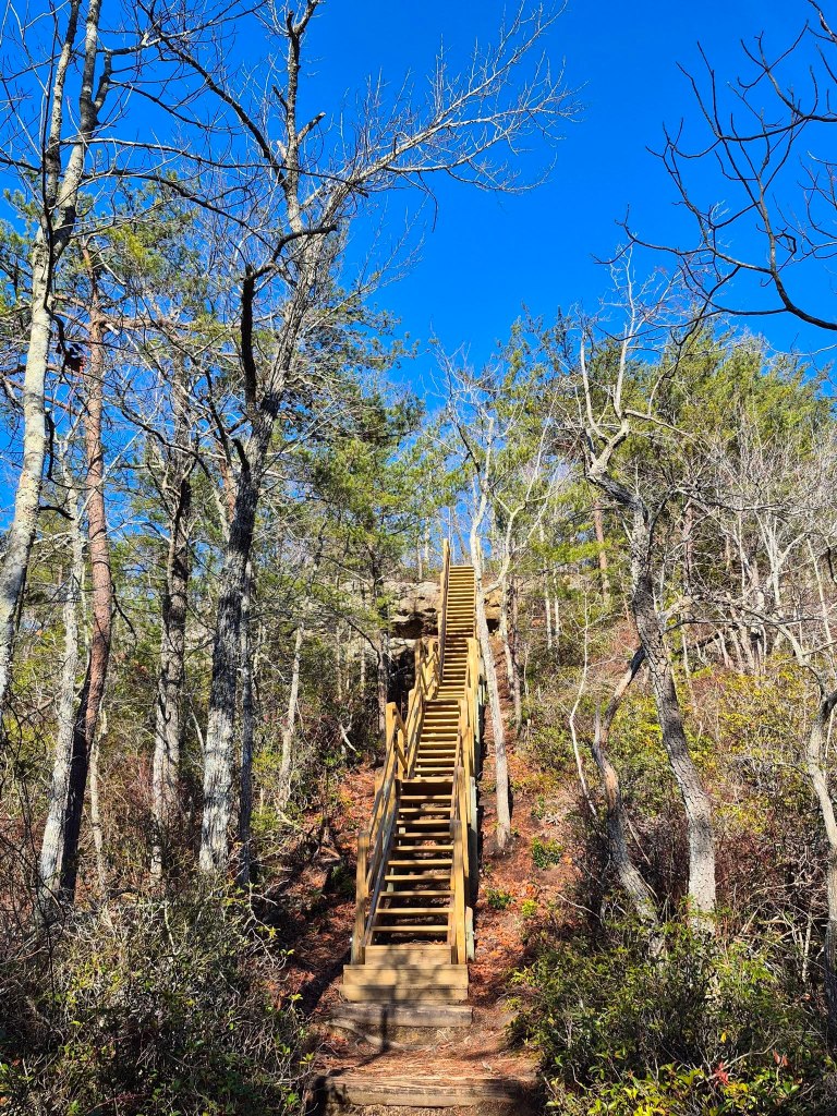
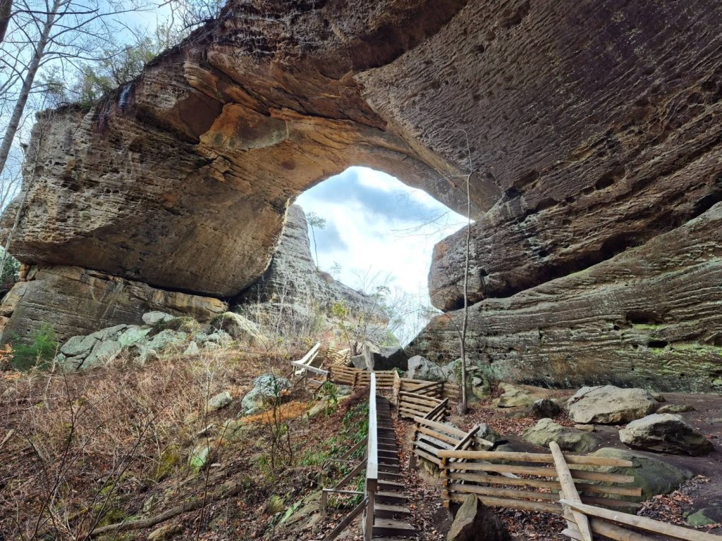
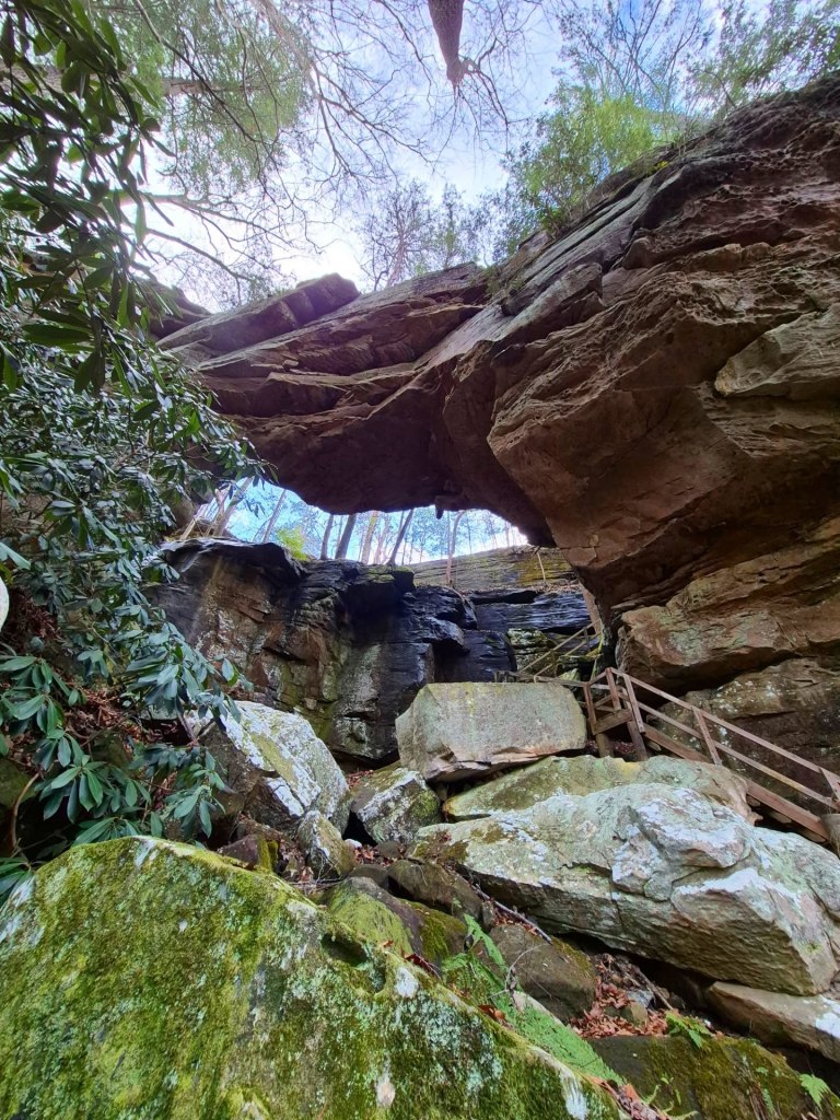
TWIN ARCHES are two adjoined sandstone arches called the North and South Arch, respectively. Together, they are the largest natural bridge complex in Tennessee and also one of the largest worldwide.
North Arch is 62 feet high and 93 feet across, and South Arch is 103 feet high and spans 135 across.
Hiking through this 1,500-acres natural area on the 1.4-miles Twin Arches Trail and then walking across it was so fun.
Once you reach the arches on the Twin Arches Trail, you can continue your hike by following the longer Twin Arches Loop Trail for another 3+miles, with the total distance of the Loop Trail being 4.6 miles.
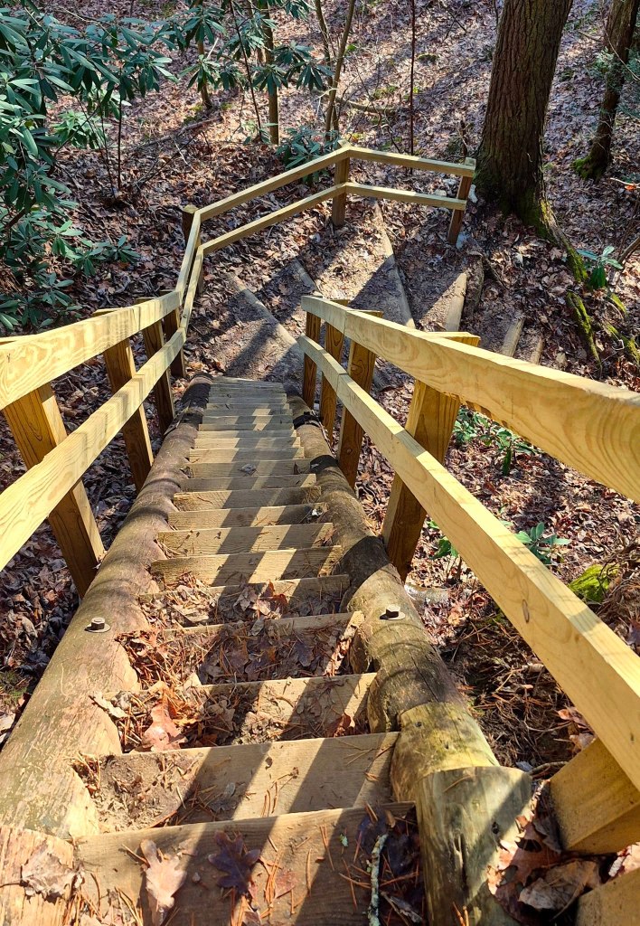
There are a few different spots with steep wooden steps you should know about, but they are sturdy and have solid handrails.
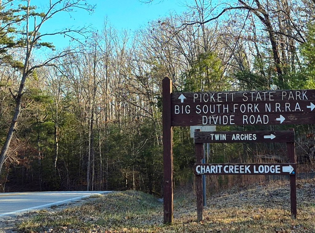
Check out Charit Creek Lodge that is accessible by the Loop Trail, if you want to stay overnight.
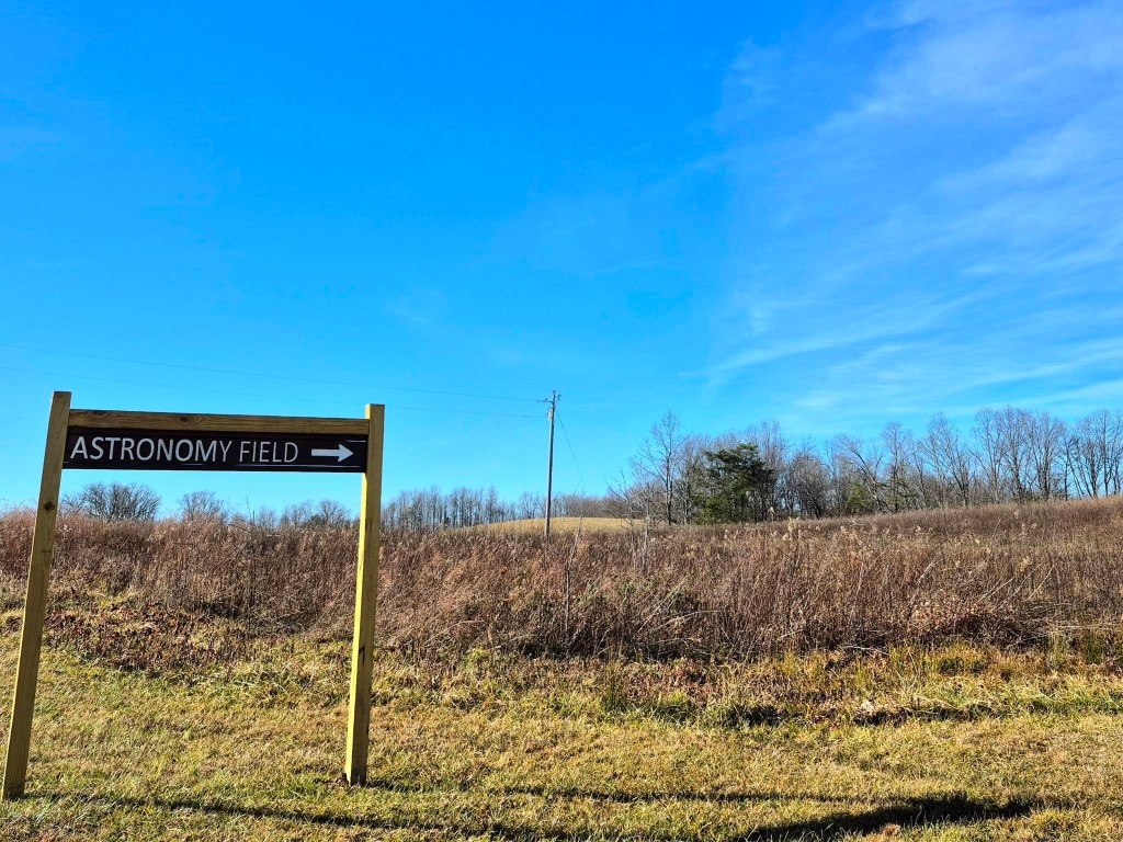
To reach the Twin Arches parking lot, you will pass the Pogue Creek Canyon State Natural Area with its Astronomy Field, and drive through Pickett CCC Memorial State Park.
I would love to return to the Astronomy Field when they host a Dark Sky Viewing event.
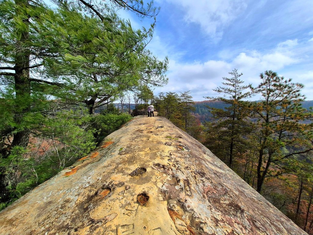
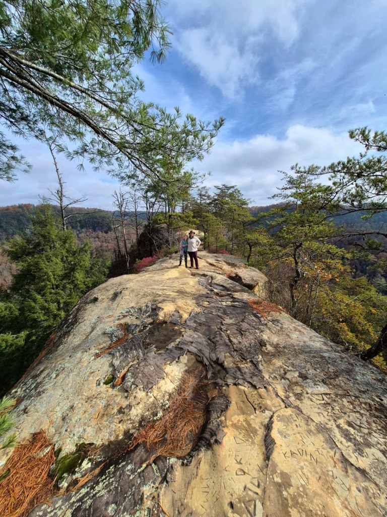
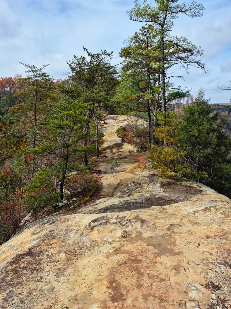
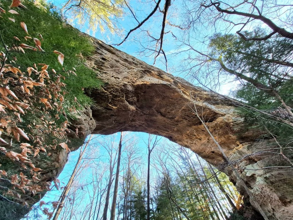
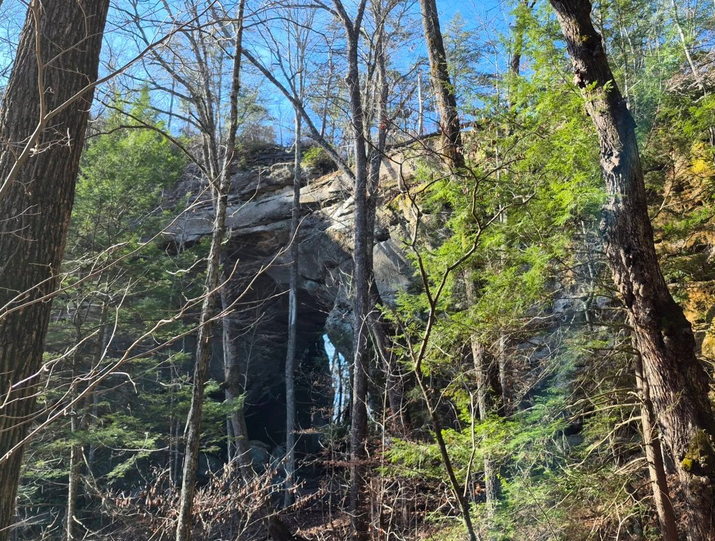
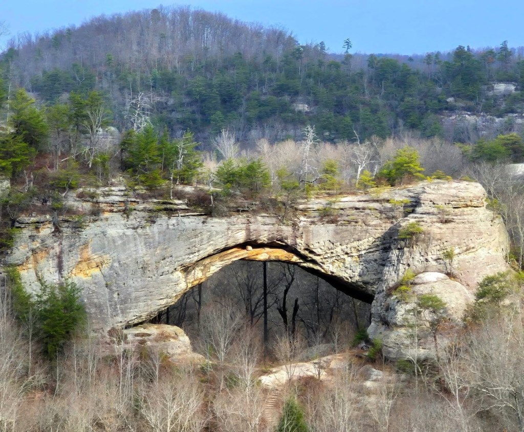
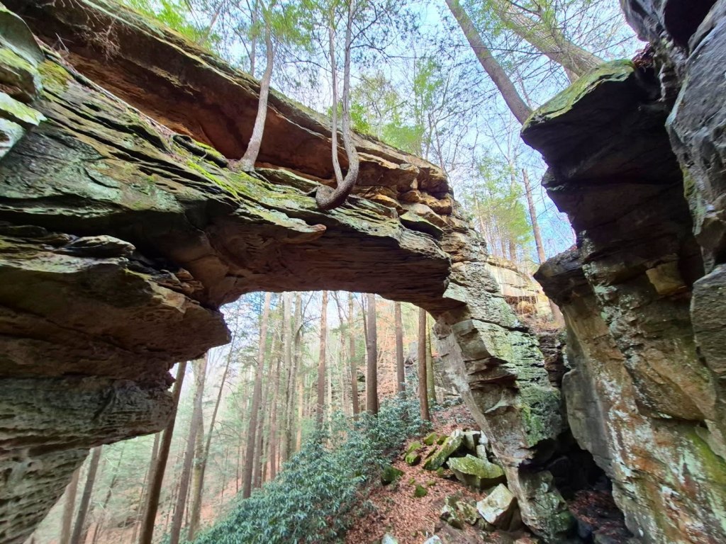
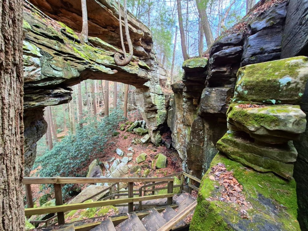
NATURAL ARCH SCENIC AREA is home to a 100-feet long sandstone arch.
Follow the mile-long Natural Arch Trail #510 to see the arch, or you can follow the 5.13-miles Buffalo Canyon Trail #508 that you will see once you start Trail #510.
The scenic area has a beautiful park with several picnic sites and shelters, and an amphitheater.
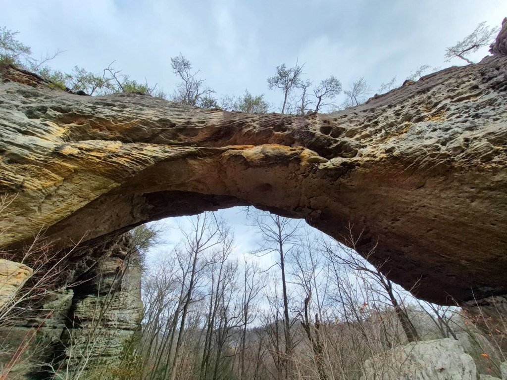
Below is the view of the arch from an overlook near the parking lot.
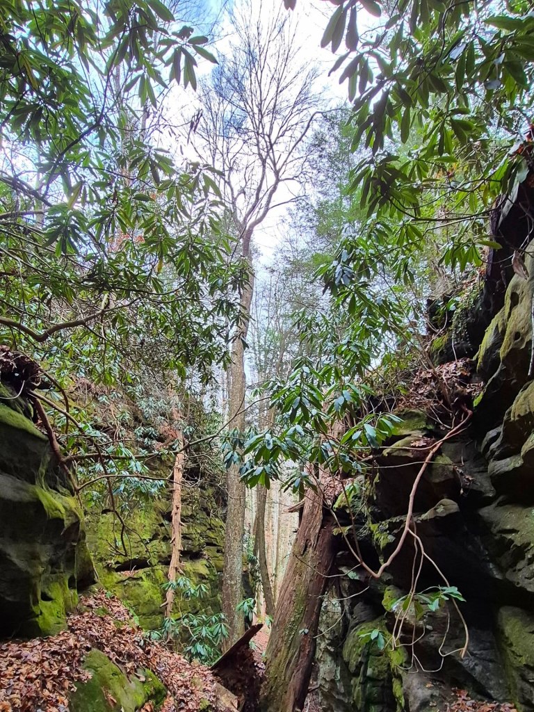
I was really wowed by the intricate markings of the rock walls and various structures we walked through.
You can download a guide and map here.
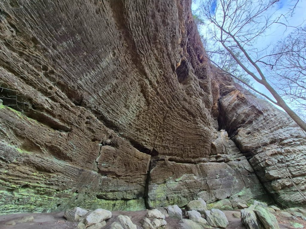
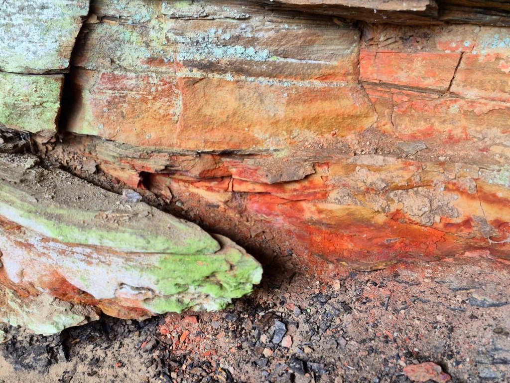
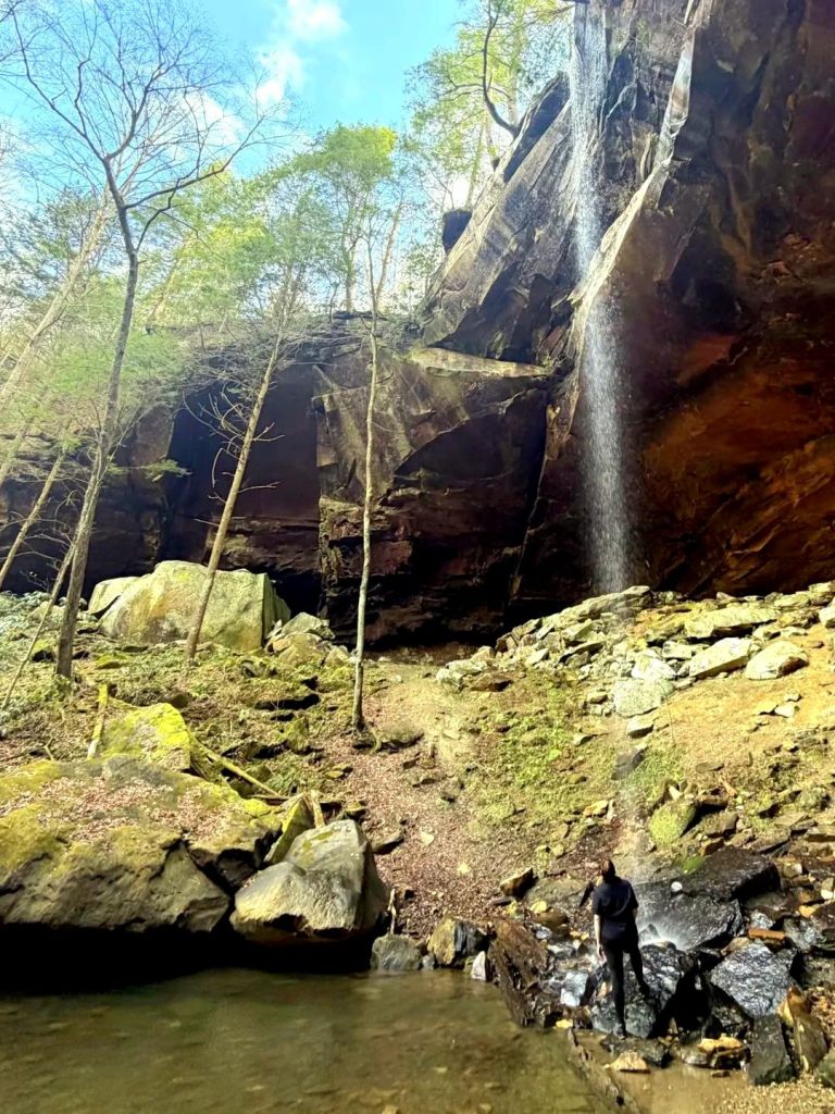
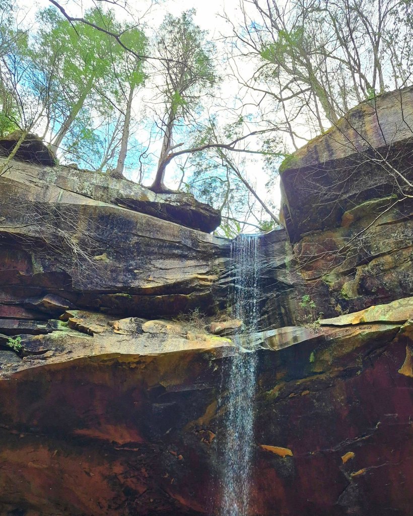
YAHOO FALLS is the highest waterfall in Kentucky, dropping 113 feet from top to a shallow wading pool underneath.
The name “Yahoo” allegedly came from an incident where Daniel Boone, the Daniel Boone National Forest’s namesake, shot a Bigfoot. The word “Bigfoot” did not exist back then so Boone referred to the creature as a “Yahoo.”
“Yahoo” is also a slang term used in Gulliver’s Travels to describe a crude person.
Folks in the South/Southeast sometimes pronounce Yahoo like “YAY-hoo” but I was not able to verify local preferences.
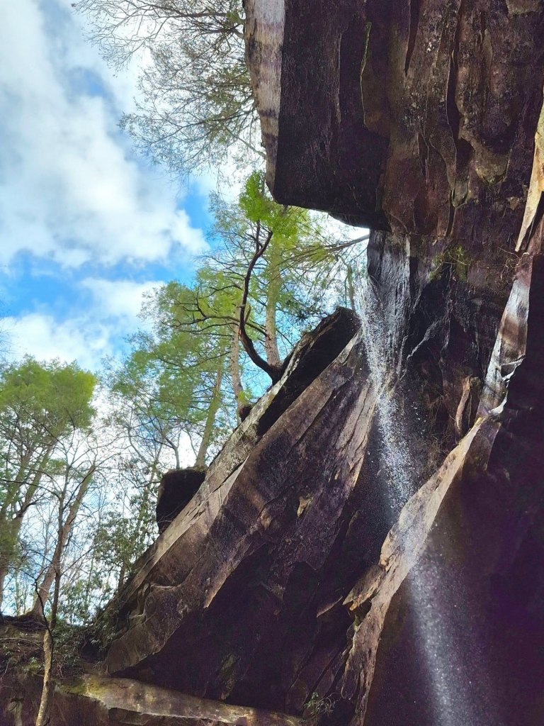
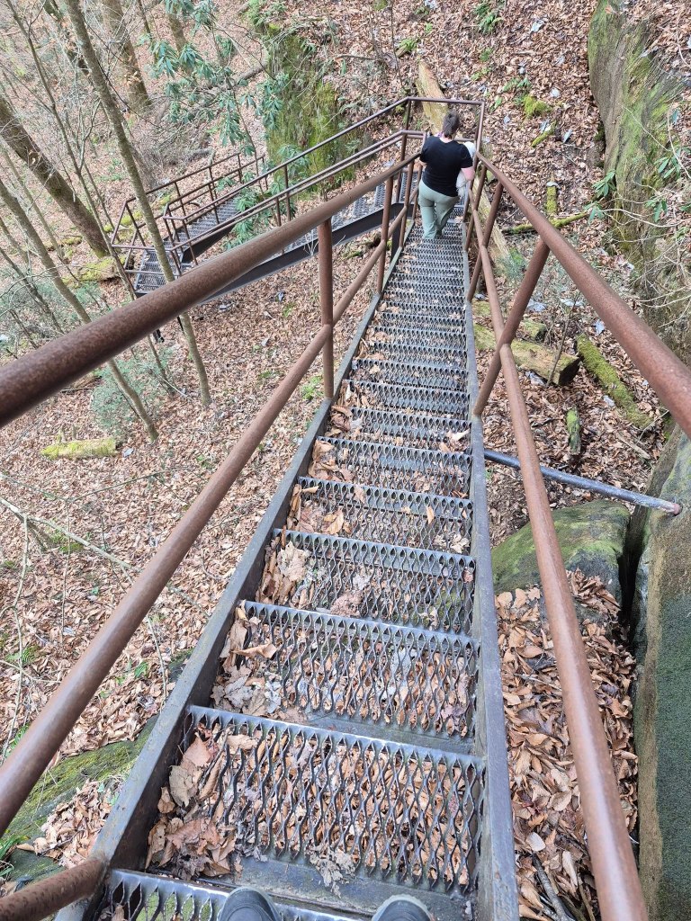
From the parking lot, we followed the trail to the split where you go left and downhill to the stairs and lower falls.
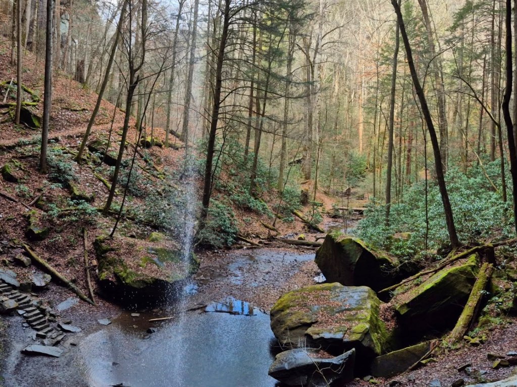
This came with a series of around 100 steep metal stairs that could be daunting for some to go up or down.
We were rewarded abundantly by our arrival into the rock wall shelter.
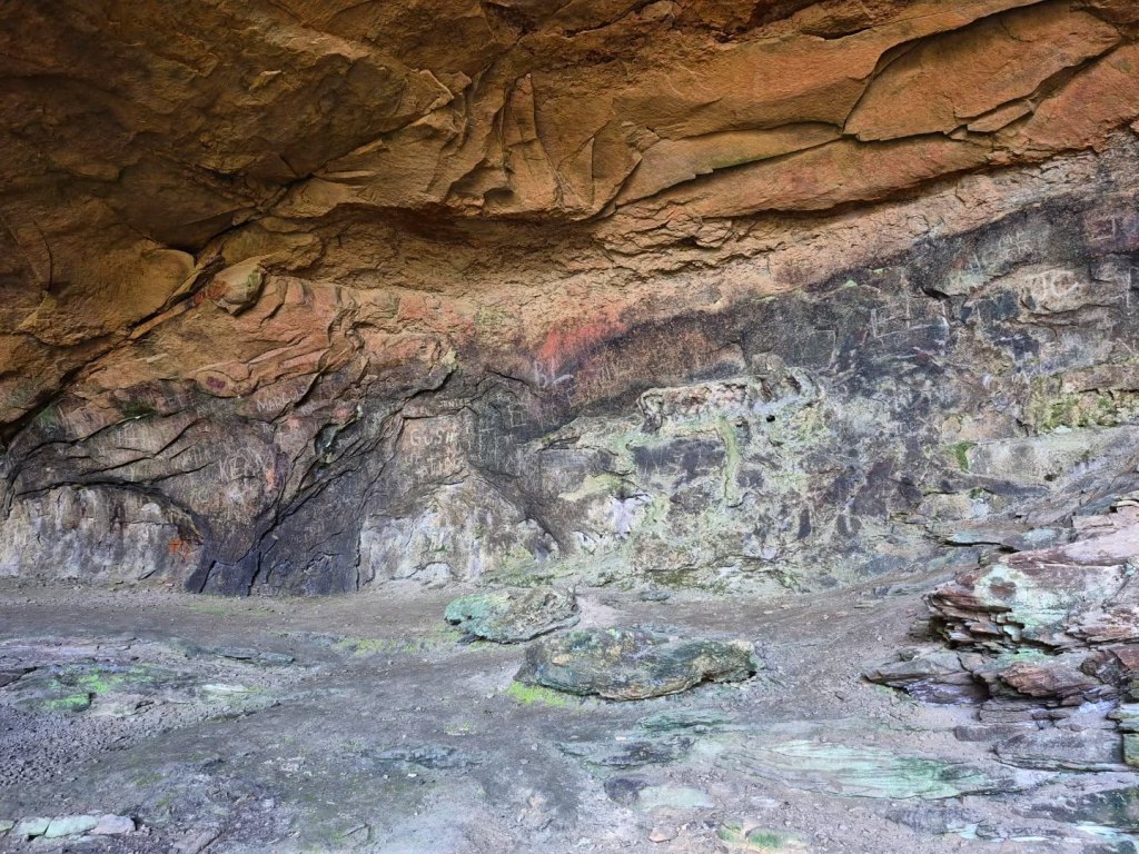
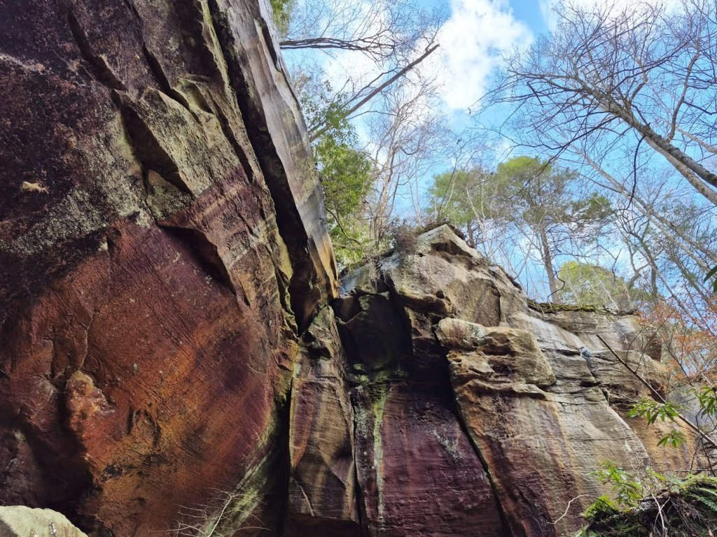
The whole area is full of vivid colour-striping from mineral deposits, and it felt like another planet.
We spent a significant amount of time standing directly under the falls and wading in the pool, reminiscing about our former lives as Hellbenders.
Once we were ready to move on, we opted to backtrack to the parking lot instead of continuing the rest of the steep loop uphill. This was our second of three separate hiking trails to conquer for the day and we wanted to conserve a little energy.
SPLITBOW ARCH somehow feels like the most mystical of all the arches I have visited so far.
Unlike most, this one is split and you can actually climb around inside it.
The 0.7-mile Splitbow Arch Trail can be accessed as a 0.3-mile out and back or a full 0.7-mile loop. I would absolutely suggest the full loop, though the second half is a little steep.
The foliage in and around it give it a jungle vibe, and the fascinating rock walls and structures inside remind me of an ossuary. I kept pointing out all the different “skulls” I saw as we walked through.
Splitrock Arch is on the same property as Bear Creek Horse Camp, which is absolutely full of black bears in appropriate seasons. You can also tour the formerly thriving Blue Heron Mining Community or book a ride on the Big South Fork Scenic Railway while you are out near Stearns.
On top of my list for Big South Fork returns will be Angel Falls & the Honey Creek trails.
4. REDBIRD RANGER DISTRICT
Stars of the Redbird Ranger District are Buckhorn Lake State Park and the Redbird Crest Trail. I have not spent much time in this district, as it is disconnected from the forest’s “mainland” and is mostly traversed by ATVs, which I do not own.
The Redbird Crest Trail (RBCT) has more than 100 miles of trails for ATVs and off-road vehicles winding through this rugged 145K+ acres tract of land. You can also hike, bike, or ride horses there, but the trail is considered extremely challenging and technical, and I don’t know about all that.
Speaking of areas I have not been, the Daniel Boone National Forest has many wilderness and wildlife management areas including the 4,800+ acres Beaver Creek Wilderness Area, the nearly 13,000-acres Clifty Wilderness Area, the 44,000+ acres Daniel Boone WMA, Cumberland Forest WMA, and others.
Maybe I can meet a new friend that will give me an ATV tour someday, but for now I will stick to Buckhorn Lake State Park.

I will update this blog again once I visit more places, but drop me a line if I missed something!
In the area for a while? Follow me to some other great spots nearby like the Cumberland Gap National Historic Park, Mammoth Cave National Park, Bernheim Forest, Lexington, Louisville, Harlan, Berea, Big Bone Lick State Historic Site, and Somerset.
*************
© Fernwehtun, 2015- Current. Unauthorized use and/or duplication of this material without express and written permission from this site’s author and/or owner is strictly prohibited. Excerpts and links may be used, provided that full and clear credit is given to Fernwehtun and Fernwehtun.com with appropriate and specific direction to the original content.


Leave a comment