
Cherohala Skyway is just one of thirteen famous byways in Tennessee, including Natchez Trace Parkway, Newfound Gap Road, Great River Road, Cumberland Scenic Byway, East Tennessee Crossing, Woodlands Trace, Norris Freeway, Sequatchie Valley Scenic Byway, Great Smoky Mountains Byway, Tennessee River Trail Scenic Byway, Walton Road Scenic Byway, and Ocoee Scenic Byway

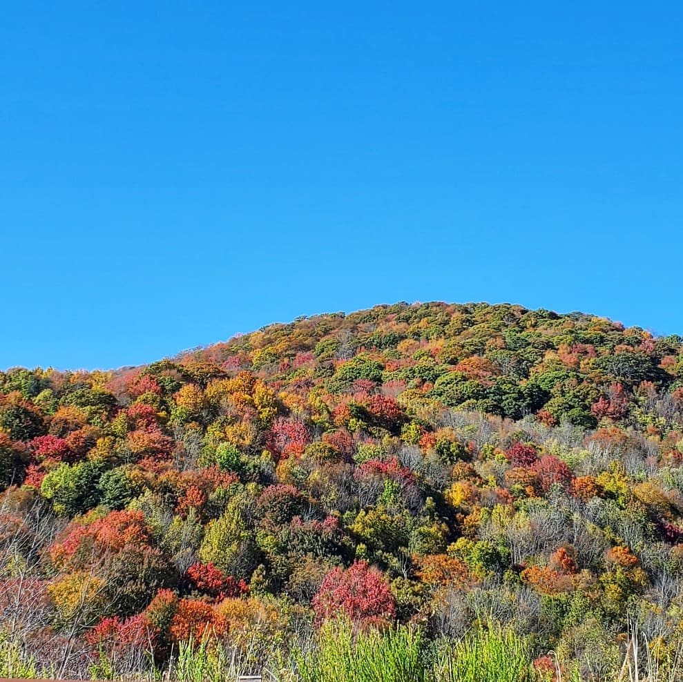
One of my favourite drives for viewing fall leaves in East Tennessee is the Cherohala Skyway, a National Scenic Byway that connects Tellico Plains, TN to Robbinsville, NC.
The Cherohala Skyway is also known as TN State Hwy 165 and NC-143. “Chero-” comes from the Cherokee National Forest, and “-hala” comes from the Nantahala National Forest, both connected by the Skyway.

TELLICO PLAINS
If you are jumping on the Skyway from the west end, you will start in Tellico Plains, Tennessee. The tiny town is the gateway to the Cherohala Skyway and currently has less than 1,000 residents.
This land used to be an Overhill Cherokee village called Telliquah and is flush with Cherokee and Muscogee history, from the Tellico River to the Unicoi and Appalachian Mountains.
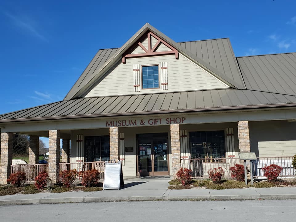
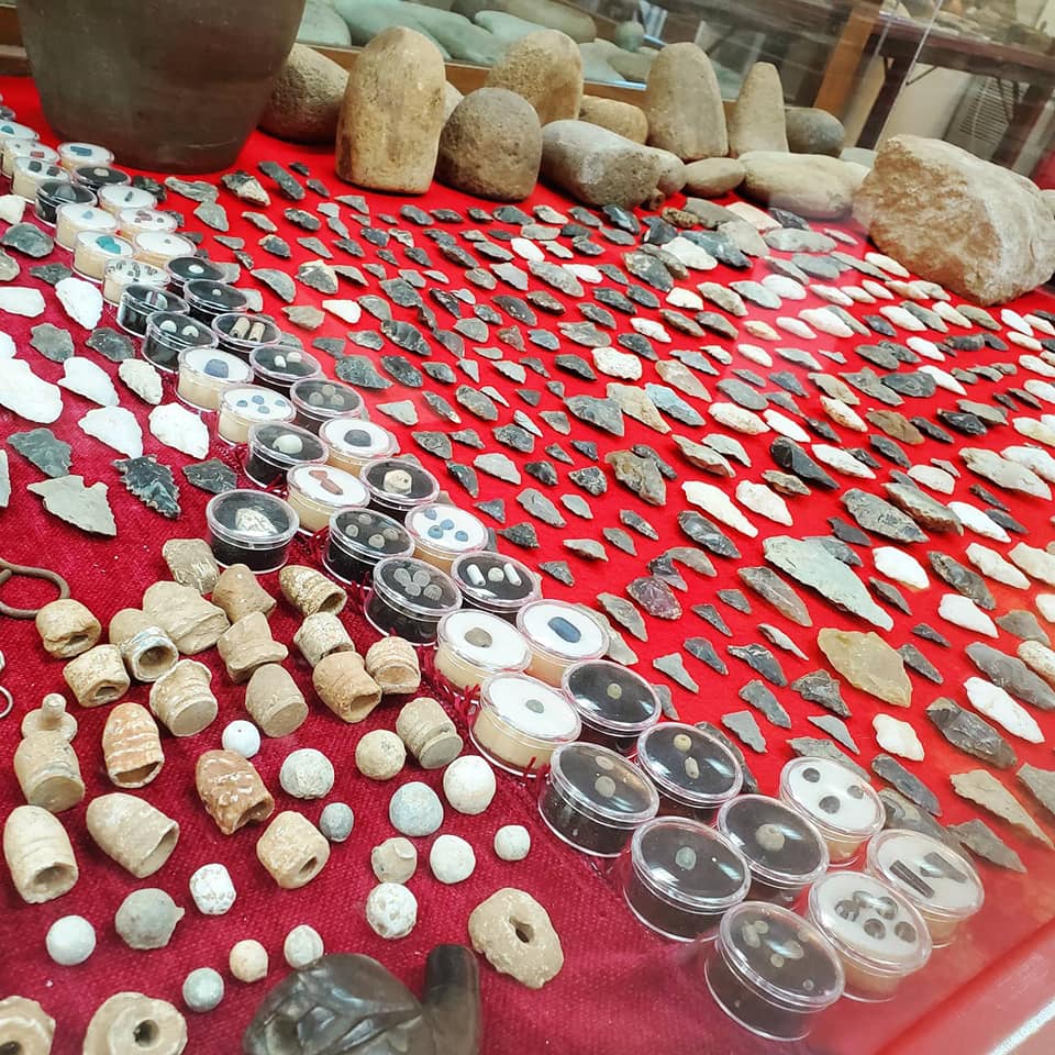
Visit the Charles Hall Museum & Heritage Center in Tellico Plains before you begin your journey to learn the area’s history.
Hall’s incredible legacy and collection of town memorabilia, photos, weapons, artifacts, musical instruments, household items, pottery, art, and more have created an enormous compendium of Monroe County and Cherokee history.
Outside the museum, other spots to visit in Tellico Plains include the Bears Den Café, Tellicafé, Tellico Grains Bakery, Trout Mountain Coffeehouse & Inn, Tellico Outfitters, Stone Cottage Shops & Gardens, and The Bookshelf. You can read my blog about Tellico Plains here.
Once you make that turn from Highway 68 in Tellico Plains onto Hwy 165, just keep going.
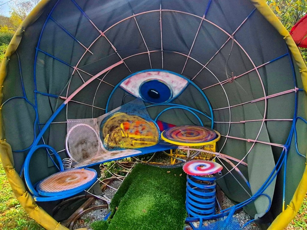
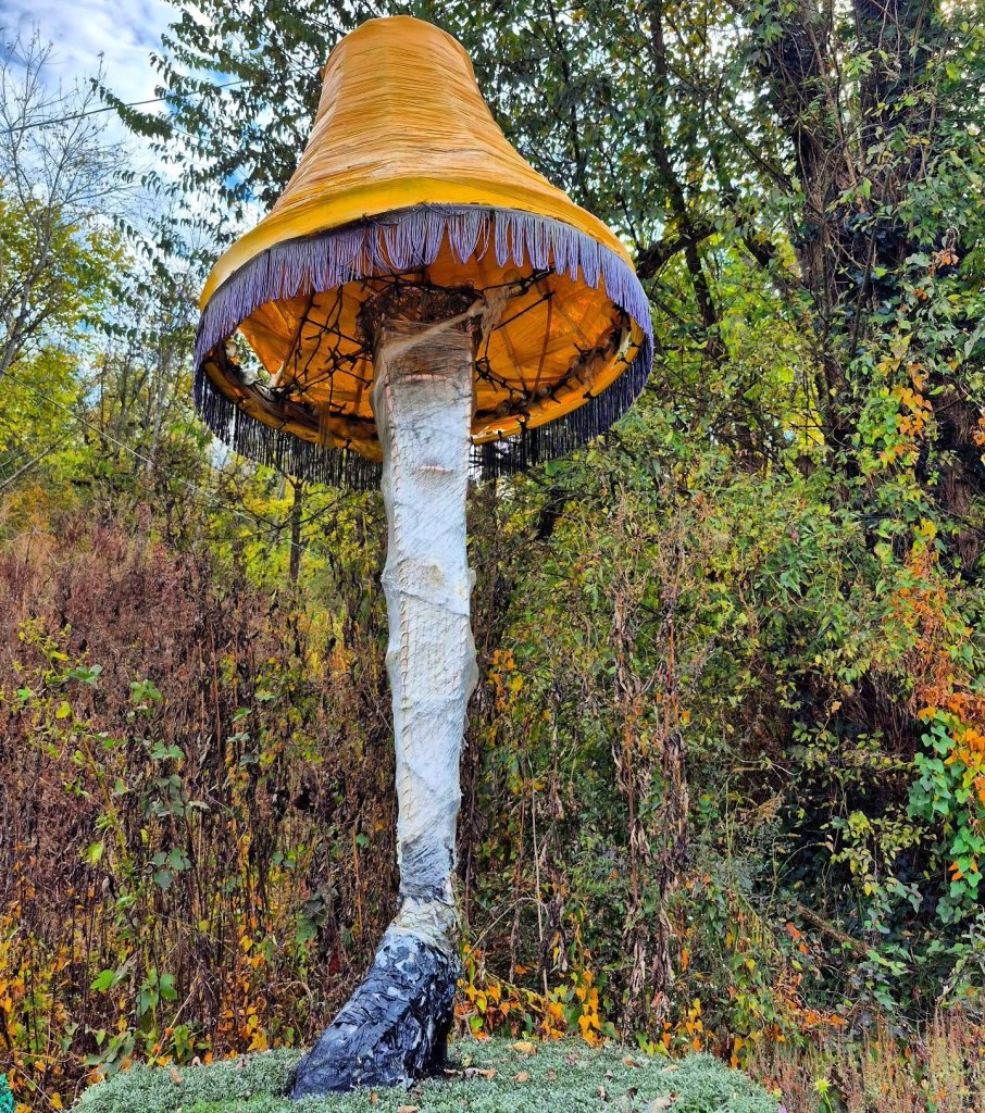
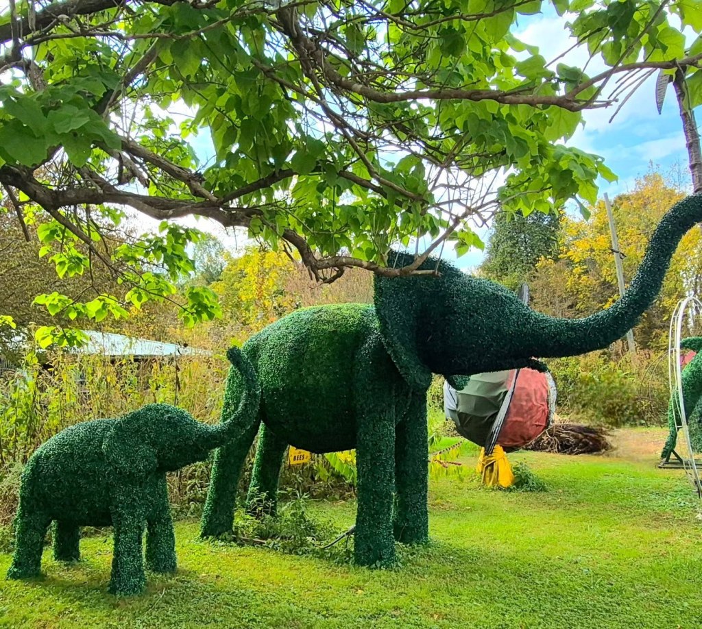
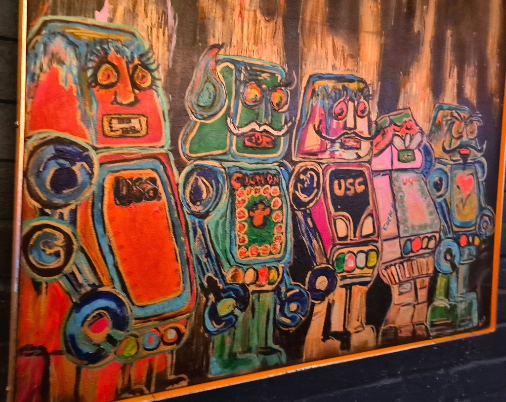
One of the first stops you might be inclined to make is the highly visible private property of an artist who frequently puts out their fun and kooky creative works on display in their front lawn.

Construction of the Skyway took over 30 years and it finally opened to sightseers in 1996.
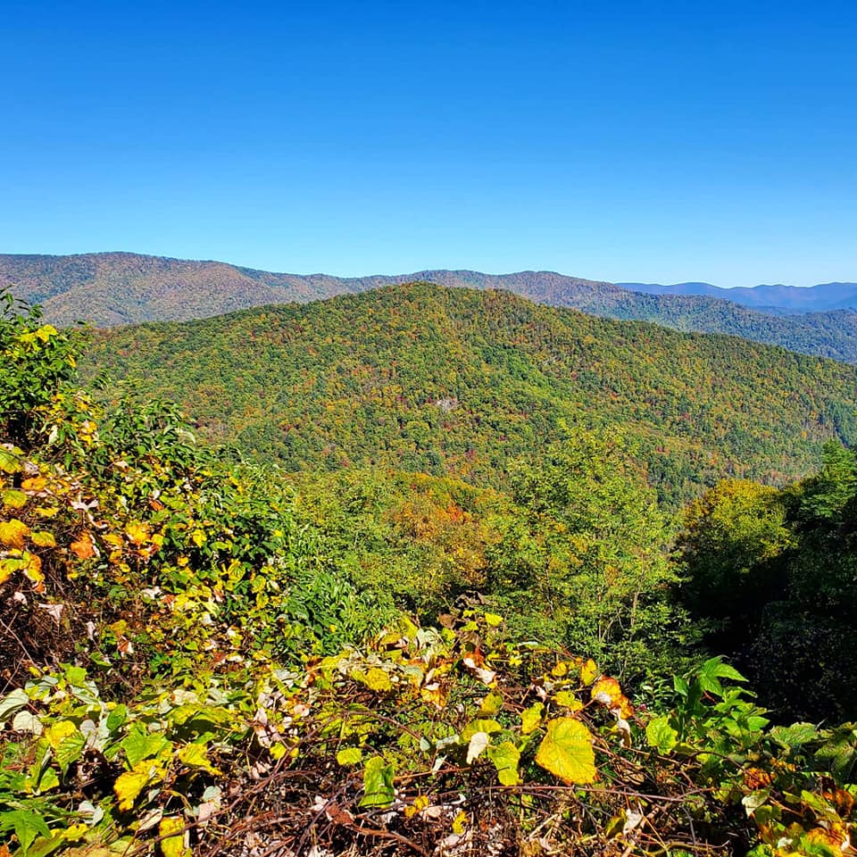
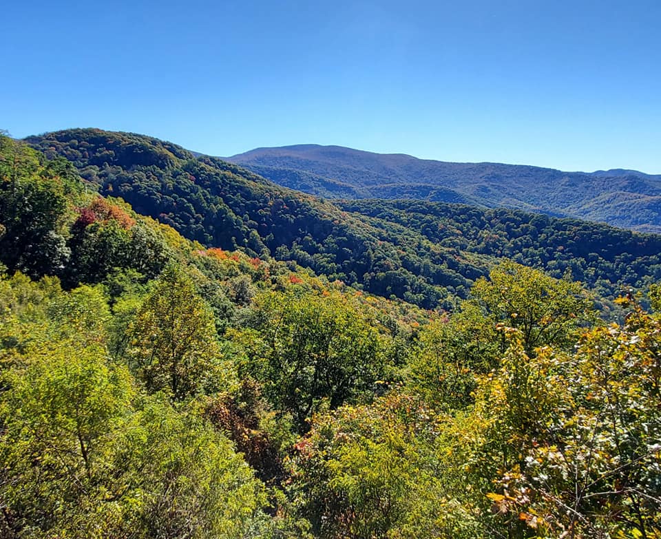
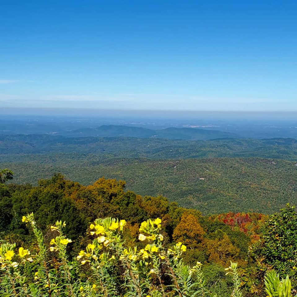
Santeetlah Overlook is one of the Skyway’s most popular stops at nearly 5,400 feet high, though there are four other peaks at over 5,000 feet high and nine that reach over 4,000 feet.
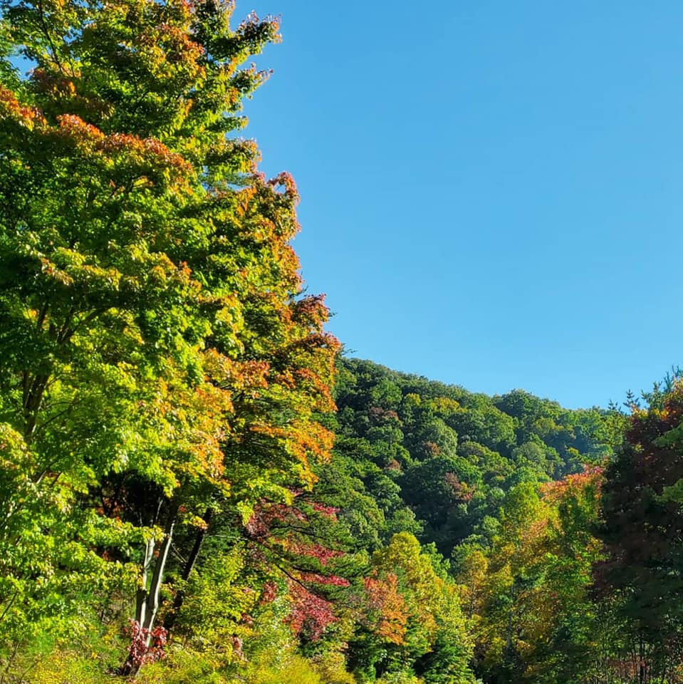
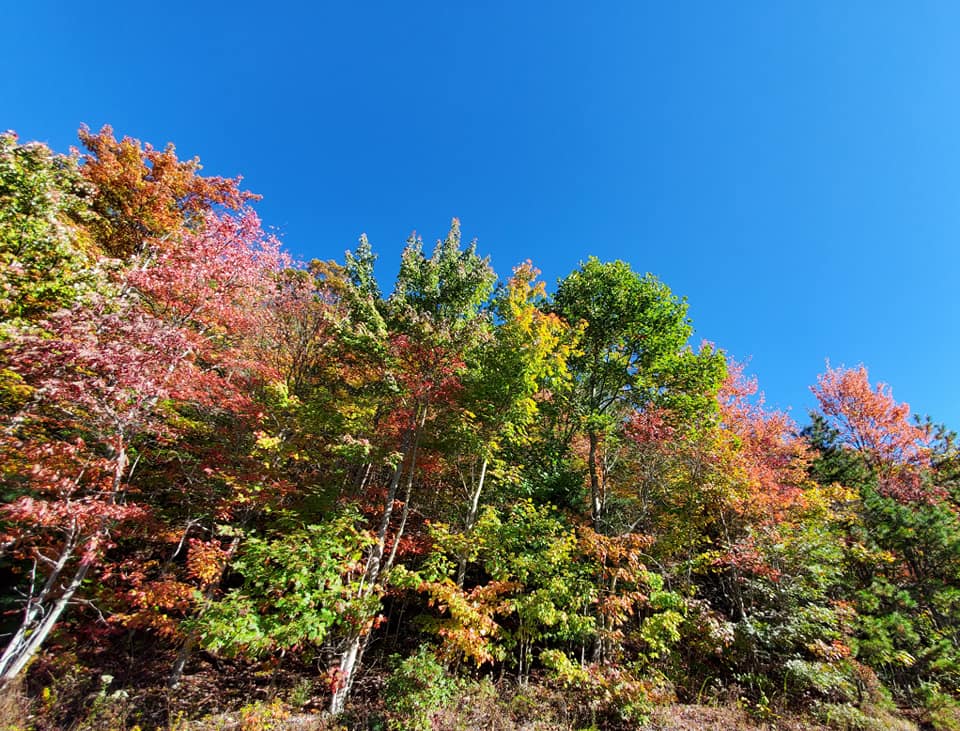
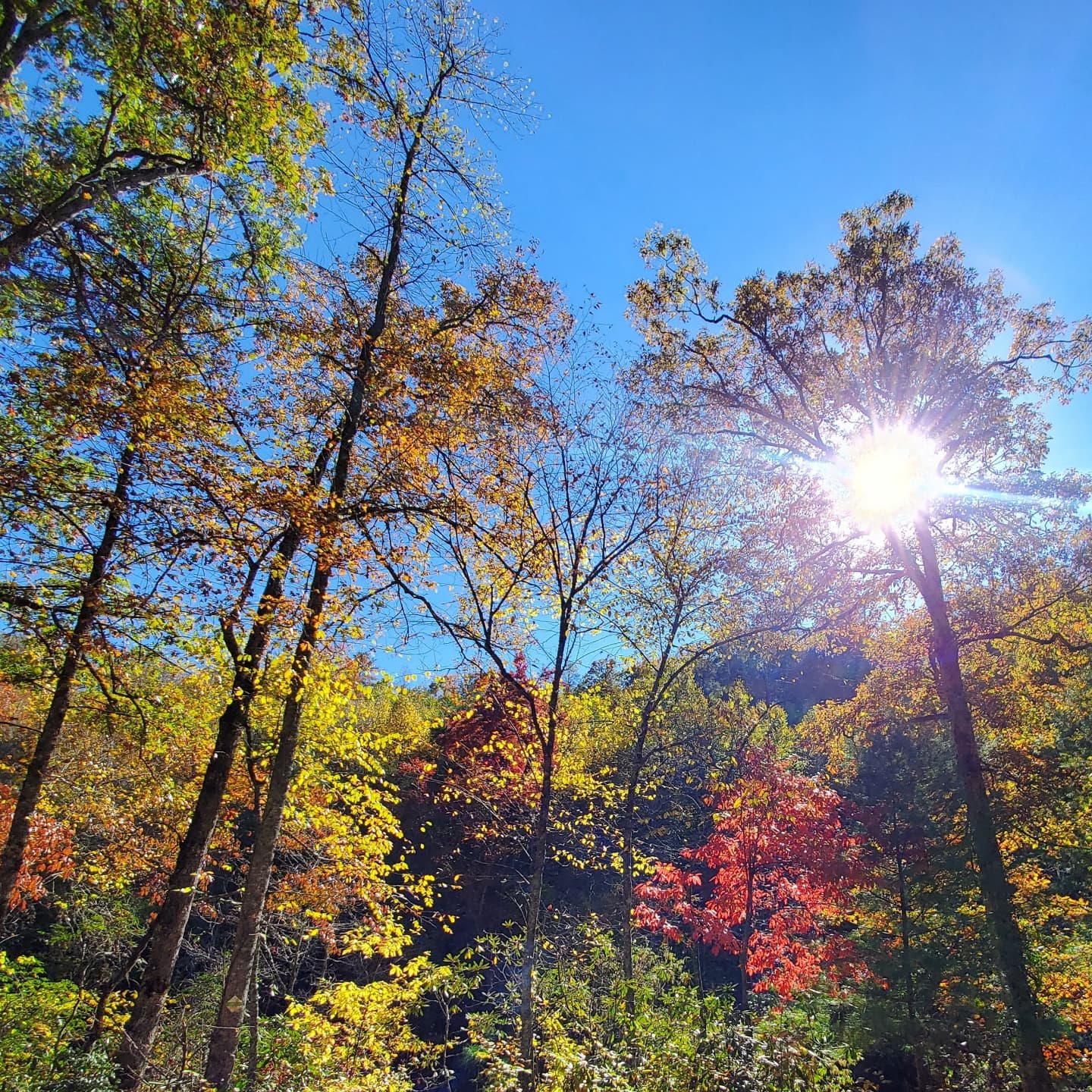
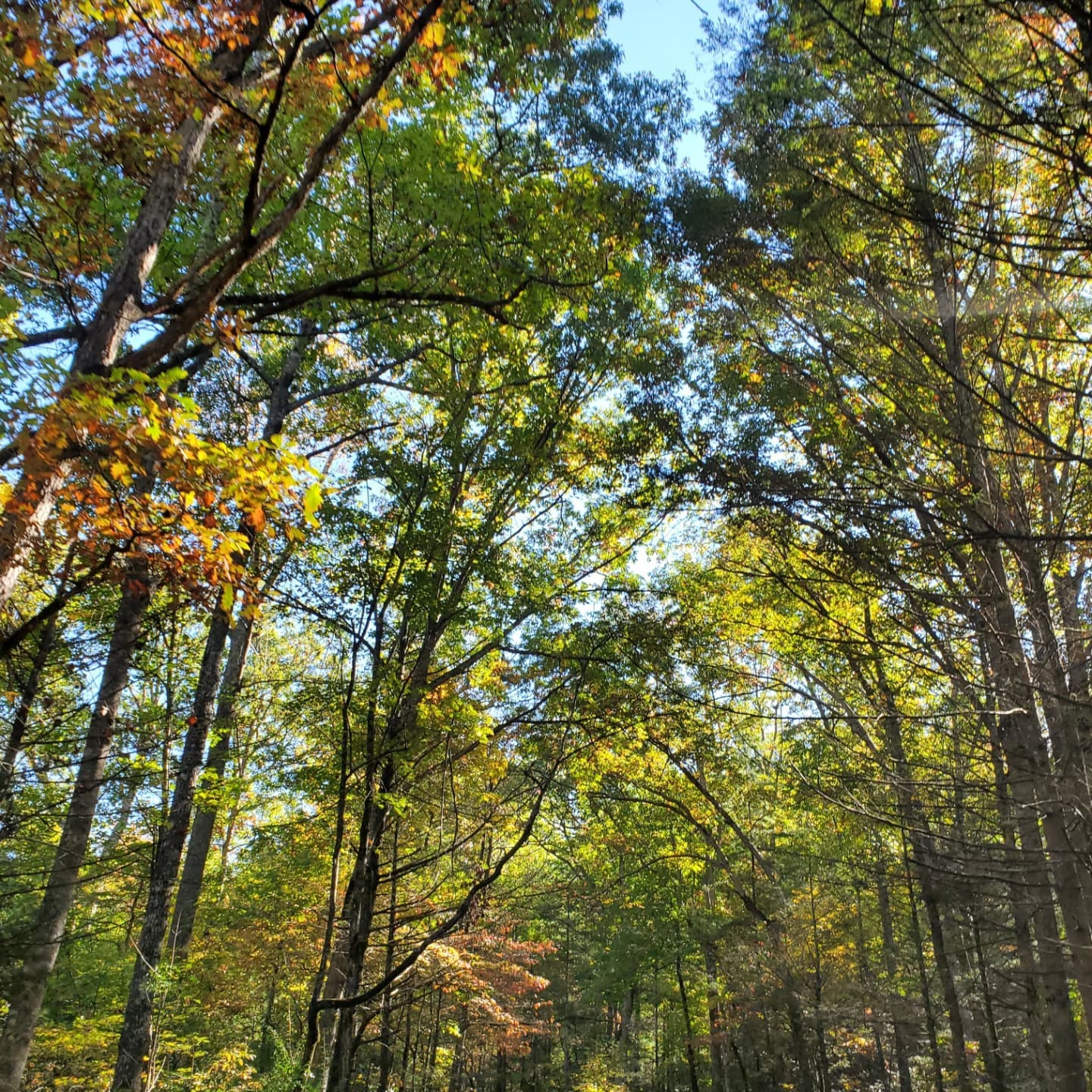
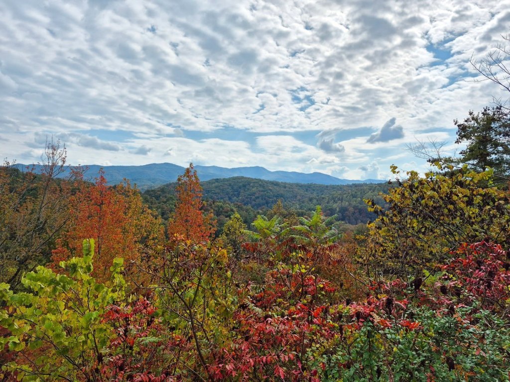
Along the way you can explore multiple overlooks, trails, and picnic areas leading through the Cherokee National Forest, to Wildcat Falls, Bald River Falls, Fall Branch Falls, Tellico River Gorge, Indian Boundary Campground on Boundary Lake, and eventually through the Nantahala Forest, and the Joyce Kilmer Memorial Forest closer to Robbinsville.
Cherokee National Forest is the State of Tennessee’s only national forest and the Great Smoky Mountain National Park sits at the heart of it.
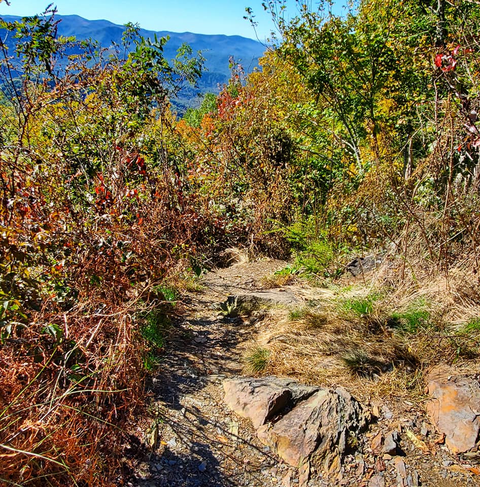
There are over 600 miles of hiking trails among these 650,000 acres and it is home to hundreds of species of mammals, birds, fish, amphibians, and reptiles.
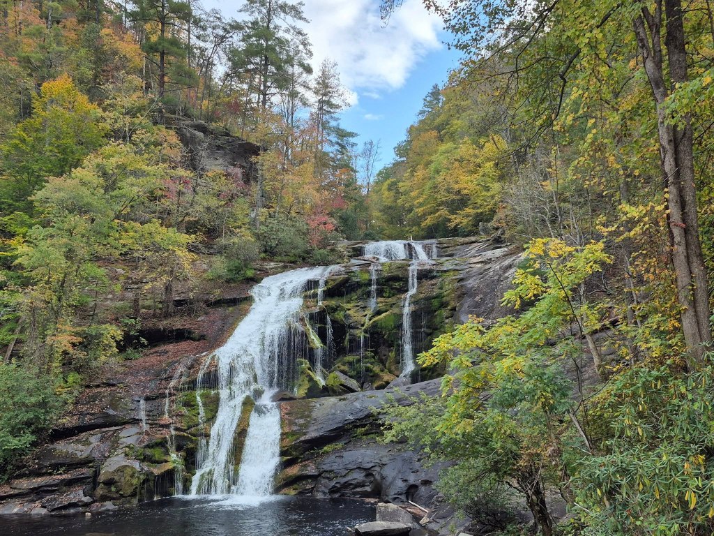
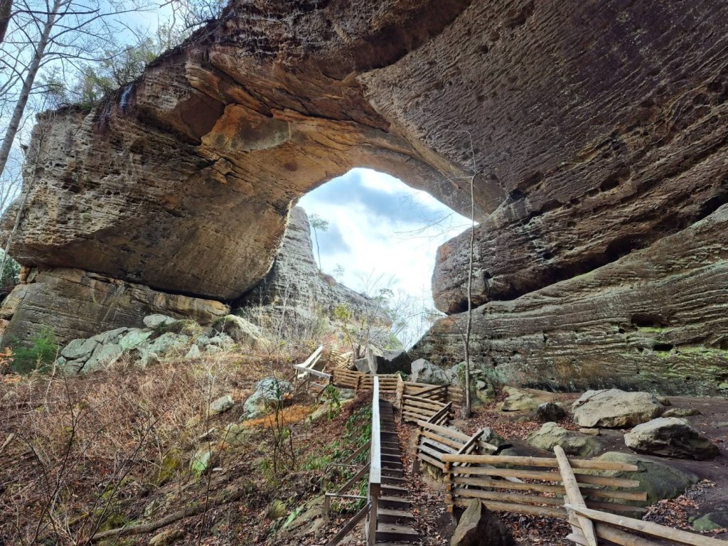
Bald River Falls is near the beginning of the Skyway in Tellico Plains, and it is a hub for white water rafting and fishing.
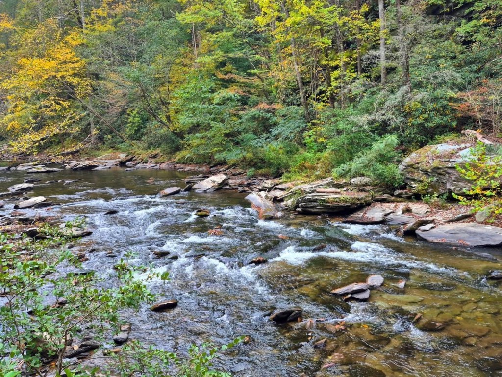
You will need to drive several miles down the newly paved and reopened River Road right off Cherohala Skyway to visit to the 100 feet high falls, which can be seen from the road.
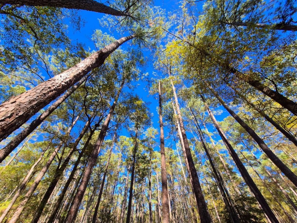
Indian Boundary Campground is right off Hwy 165, that also leads to Boundary Lake.

The tree-lined canopy of pines was beautiful, and the smell of campfires and marshmallows was going strong.
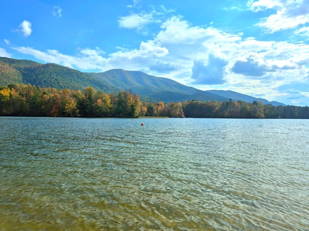
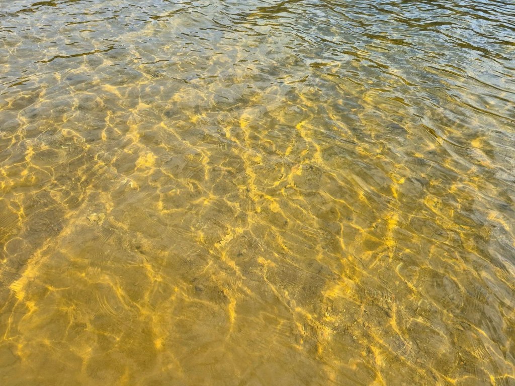
When you reach the beach, you can spread out on the grassy hill overlooking the sand or you can post up right by the water.
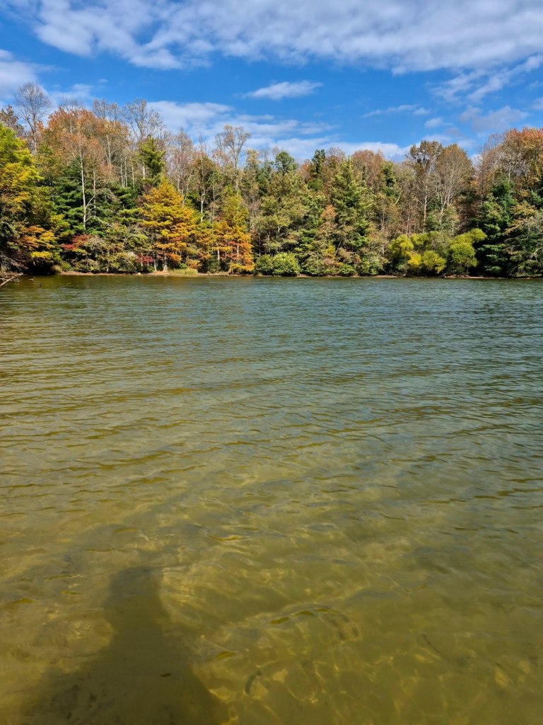
The water is rather shallow for several yards so it is perfect for wading or sitting in, or learning to use a kayak for the first time.
Entering North Carolina, you will drive into the Nantahala National Forest, and the road name changes from TN 165 to NC 143. Nantahala is the largest of North Carolina’s four national forests and has over 530,000 acres.
This forest is divided into three districts, and if you continue to Robbinsville you will be entering the Cheoah district.
Joyce Kilmer Memorial Forest can be accessed from NC 143 onto a a two-mile sidequest loop through this lovely forest of poplar and hemlock trees.

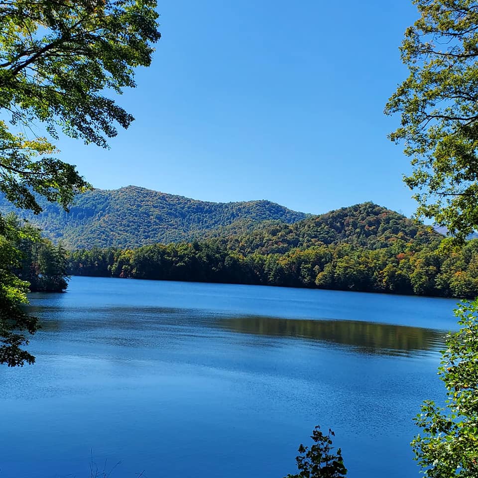
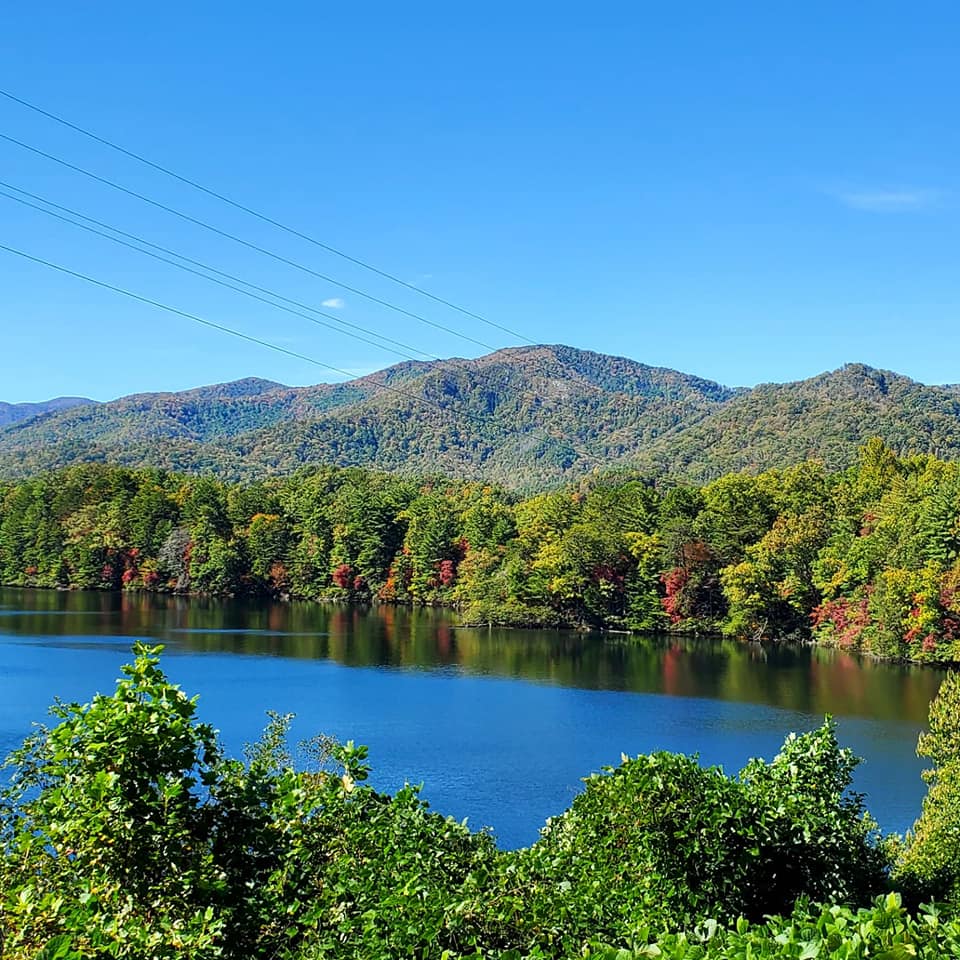
Lake Santeetlah is just six miles from Robbinsville and about fifteen minutes from the Great Smoky Mountains National Park. Lake Santeetlah is the name for the the town itself and its gorgeous, award-winning lake that has been voted the most beautiful lake in America.
There are only around 200 residents here and most properties are either rental/vacation homes, campgrounds, and marinas.
Robbinsville is also a tiny town with just 0.4 square miles and around 600 residents. Scenes from the films Nell and The Fugitive were filmed here, and the Avett Brothers released an ode to the town called Four Thieves Gone: The Robbinsville Sessions.
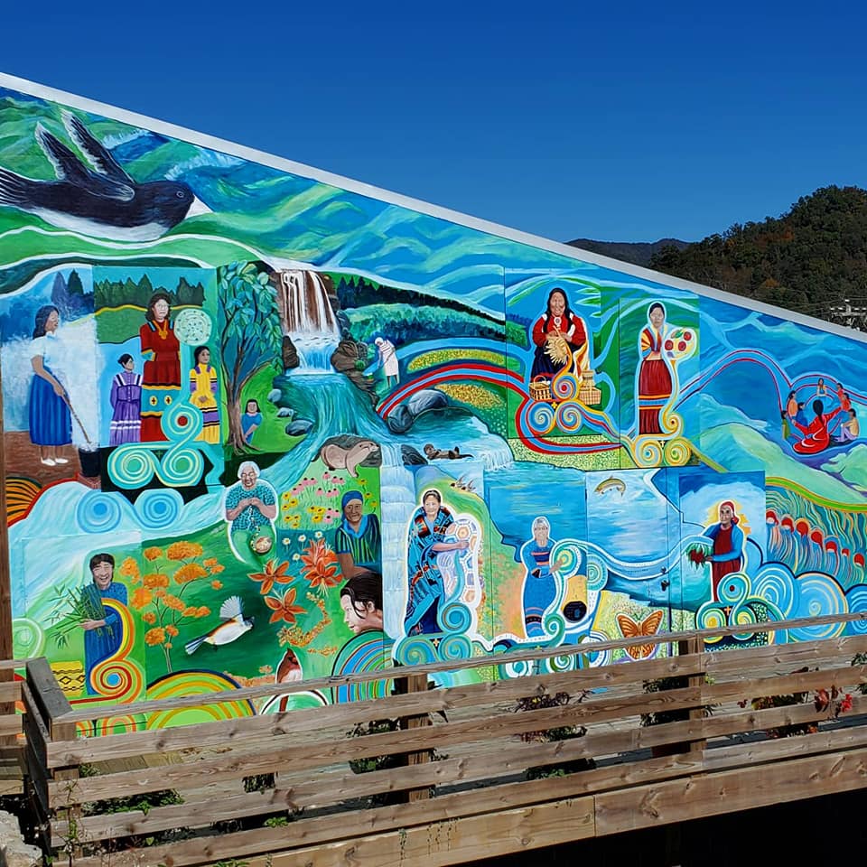
The first thing I saw on the main drag was this vibrant mural.
The Junaluska Memorial & Museum is a cool site that has unfortunately fallen into disrepair after a storm destroyed the museum several years ago.
I could not find much about the site online, and when I arrived, access was blocked to anything else but the memorial. What I learned about this place was entirely on foot.

A tricky sloped driveway takes you to the top of the hill where Chief Junaluska and his family are buried in the center of multiple monuments.
These monuments are dedicated to the seven Cherokee clans and tell Chief Junaluska’s story.
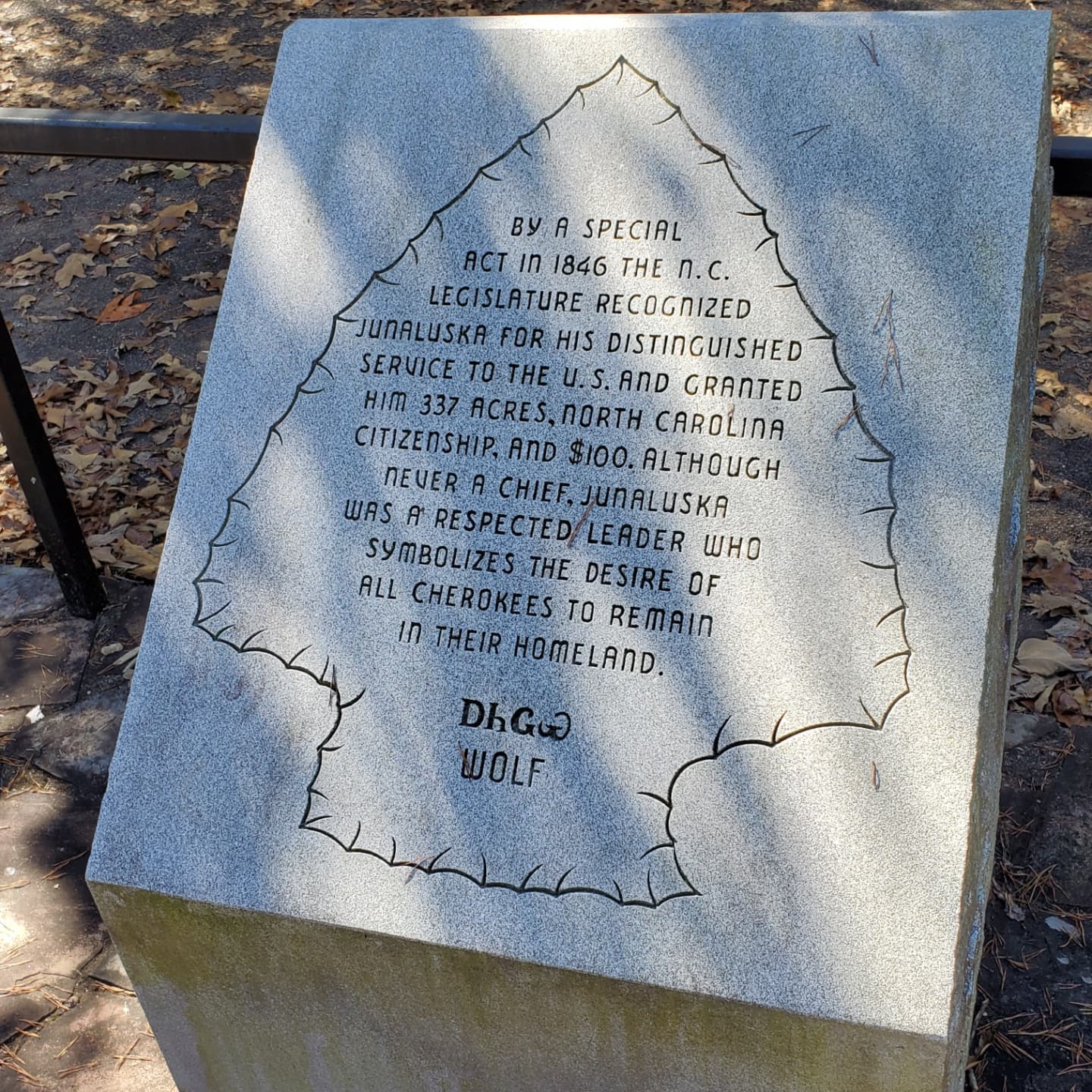
This site is said to have been one of the holding spots of the Trail of Tears.

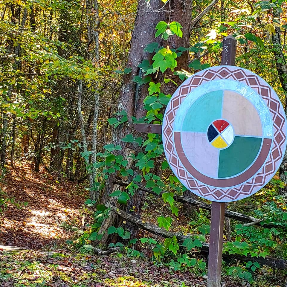
Near the back of the memorial, you will see signs directing you to the Traditional Medicine Trail.
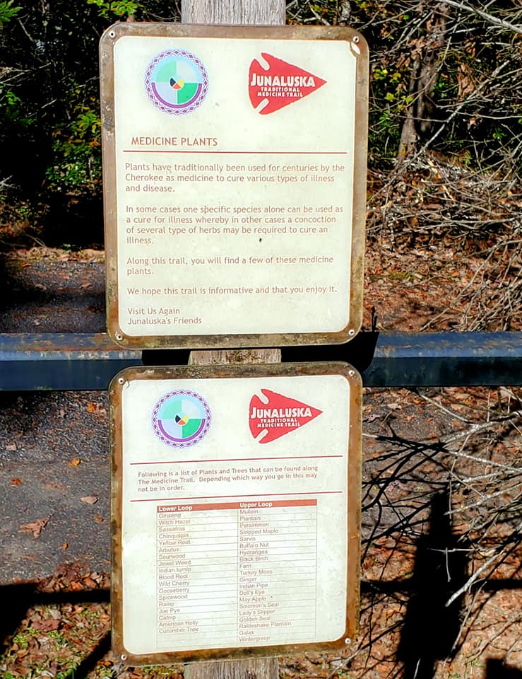
The trail would probably take about twenty minutes to complete unless you are an herbalist like me, stopping to nose around and identify every shrub and leaf.
Tread cautiously, pay your respects, and do not take anything that does not belong to you.
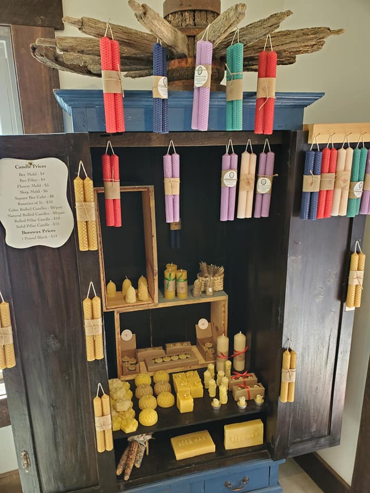
Wehrloom Honey & Mead was a fun stop where I picked up a variety of homemade mead, honey, lotion, salve, candles, spices, and other items.
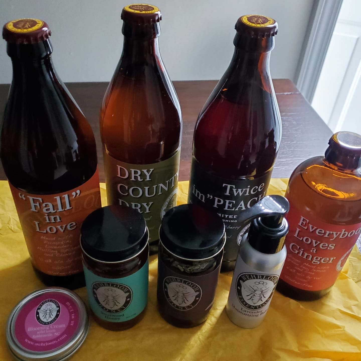

Take advantage of their free meade tastings while you visit.

They have a second location in Asheville just down the hightway, but still meet my criteria of being locally owned.
My favourite restaurant here, The Hub, closed permanently due to a fire. Other places like the Notorious P.I.G. BBQ, Wolf Creek General Store & Café, Willow Tree Restaurant & Bakery, Graham Coffee, and the Tapoco Tavern are on my list for future visits.
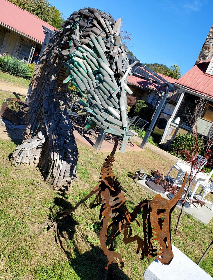
Speaking of unexpected, on the way back I passed this place with dragon sculptures all over the lawn.
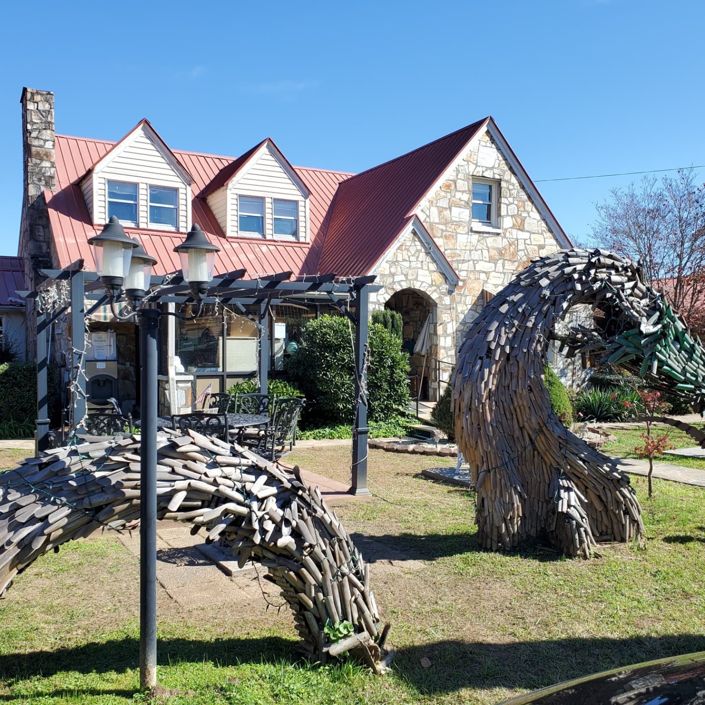
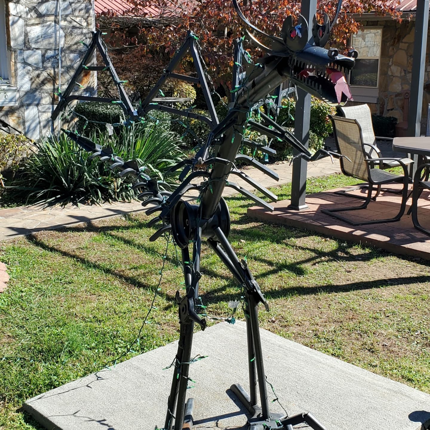
I had heard of, and even seen, some of the magical dragon art near Robbinsville where the Tail of the Dragon scenic route begins. This one caught me by surprise though, and I believe it is a B&B.
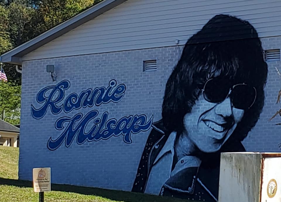
Last but not least of the unexpected, I was baffled by this mural of Ronnie Milsap in the middle of downtown.
Not really knowing who he was beyond a singer, I found an article in my own town’s newspaper, of all places. The author explained that Milsap was a Robbinsville native who came over to our side of the mountain way back when.
Taking the Cherohala Skyway back to Tellico Plains is a given, but once you are in Robbinsville you will be just minutes from The Dragon, and maybe even tempted to drive it.
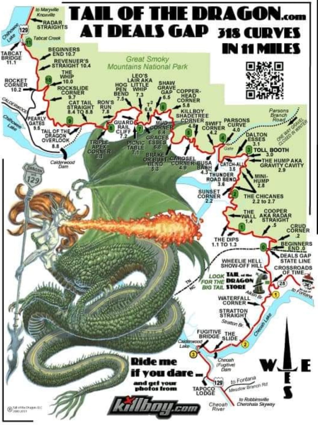
This hellacious death trap road is famous among maniacal bikers and other lunatics who enjoy driving on that type of terrain at 100 miles an hour in the pitch black of night. It does not matter how fast you drive, someone else will be faster, and they will drive right up on your bumper until they run you off the road.
Choose wisely.

In the area for a while? Follow me back to Tellico Plains, Sweetwater, Greenback Castle, the Unicoi Turnpike Trail, Ocoee Scenic Byway, Fort Loudoun in Vonore, Maryville, Cherokee, and Bryson City.
**************
© Copyright Fernwehtun, 2015- Current. Unauthorized use and/or duplication of this material without express and written permission from this site’s author and/or owner is strictly prohibited. Excerpts and links may be used, provided that full and clear credit is given to Fernwehtun and Fernwehtun.com with appropriate and specific direction to the original content.


Leave a comment