

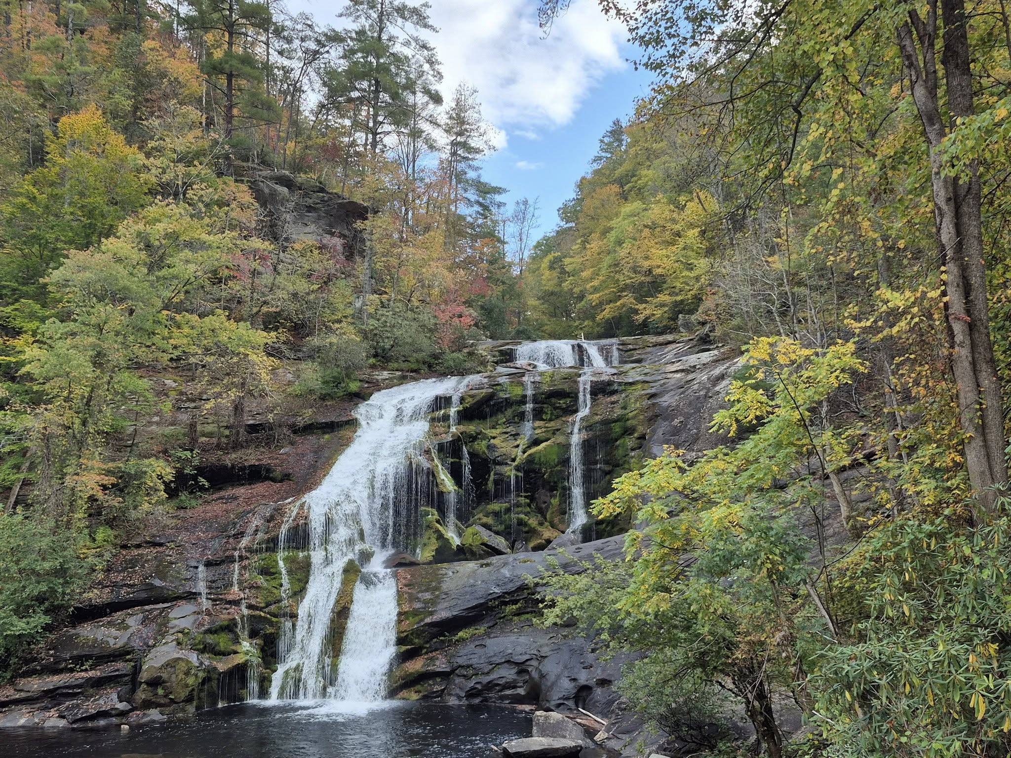
Just nine miles north of Cookeville, there is a 75-ft high waterfall that spills out over layers of stone steps into a natural swimming pool. The water is sparkling and refreshing, and you could not find a cooler place in the mountains on a sticky hot day.
My song for this blog is Malaria’s “Kaltes Klares Wasser” (Cold Clear Water):
Before you visit Cummins Falls State Park and start chasing waterfalls, make sure you have some high-quality waterproof hiking or swim shoes with grip on the soles. No sandals, no flip-flops, nothing flimsy or precious.
You will be climbing wet, comically slippery rocks and wading or swimming across the current to get to the falls.
The Old Mill Camp General Store is onsite and sells camping/swimming gear, non-perishables, takeout meals, and the staff handles camping arrangements. The campgrounds are located behind the store and there are over 40 spots of various types for as low as $20 per night.

All visitors must have a permit to enter the trails descending to the waterfall. I strongly suggest purchasing a gorge access permit before you get on the road, or you might be stuck standing around waiting until previous guests leave.
All visitors must exit the falls and trail by 5 pm so you may want to arrive as early as 8 am to get the most out of your trip. There are no guarantees for unreserved entry, so be smart and purchase permits here for just $6 per person.
If you are more interested in hiking through the park or to the overlook up above the waterfall, there is no charge for admission to access the upper trails. The Delia Bell Meadow trail is 3 miles, the Upstream trail is half a mile, and the Waterfall Overlook trail is just 0.4 miles. All three are described as moderate.
We were so tired after climbing and swimming for four hours, following a hike somewhere else that same morning, that we did not make it to the overlook. I plan to return soon though, so watch for updates!

The hike down starts off pretty typical but becomes uneven and dangerous, so tread carefully and watch for signs/tape indicating advisories.
Safe routes and conditions can change on a whim and flash flooding is not uncommon. There are lots of steep stairs and they are often muddy or slick.

The short trail ends where it connects to the shallow part of the basin. Just jump in and start moving around the bend to your left. Depending on the water level, this part is not so tough, but it would be more difficult to cross after heavy rain.

The entire trail from entry to the falls is 1.5 miles long but the descent to the basin is short. Traversing the rocks and water makes up the bulk of this journey, taking 30-45 minutes or longer depending on your speed and experience.
Rangers advise guests to plan on traveling at least one hour for the entire route to and from the falls, each way.

A one-mile trail is available but is primarily reserved for emergency evacuation and ranger use. It was not marked and we were all instructed to only take the main 1.5-mile trail.
Unpaved and rugged trails can be intimidating, but I appreciate that this park has left nature mostly untouched beyond the visitors center.

Small rocks soon give way to boulders. People of all ages were falling over but thankfully no one was injured. I personally found it hilarious when I ate it once while crossing a slick broad stone, but do remember that the potential for grave danger is real.

We were not completely prepared for the extent of boulder climbing but welcomed the challenge. There were a few moments when I really did not know the best way to get from one point to another but I figured it out, and it was a rewarding learning experience.
I feel much more confident about going off-trail in the future.

Most of the children we passed were complaining about the trek and some of them seemed too small to be navigating this terrain with their little bodies but they made it, and the joy of diving into the pool quickly made them forget the struggle.
Leashed dogs are welcome and we saw dozens of them, but they did not appear to be having a good time.

Oh, but when you finally see it…

Cummins Falls has been a popular swimming hole for locals for over a century, gaining most of its momentum among tourists in the last decade. I first learned about it in 2011 at a music festival in Cookeville, when some friends went hiking and found an easy way in. At that time it was not prohibited, but things have since changed.
Later that year, the land was purchased by the Tennessee Parks and Greenways Foundation and it became the state park as we know it today.

The falls have long held a spot in the top ten list of highest water volume in Tennessee and, despite the recently instated mandatory access permit, the number of visitors continues to grow.
Clearly the waterfall is the main attraction of this 280+ acre park but many people come to fish for bluegill and bass, enjoy picnics, and to watch for animals like this sweet little deer family.

In the area for a while? Check out the rest of Cookeville, Crossville, Cumberland Mountain State Park, Ozone Falls, Rugby, or Kingston!
********************
© Copyright Fernwehtun, 2015- Current. Unauthorized use and/or duplication of this material without express and written permission from this site’s author and/or owner is strictly prohibited. Excerpts and links may be used, provided that full and clear credit is given to Fernwehtun and Fernwehtun.com with appropriate and specific direction to the original content.


Leave a Reply