

TENNESSEE OVERHILL CHEROKEE
Overhill Cherokee people lived in what is now southeastern Tennessee, primarily between Bradley County and Polk County, but not exclusively.
The word “overhill” basically means a “mother town” or main settlement, and Chota and Tanasi, where we got the name Tennessee, were the two most revered Overhill Capitals.
The Tennessee Overhill ruled this land until the American Revolution, some as late as the early 1800s, when they were forced to give up their homeland.
Here is a map from the Tennessee Overhill website:
Countless Overhill villages and other historic communities are buried underwater in East Tennessee.
Nearly 30 known Cherokee settlements thrived in this region alone, with additional ones directly across state lines in western North Carolina and north Georgia.
Most of the Overhill settlements are long gone, but the Cherokee people still exist in great numbers.
There are more than 12,000 members of Tennessee’s Eastern Band of Cherokee, 15,000 in Oklahoma’s United Keetoowah Band, and an incredible 200,000+ in Oklahoma’s Cherokee Nation.
The history of this region is still full of mysteries and surprises even after decades of extensive archaeological projects.
COUNTIES, CITIES, & TOWNS
The Tennessee Overhill region spans McMinn, Monroe, and Polk counties.
All three are located east of I-75 and expand into the Cherokee National Forest, showcasing mountains, rivers, waterfalls, and forests as much as it does the museums and burial sites.
Major cities and towns in McMinn County include Athens, Etowah, and Calhoun. Monroe County is home to Madisonville, Vonore, Tellico Plains, and Coker Creek. The city of Sweetwater is divided between the two counties.
Polk County holds the cities/towns of Ocoee, Benton, Delano, Reliance and the Copper Basin towns of Ducktown and Copperhill, plus many other small rural communities.
You can read my blogs about Athens, Sweetwater, Etowah, Vonore, Tellico Plains, Polk County and the Copper Basin by clicking on those city names to access links.
WHY YOU SHOULD GO
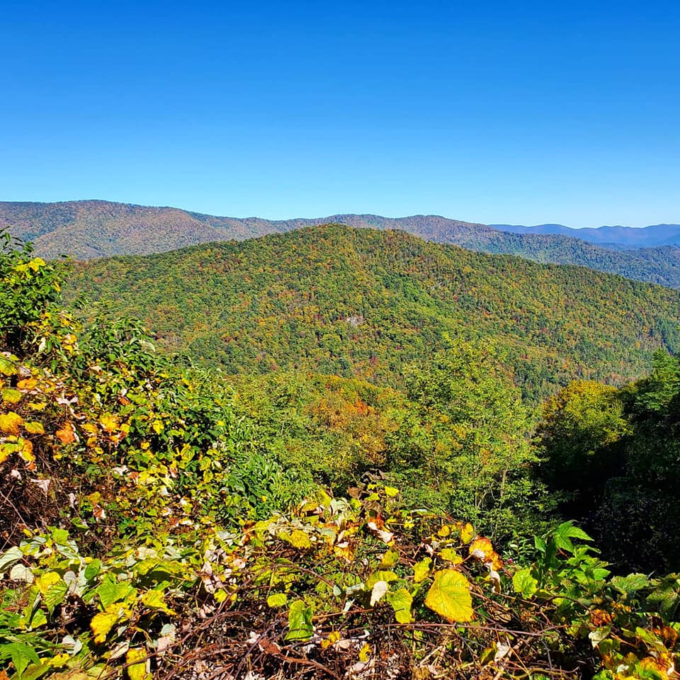
If you are fascinated by Cherokee history or Southern and Appalachian cultures, in love with the great outdoors and unbelievable scenic views, a thrill-seeker with a penchant for violent river rafting, a fan of hydroelectric power and socio-economic government initiatives, a military history buff, need a weekend off-grid, or just feel like seeing something new, you will find your niche in the Tennessee Overhill region and the Cherokee National Forest.
CHOOSING YOUR TRAIL
Do not let this or any other list of trails overwhelm you. Most of them involve taking the same roads to the exact same places, but each trail is geared toward different interests and types of travel.
Blueways are for people who want to see the natural environment by boat, but Skyways and Byways are for driving through various towns.
Heritage trails are for cultural/historical sites and interactive museums, but hiking and waterfall trails are more about fitness and engaging with nature.
Knowing what you are most interested in and how you would like to travel is your key for getting started.
DRIVING TRAILS
Exploring the Ocoee Scenic Byway and Cherohala Skyway are two of my favourite ways to spend the day.
The Ocoee Scenic Byway connects the outskirts of Cleveland, TN to Ducktown, TN with a 36-mile (depending on where you start counting) drive through the Cherokee National Forest, directly along the Ocoee River.
This region is called Ocoee Country and is centered around the Ocoee River, its bustling Whitewater rafting culture, and beautiful natural features.
You can read all about the Ocoee Scenic Byway in my blog here.

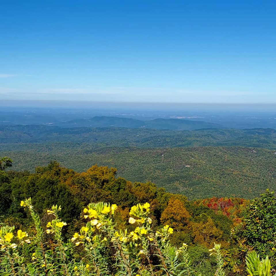
Cherohala Skyway connects Tellico Plains, TN to Robbinsville, NC with a 50-mile scenic drive.
This route leads west-east across the Cherokee National Forest, crossing over the Tennessee/North Carolina State Line.
You can read my blog about Tellico Plains here and my blog about the Cherohala Skyway here.
The Tellico River Road and Hiwassee River Road are also popular driving routes.
Tellico River Road follows TN-165 and FR-210 past the stunning Bald River Falls that are visible from the roadside, and Hiwassee River Road leads you along TN-30 and the Hiwassee State Scenic River.

BLUEWAY TRAILS
The Tennessee Overhill has two official Blueways, the Hiwassee River Blueway Trail and the Tellico Blueway.
Blueways are designated routes for exploring an area or following a path in a small boat via river or lake.
I have not taken these trails personally but would love to talk to an experienced guide.
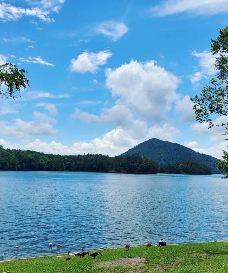
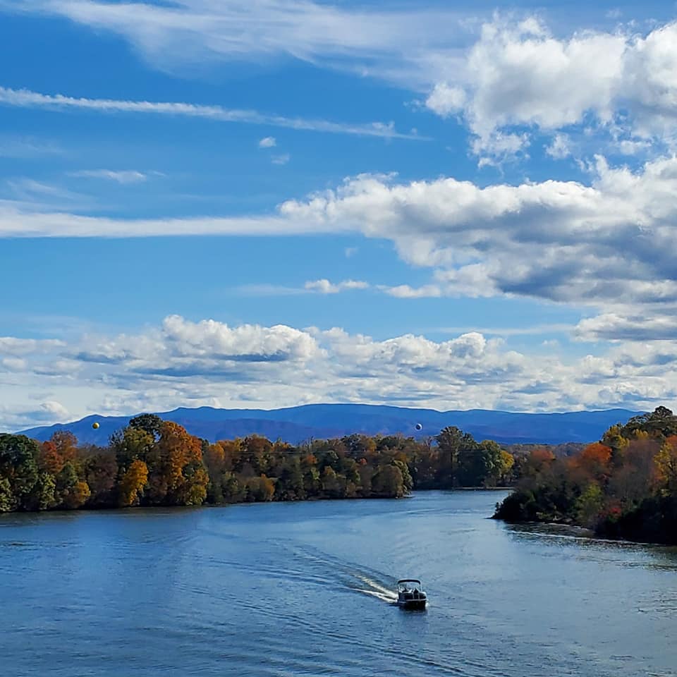
Four rivers and four lakes flow through this land, the Hiwassee, Ocoee, Tellico, and Conasauga rivers.
Man-made hydroelectric dams created the Tellico and Parksville Lakes, and the Indian Boundary & Chilhowee McKamy Lakes are both on top of mountains.

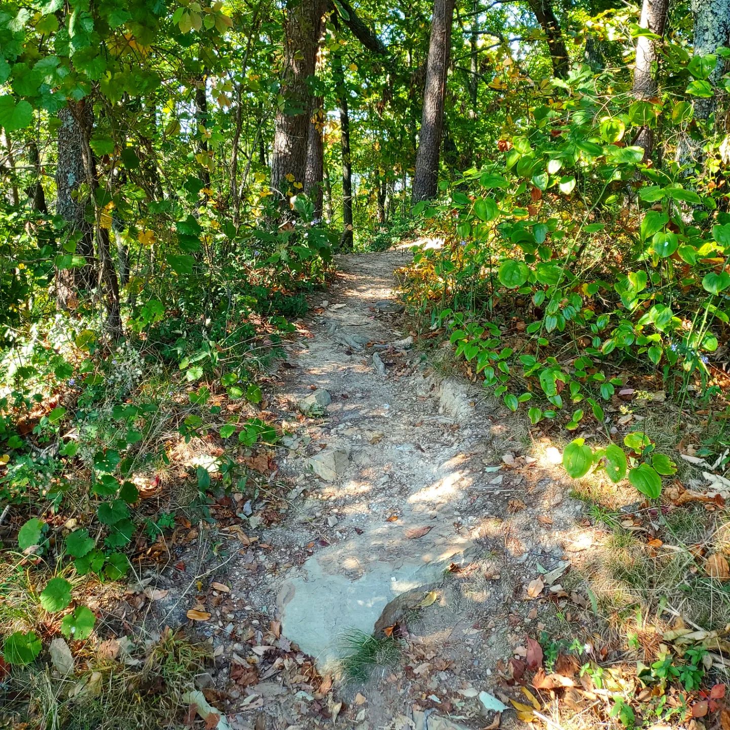
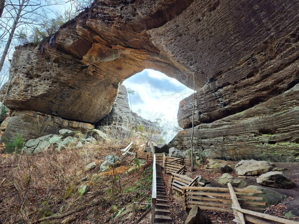
HIKING TRAILS & WATERFALLS
With four major rivers and many lakes flowing through this forested region, it comes as no surprise that there are more than 60 waterfalls, each one ranging between 5-130 feet high.
We are slowwwly but surely visiting each waterfall listed in the Tennessee Overhill Waterfalls brochure and I will be writing a separate blog about hiking trails and waterfalls later.
HERITAGE TRAILS
The Tennessee Overhill has three primary heritage trails; the Trail of Tears, the Unicoi Turnpike Trail, and the Furs to Factories Heritage Trail.
These are mostly driving routes with loads of places to get out and walk around, and to soak in all the cultural and historical information that the museums and historic sites have to offer.

TRAIL OF TEARS
Lucky for you, the National Park Service has created an interactive map for the Trail of Tears that is far more detailed and comprehensive than I ever will. Check that out here.
They have also created this page specifically for sites in Tennessee that you can visit in the Overhill region.
I want to add that Bradley County, nearest to Polk County, was once the Gateway to the Cherokee Nation.
Anyone who was not a member of the Cherokee Nation was required to obtain a passport to enter the territory, and you could only get that in Bradley County.
You can also visit the Hiwassee River Heritage Center and walk part of the actual Trail of Tears that runs behind it.
I have written more extensively about that and other significant Bradley County sites in this blog.
UNICOI TURNPIKE TRAIL
The Unicoi Turnpike Trail is a driving route through the Overhill Cherokee region and former war path. It once connected Chota, the Overhill Capital, to the coastal cities of Savannah and Charleston.
Take Highway 360 from Vonore to Tellico Plains and to Coker Creek to complete this trail.
Here is a map of the Unicoi Turnpike Trail from the Tennessee Overhill Heritage Association:

The first four of eleven stops of the Unicoi Turnpike Trail are Fort Loudon, Tellico Blockhouse, Sequoyah Birthplace Museum, and the Chota/Tanasi Memorials.
Tellico Plains and the Charles Hall Museum are the fifth and sixth stops, then Coker Creek and Unicoi Gap are the seventh and eighth.
Stops nine through eleven are the Joe Brown Highway that leads into North Carolina to the town of Murphy and its Cherokee County Historical Museum.
I have been along the Joe Brown Highway and through the town of Murphy, but it was on a real-life DND side quest with my sister and I was not even thinking of this blog at the time.
What?

FURS TO FACTORIES HERITAGE TRAIL
This trail shares many of the same stops and scenes as the Unicoi Turnpike Trail in the Vonore area like the Fort Loudoun State Historic Area, Tellico Blockhouse, and Sequoyah Birthplace Museum, and the Charles Hall Museum in Tellico Plains, and it goes through Coker Creek to its Welcome Center.
The trail then follows the same route as the Ocoee Scenic Byway to visit the Ducktown Basin Museum, the Ocoee Whitewater rafting area, Nancy Ward’s Grave, and the historic community of Reliance.
It differs from the Ocoee Scenic Byway and Unicoi Turnpike Trail in that, after Reliance, the Furs to Factories Trail heads north into McMinn County and the cities/towns of Etowah, Englewood, Athens, and Niota.
The focus of this trail also strays from Overhill Cherokee to embrace the history and cultures of other inhabitants of this region, especially white settlers and the industries they created over time.
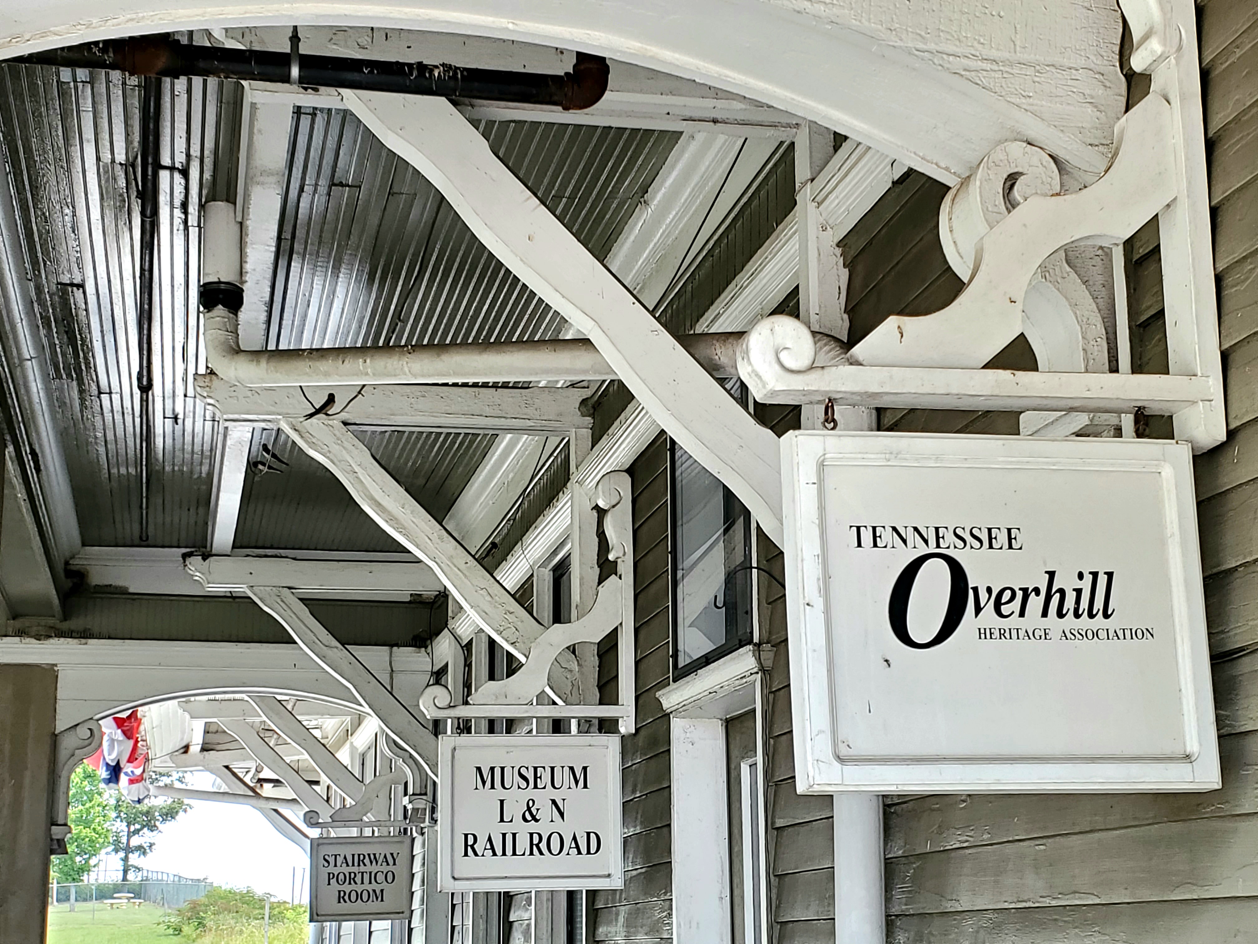
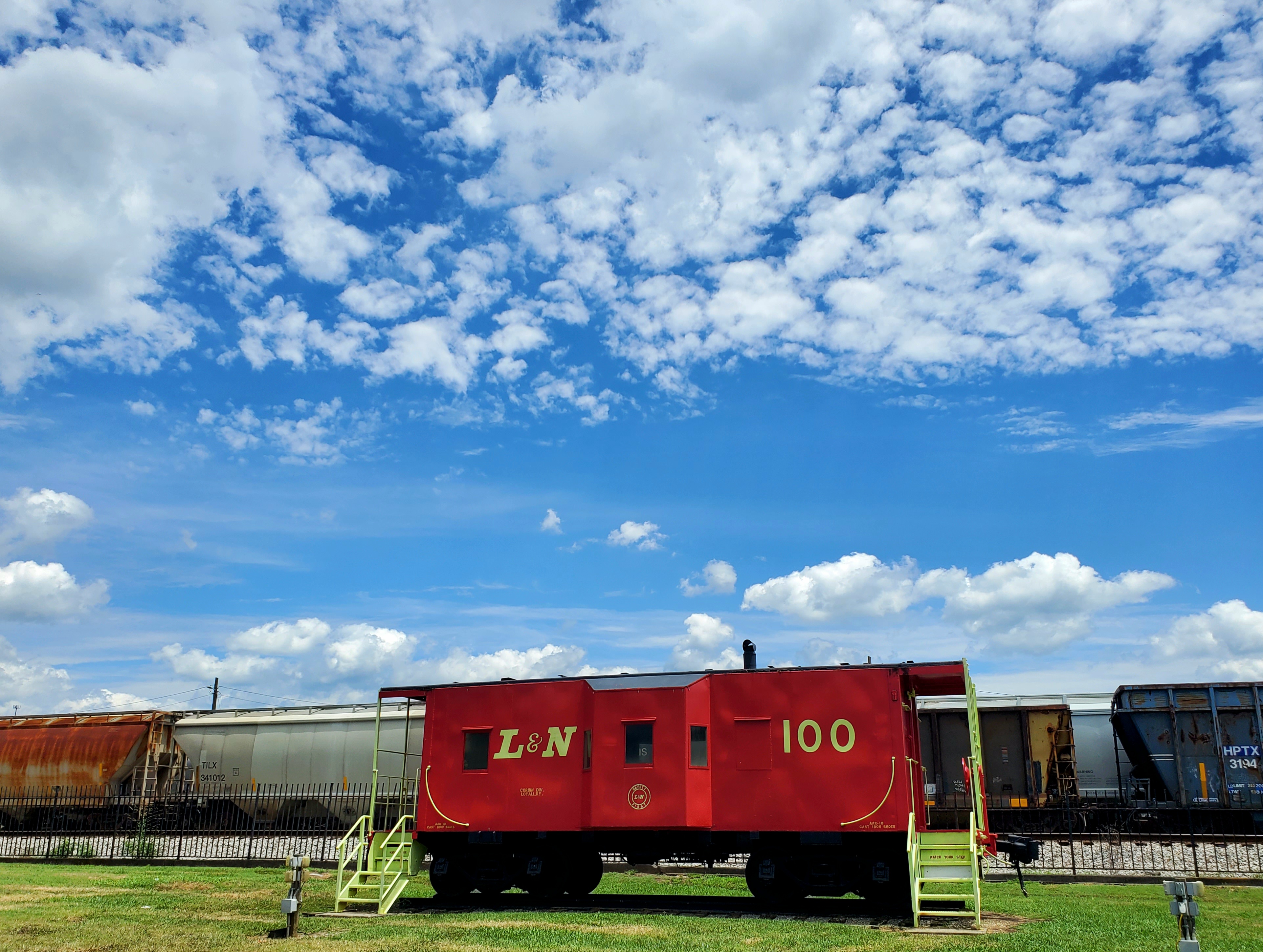
Sites on that part of the trail include the L & N Railroad Museum, Englewood Museum, McMinn Living Heritage Museum, Mayfield Farm & Dairy sites, and the Niota Depot.
THE MORE YOU KNOW
Now that you are familiar with the layout, vibe, and other details of each trail, I will tell you more about the most notable sites that we enjoyed the most.

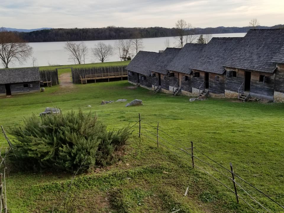
FORT LOUDOUN STATE HISTORIC SITE & PARK
Since 1965, Fort Loudoun has been a registered National Landmark. It was named after the fourth Earl of Loudoun, who was the commander of British forces in America at the time.
Loudoun is also the namesake with a slightly varying spelling for the nearby historic City of Loudon.
When Europeans began invading and settling in North America, it was a race against time to claim one’s own territory. The British and French were particularly ambitious.
French soldiers in Canada and New England formed an alliance with the Shawnee Indians and began moving South.
British soldiers on the East coast wanted to move West, and so the troops inevitably clashed.
Fast forward to Cherokee land surrounding the Little Tennessee River. British troops arrived and somehow earned the trust/alliance of the Overhill Cherokee Indians, gaining Cherokee warriors and protection in exchange for some of the supplies they were moving through the Carolinas on the British trade route.
Originally Fort Loudoun was constructed in 1756 and served as a military garrison for less than five years.
The Cherokee eventually realized they had been betrayed outside of the Fort, so they captured and burned it down.

Ruins were left untouched for the most part until the 1930s, when the Fort Loudoun Association was established, and in the late 1970s it became an official State Park of Tennessee.
Today, the reconstructed fort and the ruins of the 1794 Tellico Blockhouse overlook a romantic and reflective landscape.
Check out this blog for more info about Fort Loudoun and the Fort Loudoun State Historic Site.

TELLICO BLOCKHOUSE
Just across the lake from Fort Loudoun, you can see the remains of the old Tellico Blockhouse.
Unlike Fort Loudoun, this is not a replication, but it is bare bones of the original structure.
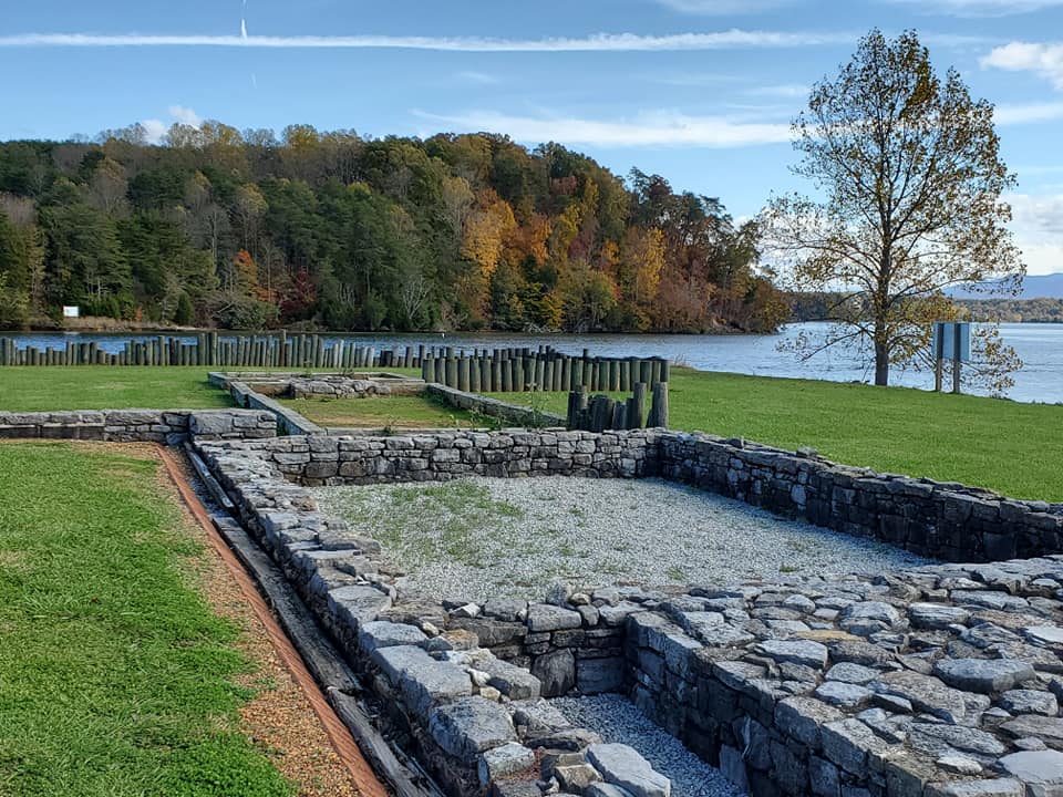
What remains here is from the actual fortified garrison that was built in 1794.
It was used for about 17 years to manage trade routes, monitor Cherokee residents, provide necessities for passage of European or white settlers and travelers, and other purposes.

You can learn more about Tellico Blockhouse in this blog.
SEQUOYAH BIRTHPLACE MUSEUM
Sequoya was half-Cherokee and half-European, and he invented both the Cherokee alphabet and its written/spoken language.
He was born in 1776, nearly two decades after Fort Loudoun was constructed, in what used to be the Tuskegee village which was created at the same time or shortly after Fort Loudoun was built.
Sadly the village was destroyed by fire, and the land is now flooded by the Tellico Lake.

Other members of the Cherokee Nation mastered Sequoyah’s syllabary and the Cherokee became more literate than the average European settlers of the region.
It is worth noting that his syllabary was so effective and precise, he and his daughter were accused of witchcraft and even put on trial.
Sequoyah also invented a numbering system that allowed him to keep financial records like a ledger.
Having these new systems allowed the Cherokee to gain literacy, create and share information, advocate for themselves in legal matters, chronicle their personal and cultural knowledge and stories, and to navigate the new America.
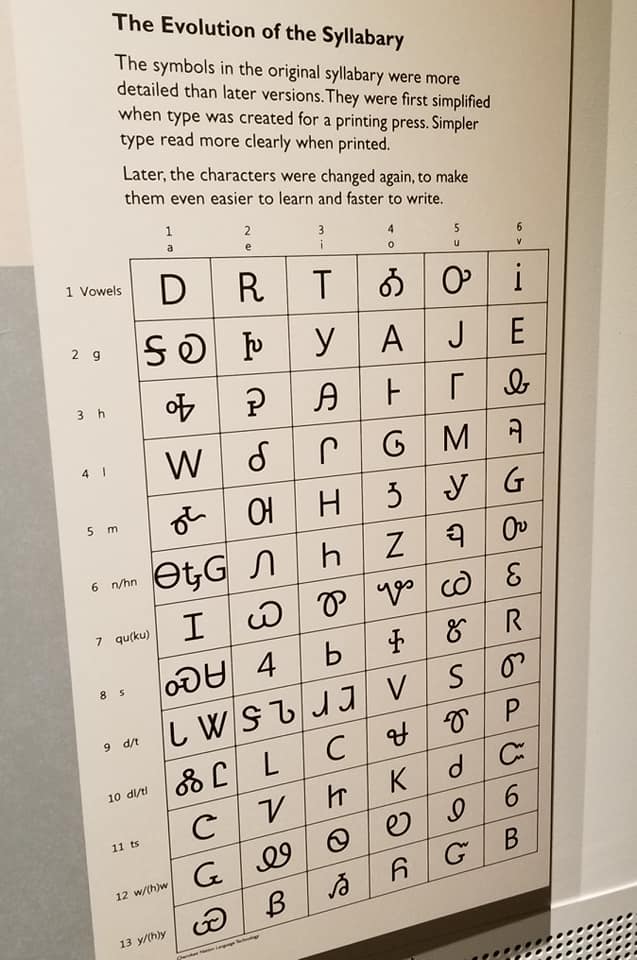
The Cherokee were the first Native Americans to have or use written language, and would likely not have survived without Sequoyah’s revolutionary contributions.
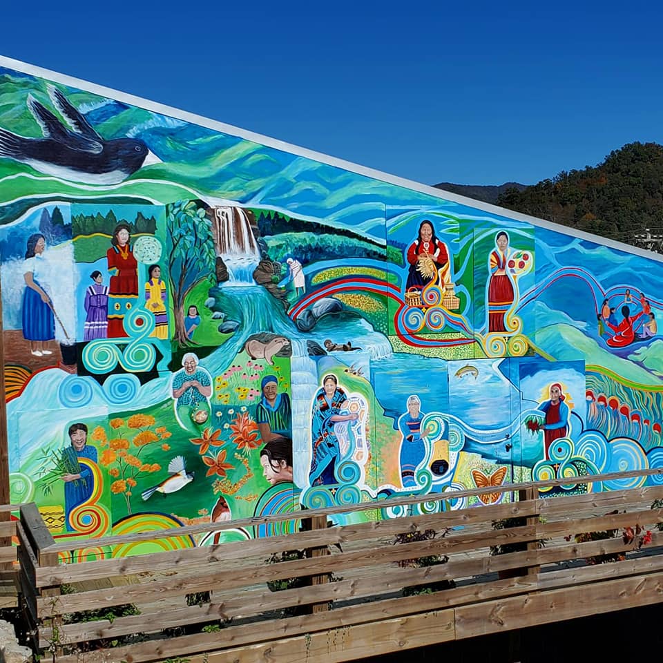
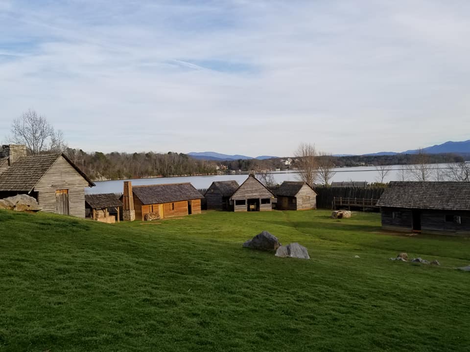
The Sequoyah Birthplace Museum tells about Sequoyah and the Overhill Cherokee as a whole, their way of life, their innovations and inventions, and the people who helped and hurt them.
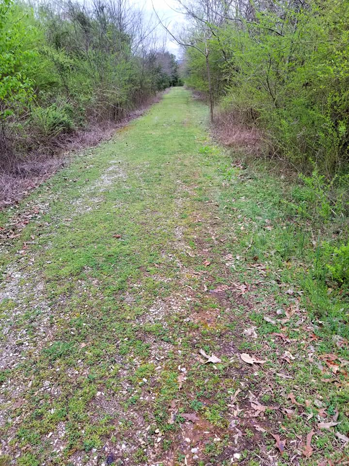
An amphitheater, monuments, and burial mounds are on site. You can tour an example of a typical home that the settlers and some Cherokee lived in during the period and take a walk along the 1.5-mile waterfront path.

CHOTA / TANASI MEMORIAL
A short drive from Sequoyah Birthplace Museum will take you to the Tanasi (Tennessee) and Chota Memorial Sites, which are an extension of the museum.
The memorials were created in 1989 as a collaborative effort between Tennessee Valley Authority and the Tennessee Historical Commission Foundation.
I have been twice and on both occasions, parking was plentiful and we did not cross any other humans.
Tanasi and the neighbouring town of Chota were, together, the home of the Overhill Cherokee and the Capital of the Cherokee Nation from 1721-1730.
Eventually the more popular Chota sprawled into Tanasi territory, war destroyed the towns, and then everything was flooded.

Continue driving to the Tanasi Memorial and you will find the parking circle for the Chota Memorial.
There is a short but lovely walk through a wide clearing in the woods that leads you directly to it.
A pillar for the entire Cherokee Nation plus six other pillars for each clan that lived here all form a large circle.
The Deer Clan, Wild Potato Clan, Wolf Clan, Bird Clan, Long Hair Clan, Blue Clan, and Sequoyah’s Paint Clan are represented in the memorial.
According to family lore and Ancestry.com, my maternal great x9 grandfather was part of the Bird Clan and lived in Chota during the 1730s before he and his family were sent off west.
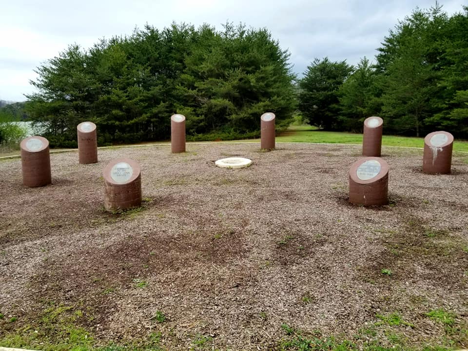
Oconastota, also known as Aganstata and as Stalking Turkey, was the most revered warrior (skiagusta) of the Overhill Cherokee.
His remains were found during an archaeological dig and relocated to a spot at the head of the Chota Memorial.
The site itself is maintained by the Eastern band of Cherokee and was built on top of the original Chota townsite, elevated several feet above flood level.

Fort Loudoun State Historic Site, Tellico Blockhouse, Sequoyah Birthplace Museum, and the Chota/Tanasi Memorials are all part of Vonore, a small city that is also a historically and culturally significant archaeological site.
Here is a screenshot I took of Google Maps so you can see how close those sites are:

I have had the honour of working with the film company NolPix Media as a production assistant for a couple films now, which collectively have been aired on PBS and other networks, plus nominated for TWO MidSouth Regional Emmy Awards and other awards.
I would be remiss not to mention the incredible films and documentaries they have produced, especially those that are relevant to Cherokee History and sites in East Tennessee.
Check out this short NolPix film for more info about Tellico Archaeology:
TELLICO PLAINS
Tellico Plains, Tennessee is a small mountain town of around 1.6 square miles in East Tennessee. It is part of Monroe County along with the cities of Sweetwater, Vonore, and Madisonville.
This land used to be an Overhill Cherokee village called Telliquah and is flush with Cherokee and Muscogee history, from the Tellico River to the Appalachian Mountains.

Telliquah was the crossroads of two major Native American paths called the Trading Path and the Warrior Path. Additionally, what we now know as the Unicoi Turnpike was another major pathway that connected the village to the East coast.
Tiny as it may be, Tellico Plains holds great significance in the history of the Muscogee and Cherokee, who inhabited this land long before white folk arrived.

Researchers believe that Hernando DeSoto’s crew once spent two days in Telliquah looking for gold and treasures in the 1500s before the Cherokee ran them off, but not before the bastards could destroy parts of the village.
In the 1760s, white hunters and traders showed up and began establishing their own settlements.
A Smithsonian researcher documented finding more than a dozen Cherokee mounds in Tellico Plains in the late 1880s, but they were sadly destroyed during local farming practices afterward.
The Cherohala Skyway Festival and the Tellico Trout Festival are two fantastic events in town.
Outside the museum, other spots to visit in Tellico Plains include the Bears Den Café, Tellicafé, Tellico Grains Bakery, Trout Mountain Coffeehouse & Inn, Tellico Outfitters, Stone Cottage Shops & Gardens, and The Bookshelf.
I have written separate blogs about Tellico Plains and Cherohala Skyway, so check those out for more info.

CHARLES HALL MUSEUM
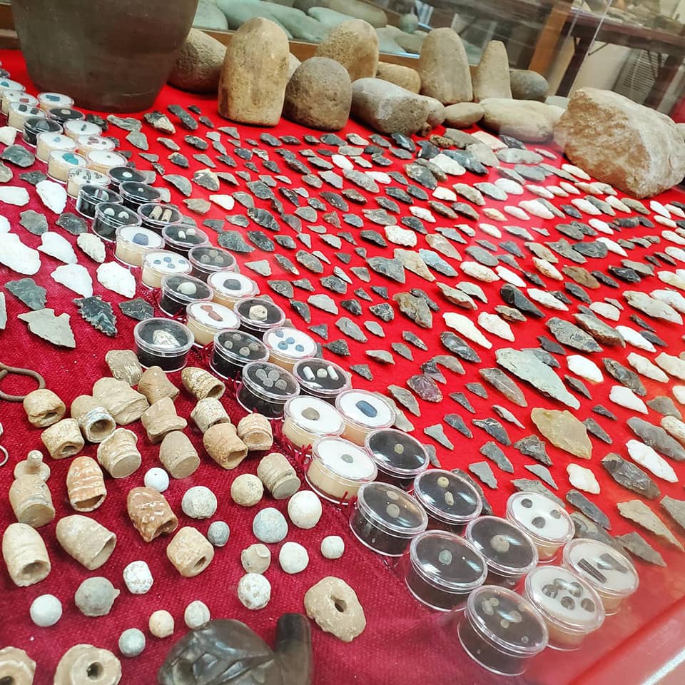
Visit the Charles Hall Museum & Heritage Center to see Hall’s incredible legacy and collection of town memorabilia, photos, weapons, artifacts, musical instruments, household items, pottery, and art.
A few times now, I have attended the annual Cherohala Skyway Festival, hosted by VisitMonroeTN, which largely revolves around the Charles Hall Museum.
Live music and dobro performances, food vendors, antique farm equipment and demonstrations, horse wagon and hay rides, games and other activities filled the day.
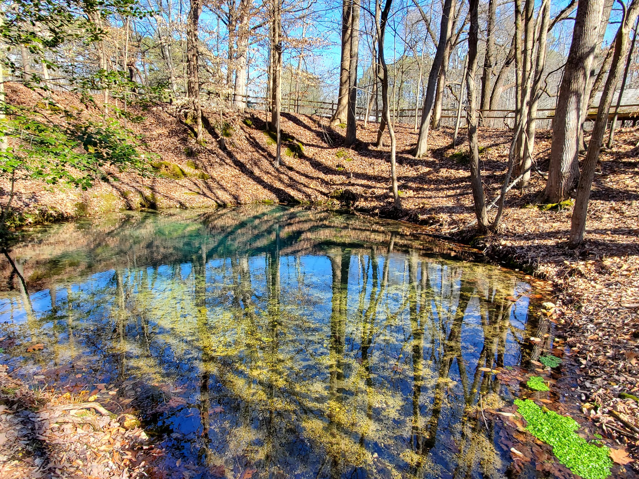
RED CLAY STATE PARK
Red Clay was the last Cherokee eastern capital and council grounds, used from 1832 until 1838 when the Cherokee were forced out.
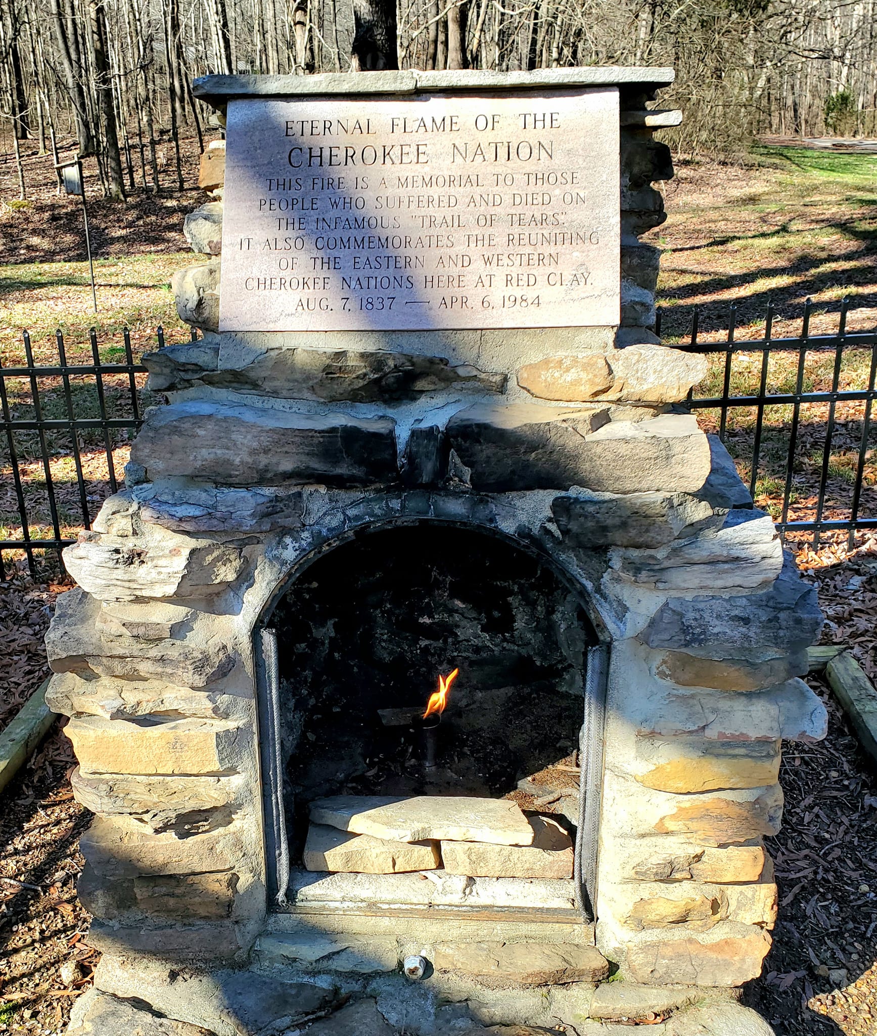
The park sits on more than 260 acres and contains replicas of the council house, Cherokee farmhouses, and other structures that demonstrate what life was like for the families who lived and met here.
Red Clay State Historic Park is a certified interpretive site on the National Historic Trail of Tears and has been on the National Register of Historic Places since 1972.
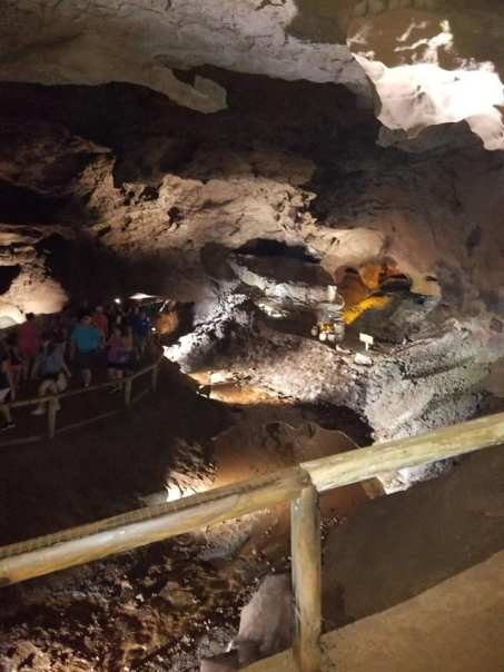
THE LOST SEA
America’s Largest Underground Lake, The Lost Sea, is located along the Unicoi Turnpike Trail in Sweetwater. It is also part of the historic Craighead Caverns.
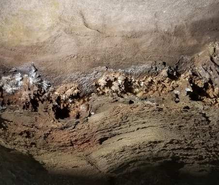
The Lost Sea attraction has earned national and international attention with its membership of both the National Cave Association and the Southern Highlands Attractions, putting it closer to the top of the US Travel list. Check out this blog to learn more.
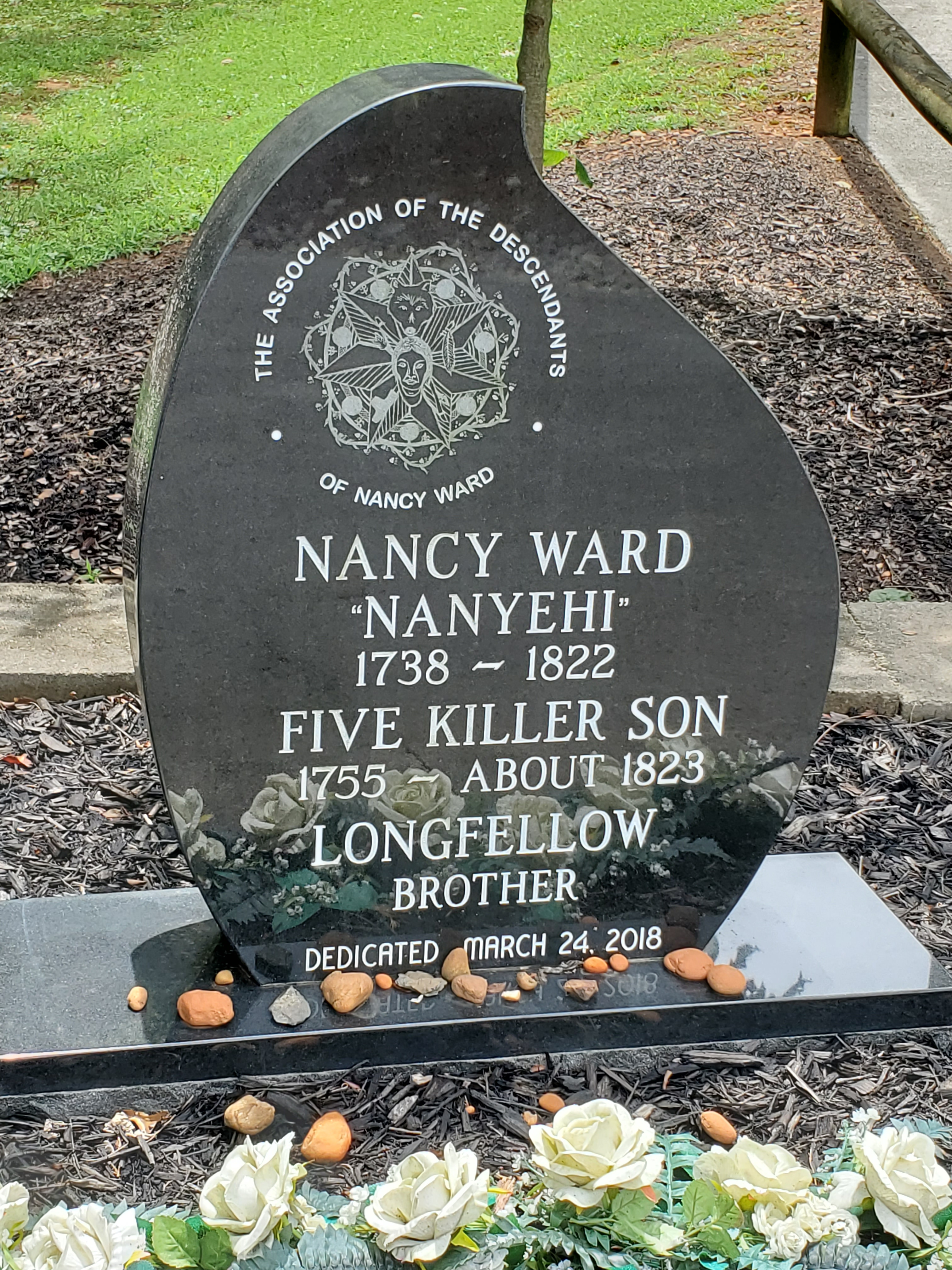
NANCY WARD’S GRAVE
Nanyehi “Nancy” Ward was a Cherokee woman and leader celebrated for helping the white folk when they swarmed in. I wrote a little more about that in my Ocoee Country blog.
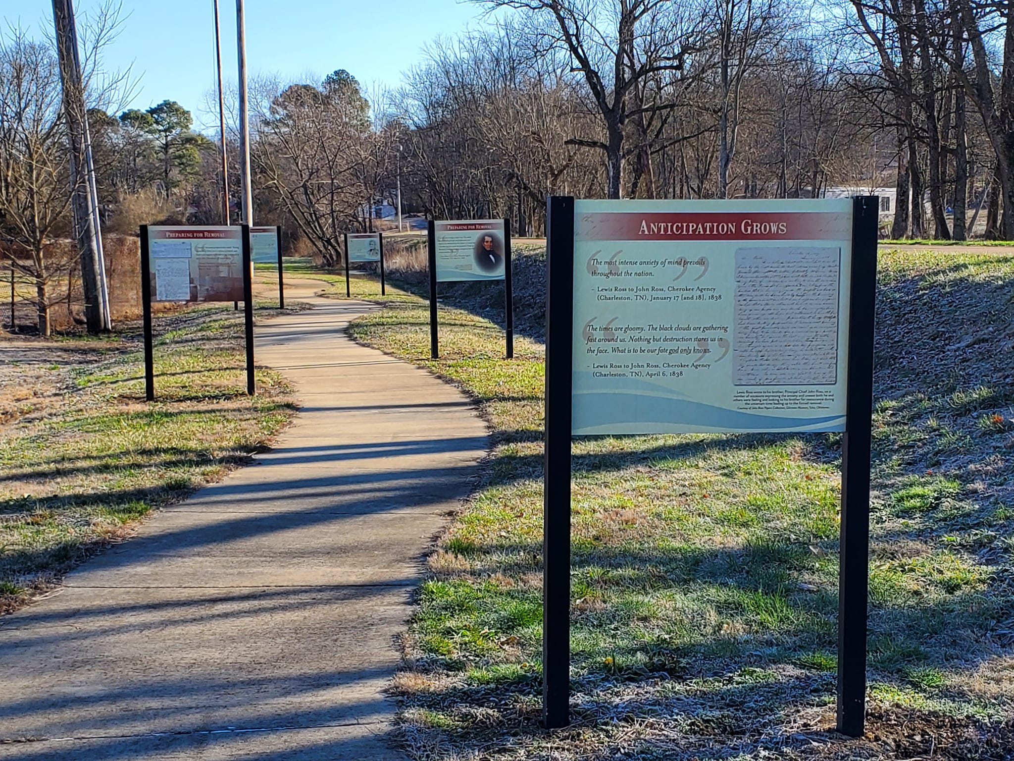
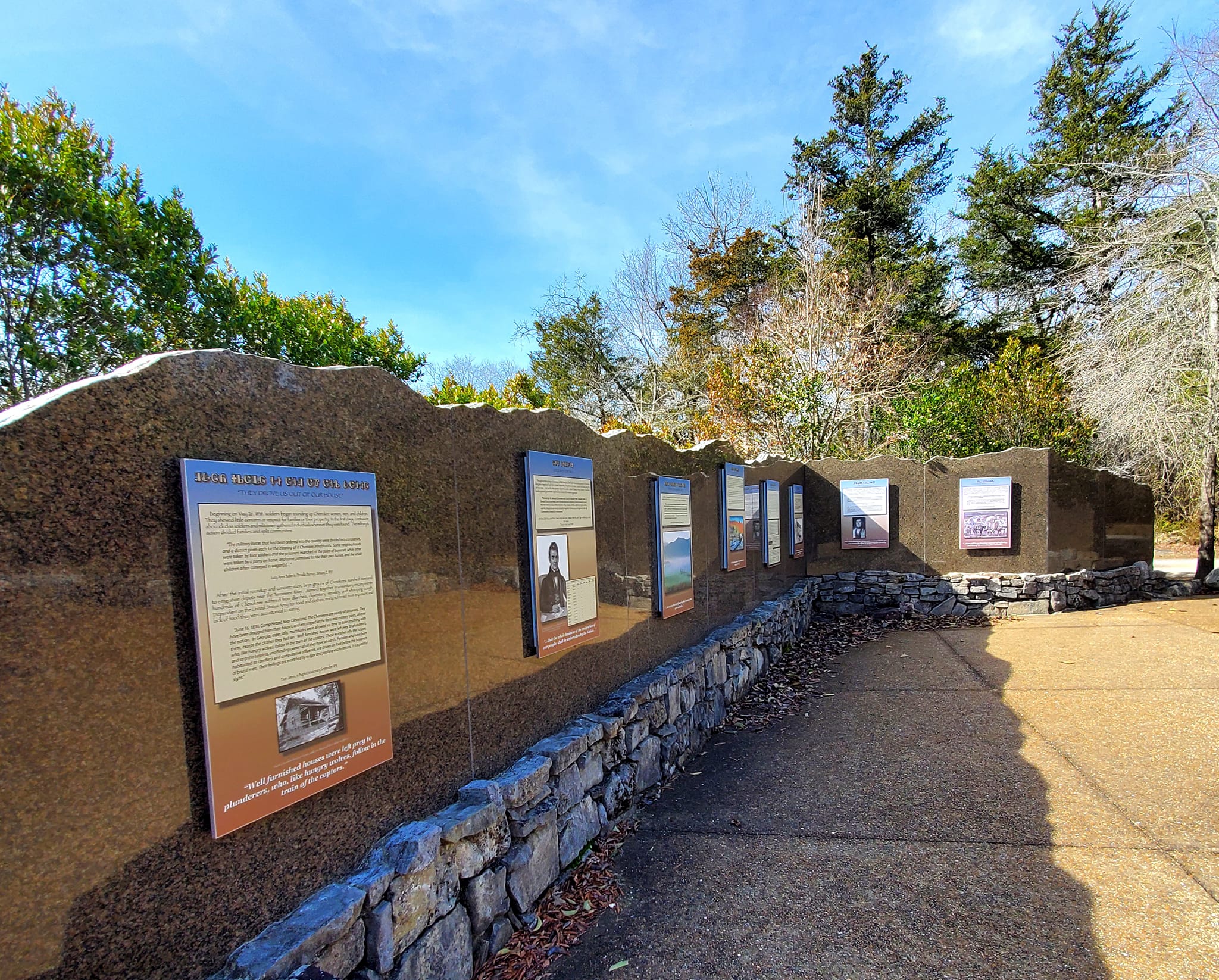
BLYTHE FERRY & THE CHEROKEE REMOVAL MEMORIAL PARK
Birchwood is a small community in Meigs County, neighbour to Bradley County, and home to the Cherokee Removal Memorial Park at Blythe Ferry.
The park has a monument with the names of each known Cherokee person expelled onto the Trail of Tears, divided by state of origin.

There is also a large map showing significant sites of the Cherokee Nation, Trail of Tears, and various routes that were taken, plus a walking exhibit that shows a historical timeline of Cherokee history.
Additionally, the Ducktown Basin Museum, Englewood Textile Museum, McMinn County Living Heritage Museum, Sweetwater Heritage Museum, and the Vonore Heritage Museum are on the Overhill, Furs to Factories, and Unicoi Turnpike trails, and each one is well worth the visit.
In the area for a while? Follow me to Sweetwater, Tellico Plains, Athens, Etowah, Vonore, the Cherohala Skyway, Ocoee Country, the Copper Basin, and Blue Ridge!
*************
© Copyright Fernwehtun, 2015- Current. Unauthorized use and/or duplication of this material without express and written permission from this site’s author and/or owner is strictly prohibited. Excerpts and links may be used, provided that full and clear credit is given to Fernwehtun and Fernwehtun.com with appropriate and specific direction to the original content.


Leave a comment