
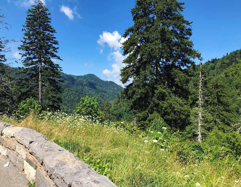
This blog may get a little complicated.
My original intent was for this to be Part II of my Blue Ridge Parkway series. What complicates this blog is that I also want to write about the Pisgah National Forest which overlaps the Pisgah Region of the Blue Ridge Parkway, but has so much more to offer than you will see if you only stay on the BRP.

The BLUE RIDGE PARKWAY (BRP) is a US National Parkway and it is the longest linear park in the country. It extends from Shenandoah National Park (Milepost 0) down to the Great Smoky Mountains National Park (Milepost 469) and is divided into six regions:
1. Shenandoah Region- overlaps Shenandoah National Park
2. Ridge Region MP 0-106
3. Plateau Region MP 106-217
4. Highlands Region MP 217-340
5. PISGAH REGION MP 340-469 – Overlaps Pisgah National Forest
6. Great Smoky Mountains Region – overlaps Great Smoky Mountains National Park
Here is a map I am sharing from BlueRidgeParkway.org that shows you how the Blue Ridge Parkway regions are divided:

The first and last regions of the Blue Ridge Parkway are National Parks, and the four inner regions are defined by the Milepost (MP) markers they fall within. View the official list of Blue Ridge Parkway Mileposts here.
From the Great Smoky Mountains National Park region, you will enter the BRP at its southern terminus in Cherokee, NC at Milepost 469 and drive northeast toward Shenandoah.
Along the way, you will be passing through or near Bryson City, Sylva, Dillsboro, Maggie Valley, Waynesville, Lake Junaluska, Brevard, Hendersonville, Asheville, Weaverville, Black Mountain, Craggy Gardens, Mount Mitchell, and Crabtree Falls where the Highlands region of the BRP begins.
Here is the official map of the Blue Ridge Parkway’s Pisgah Region from BlueRidgeParkway.org:

PISGAH NATIONAL FOREST
The Blue Ridge Parkway’s Pisgah Region overlaps the Pisgah National Forest. This forest was the first land purchased under the Weeks Act of 1911 which laid the groundwork for creating national forests in the eastern half of the US.
Currently there are around 500,000 acres of hardwood forest full of rivers, waterfalls, mountain views, and trails. One of its most famous sites is the Cradle of Forestry Museum at the historic Cradle of Forestry in America site.
The Pisgah National Forest is divided into three administrative parts called ranger districts; the Pisgah District, Appalachian District, and Grandfather District. These districts allow administrative control with more even access and convenient locations to different parts of the forest.
Pisgah District is located southwest of Asheville in Haywood, Buncombe, Transylvania, and Henderson counties. The ranger office for the Pisgah District is located just outside of Brevard.
Appalachian District covers Madison and Haywood counties, and stretches up toward Roan Mountain. Its ranger office is in Mars Hill.
Grandfather District covers areas further north and east, including the dramatic Linville Gorge Wilderness, famous for its rugged terrain. The Grandfather District spans from Asheville to Blowing Rock, and its ranger office is in Nebo, NC.

As you can see, Pisgah National Forest is not one linear tract of land. It is broken up into disconnected pieces on either direction of the Blue Ridge Parkway.
If your goal is to drive the entire Blue Ridge Parkway, you can drive straight from Cherokee to MP 340 in Crabtree Falls, but you will miss most of the cool nearby towns in Pisgah National Forest.
If your goal is to explore the Pisgah National Forest and all of its cool towns, you will constantly be straying from the Blue Ridge Parkway route.
Take Note:
The Blue Ridge Parkway is not a linear drive adhering to one road.
The Blue Ridge Parkway has a region called the Pisgah region.
The Pisgah region overlaps Pisgah National Forest.
Pisgah National Forest has a ranger district called the Pisgah Ranger District.
Here is a more detailed map from U.S. Forest Service – National Forests in North Carolina:

Because I live near the southern terminus of the BRP, I wrote about the Great Smoky Mountains National Park region first, and will be telling you about the route as if you are driving it backwards toward Shenandoah National Park.
Leaving the Great Smoky Mountains Region of the Blue Ridge Parkway from Cherokee at MP 469, you will enter the Pisgah Region and Pisgah National Forest.

Mileposts 469-455 lead through Swain County, and the towns of Cherokee and Bryson City.
Cherokee is best known for its thriving Eastern Band of Cherokee community, which is synonymous with the unique, authentic art and crafts made by tribal members. The most popular attractions in Cherokee are the outdoor drama production called Unto These Hills and, of course, the tribe-owned Harrah’s Casino.
Check out these two separate blogs I wrote about Cherokee (in progress) and its CDP community, Bryson City.

Heading north from Cherokee, one of the first sites you must visit is the Oconoluftee Visitor Center and Mountain Farm Museum at MP 462.
The exhibits in the visitor center and the outdoor living history museum provide a glimpse into what life was like for early Appalachian pioneers, and staff can give you all the information and tourism literature you could ever dream of.
Big Witch Tunnel & Overlook is at the next milepost, MP 461. Believe that we had way too much fun cackling and taking selfies there.

BRYSON CITY is a CDP (community-designated place) of Cherokee, North Carolina. The two communities share many of the same geographic features and attractions like tubing, rafting, fishing, kayaking, biking, camping, the Nantahala Gorge, Fontana Lake and Dam, and the Road to Nowhere.
Bryson City is a hub for the Great Smoky Mountain Railroad where you can book a sightseeing or dinner tour of western North Carolina, and the Smithsonian gassed it up as number 10 on the Top 20 “Best Small Towns to Visit” 2016 list.
I am completely in love with the Deep Creek Waterfall Loop Trail just north of Bryson City.

Mileposts 455-443 pass through Maggie Valley then Waynesville, the heart of Haywood County. Waynesville has an impressive 18 mountain peaks with altitudes over 6,000 feet.
At MP 454, Thunder Struck Ridge Overlook peers out from an elevation of 4,780 feet, and Woolyback Overlook at MP 452 looks out from an elevation of 5,425 feet.

Stop by the visitor center in Waterrock Knob at MP 451.

Waynesville is credited as the site of the last shot fired of the Civil War east of the Mississippi River in May of 1865. You can visit the memorial on Sulphur Springs Road.

I would recommend spending at least one full day or stay overnight so you can explore the town as well as its Lake Junaluska and Cataloochee Valley,
Be sure to visit Boojum Brewing Company to ask them about the Legend of Boojum while you try out various craft beers.

Lake Junaluska is another multi-purpose name, referring to the 200-acre man-made lake, the community surrounding it, and its world-renowned religious conference center.

You do not have to be a member of any religion or be an attendee of any conference to enjoy a walk around this beautiful lake that features North Eaglenest Mountain in the background.
Check out this blog about Waynesville and Lake Junaluska.

Cataloochee Valley is just northwest of Waynesville. It has become the prime spot for elk viewing since 2011, after an experimental program reintroduced elk to this part of the Great Smoky Mountains National Park.
The program was led by the National Park Service, Rocky Mountain Elk Foundation, and a few other partners. Twenty-five radio collared elk were brought in and released. Additional elk and other animals were gradually brought in over the years, and today there are around 200 elk.

Some elk have migrated toward Cherokee, North Carolina and other areas of Appalachia where they originally roamed, before excessive hunting and loss of habitat led to regional extinction in the 1700s.
You can read more about Cataloochee Valley here.

Mileposts 455- 443 lead you near the towns of Sylva, Dillsboro, and Cashiers.
Sylva is a tiny town of about 2,500 people in three square miles, but you will be shocked by the cultural diversity you can find between its punk bars, goth and drag nights, karaoke cocktail lounges, foreign and antique bookstores, coffee shops, and historic buildings.
Sylva was the filming location for Three Billboards Outside Ebbing, Missouri which stars Frances McDormand, Woody Harrelson, and Sam Rockwell.

Check out Dillsboro, Cashiers, Highlands, and Franklin while you are there.

Mileposts 423-312 lead to Richland Balsam (highest point on the BRP), the Devil’s Courthouse, Graveyard Falls, Looking Glass Rock Overlook, Cradle of Forestry in America, and Brevard.
Brevard is surrounded by Pisgah National Forest, DuPont Recreational State Forest, and the French Broad River. It is located about 25 miles south of Asheville and 8 miles north of the South Carolina state line.
Brevard is known for its abundance of otherwise rare white squirrels, and as the Land of Waterfalls. Looking Glass Falls, Sliding Rock, Slick Rock Falls, Bridal Veil Falls, Rainbow Falls, Moore Cove Falls, Hooker Falls, Triple Falls, Turtleback Falls, are among its most popular.

You will see the white squirrel motif all over downtown and incorporated into decor, business logos, souvenirs, murals, and everything else. We even had our photo taken with a guy in a full-body white squirrel costume. Why? Why not.
Also, it is difficult to catch a clear photo of any real ones before they scurry off.

Mileposts 412-389 lead to Lake Powhatan, the North Carolina Arboretum, and Hendersonville, which has a high concentration of things I enjoy like cozy cafes, bookstores, bars/restaurants with literary themes, coffee shops, boutiques filled with crystals and witchy stuff, farmers markets, Art Deco buildings, and museums, all within a handful of city blocks.

Mileposts 389-382 lead to the Biltmore Estate & Village, Asheville, the Folk Art Center, Craggy Gardens, Black Mountain, and Weaverville.
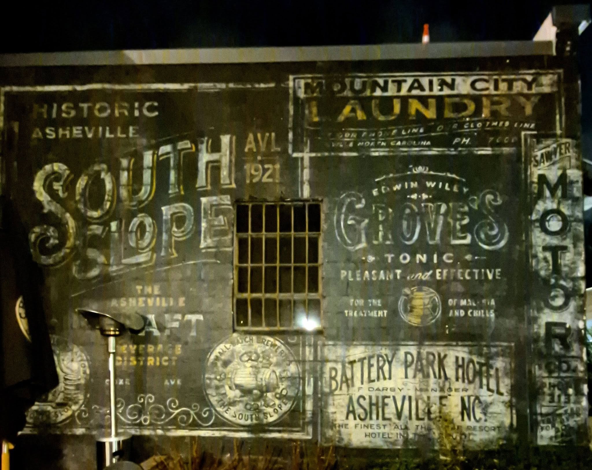
Asheville is a fairly large city that I have way more to say about it than I could fit in a short paragraph, so check out these blogs about West Asheville, South Slope Brewery District, River Arts District, or join me for a epicurean tour of downtown Asheville.

Northwest of Asheville Side Quest:
Marshall is part of the greater Asheville MSA, though Asheville proper is about 20 miles away. It has less than 700 residents within its 3.8 square miles.
Downtown stretches along the eastern bank of the French Broad River, and its Main Street underlines a steep hill that seems to nearly topple into the water. It has, in the past.

If you have seen the show The Peripheral, this will all look familiar. Marshall’s iconic Madison County Court House is featured in the show and was built in 1907 by Richard Sharp Smith, the same guy who constructed the Biltmore.
I am a bit biased in saying this, but Marshall is one of my happy places.

Mars Hill has around two thousand residents in less than two square miles, but its population fluctuates as each new semester and season changes.

Mars Hill University is the oldest college institution in western North Carolina and was founded by Baptists, but is now on record as no longer being affiliated with any religion.
The town was basically built around the college, and being in such close proximity to the Blue Ridge Parkway and the Appalachian Trail, Mount Mitchell and Max Patch, plus the Wolf Ridge Ski Resort, more businesses continue to open in order to cater to both students and tourists.

Hot Springs is a small, friendly town in western North Carolina that is famous, as you might guess, for its natural hot mineral springs. I usually stop in for coffee traveling to and from visiting a friend in Marshall, so I have become well acquainted with the tiny downtown.
Sometimes the town can seem empty, but you will almost always see Appalachian Trail hikers stretching, or stretched out, all over the streets. Hot Springs can be just as ornery as it is charming, depending on the season.

Northeast of Asheville Side Quest:
While you are in Asheville, consider touring the the Hickory Nut Gorge region which includes Lake Lure, Chimney Rock, Chimney Rock State Park, Bat Cave, and some other places that are not directly on the BRP or part of the Pisgah Region but absolutely worth a visit on their own.
CHIMNEY ROCK covers less than three square miles in the Hickory Nut Gorge with only around 100 residents. It is a village in Rutherford County that shares its border with the town of Lake Lure. Most people come here to visit the Chimney Rock State Park which was inducted into the NC Parks list in 2007.
Parts of the films Last of the Mohicans and Stephen King’s Firestarter were filmed in Chimney Rock State Park, which draws a lot of tourism.

LAKE LURE is nestled in the center of North Carolina’s massive Hickory Nut Gorge and the wild Rocky Broad River flows through it. Territory spans a little over 13 square miles of which more than 1 square mile is water.
Many scenes from the 1987 hit Dirty Dancing were filmed in Lake Lure. The writer Eleanor Bergstein was visiting and it reminded her of the Catskills in New York where her story actually took place.
Thunder Road, A Breed Apart, Firestarter, My Fellow Americans, and The Last of the Mohicans were all filmed in Lake Lure area during the 80s, 90s, and early 2000s. Just last year, a new film called Careful What You Wish For wrapped up, proving the town’s unique beauty game is still strong over time.

Once you are back on the Blur Ridge Parkway…
Black Mountain was first inhabited by the Cherokee and later became a small village called Grey Eagle until it was incorporated in the early 1890s. The town is around 6.5 square miles and has a population of almost 8,000.
Several novels mention or are centered around Black Mountain, including those by authors Patricia Cornwell and Nicholas Sparks. A few key scenes from Three Billboards Outside Ebbing, Missouri were filmed there as well.

Weaverville was chartered in 1875 and incorporated in 1909, but by that time it had already existed as a farming community for over a century. Its natural beauty frequently drew in Methodist campers on retreat, and some of the earliest public buildings functioned as schools, conference centers, and inns.
Driving from Marshall or Hot Springs to Weaverville leads through a stunning landscape along the Blue Ridge Mountains and Mount Mitchell. It is so beautiful through here, I had to pull over a few times to take it all in.

Mileposts 382-364 lead to Montreat, Swannanoa, Barnardsville, and other towns.
Montreat is a lovely historic garden neighbourhood full of fantastic architecture, but I have not spent much time in Swannanoa other than passing through. Barnardsville is home to Hawk & Hawthorn which is a permaculture community that hosts a lot of rad events throughout the year.

Mileposts 364-344 lead to Burnsville and Mount Mitchell. Continue into Madison County to visit Marshall, Mars Hill and Hot Springs, if you have not already.
Additional places that are in Pisgah National Forest’s Grandfather District are not technically on the Blue Ridge Parkway. Instead of duplicating all of the information, I will write about those in my next blog about the Highlands Region.
In the area for a while? Follow the Blue Ridge Parkway to Mt. Mitchell State Park and Crabtree Falls where the Highlands Region begins. (in progress)
********************
© Copyright Fernwehtun, 2015- Current. Unauthorized use and/or duplication of this material without express and written permission from this site’s author and/or owner is strictly prohibited. Excerpts and links may be used, provided that full and clear credit is given to Fernwehtun and Fernwehtun.com with appropriate and specific direction to the original content.


Leave a Reply